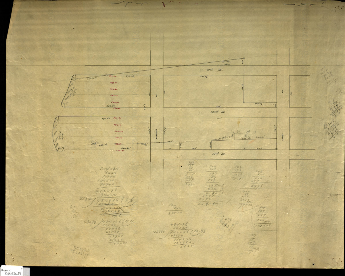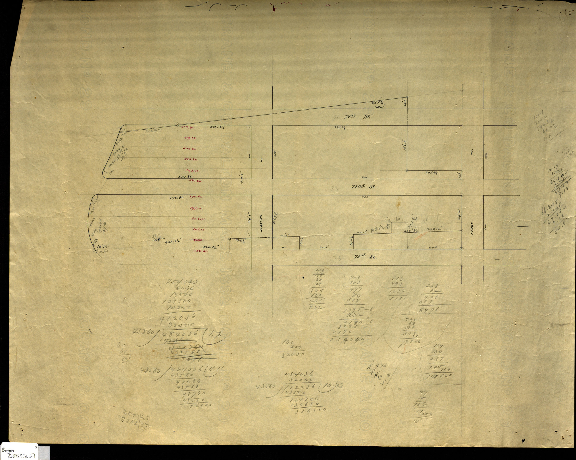
[Map of area bounded by Narrows Ave., 73rd St., 1st Ave., and 71st St.]. [1892]
Map No. Bergen-[1892?]a.Fl
Cadastral map covering area in modern-day Bay Ridge. Shows property (including dimensions). Title devised by cataloger. Likely attributed to Van Brunt Bergen, based on handwriting on piece. Date of publication conjectured from watermark. Watermark: Crane & Co Dalton Mass 1892 Bond No 29. “W.W. Bennett”–Verso. Cataloger unable to determine Bennett’s relationship to map.
Map area shown
Relation
Full catalog recordSize
43 × 54 cmDownload
Low Resolution Image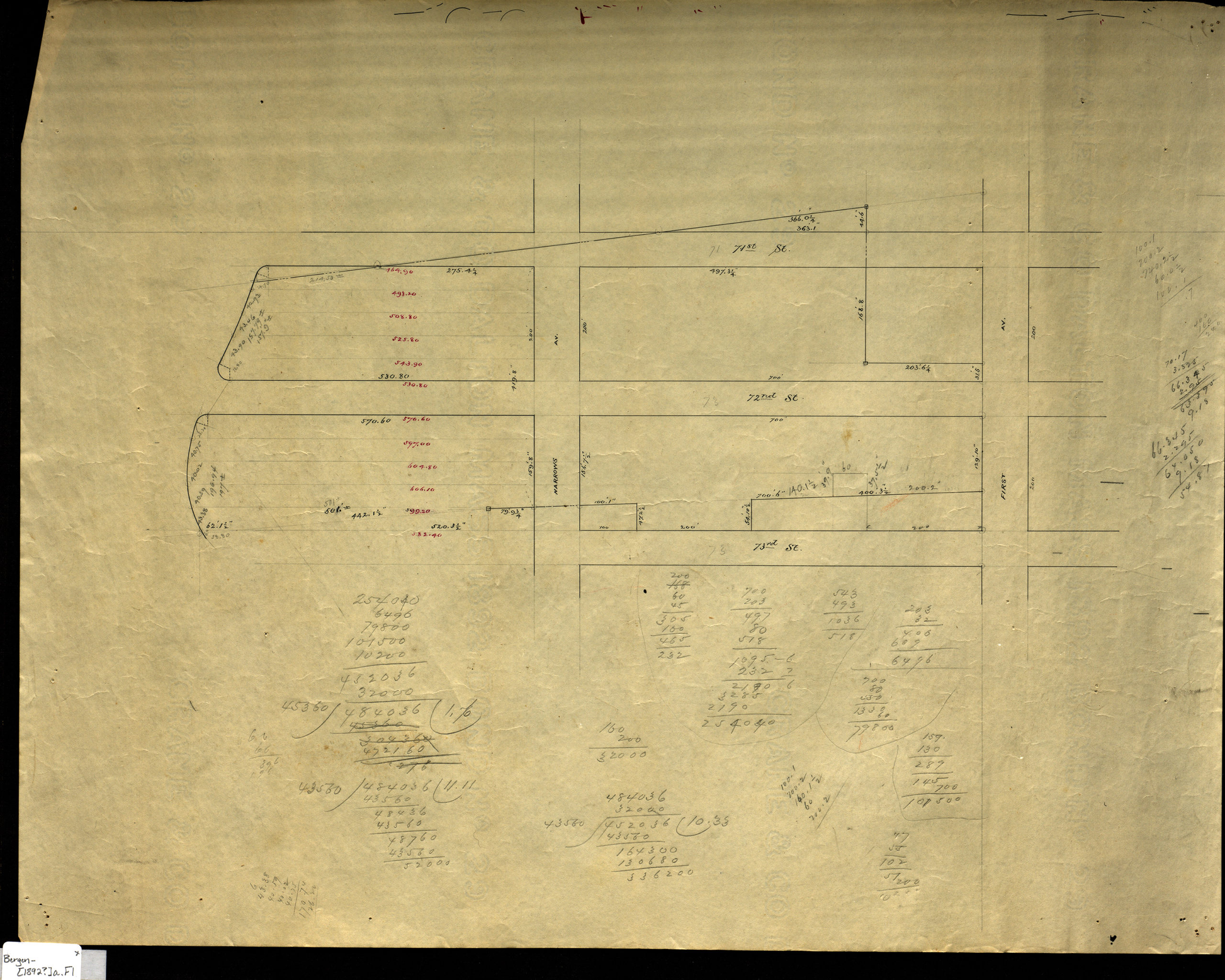
Creator
Bergen, Van Brunt,Publisher
Brooklyn Historical SocietyCitation
[Map of area bounded by Narrows Ave., 73rd St., 1st Ave., and 71st St.].; [1892], Map Collection, Bergen-[1892?]a.Fl; Brooklyn Historical Society.Scale
Scale not givenLoading zoom image...