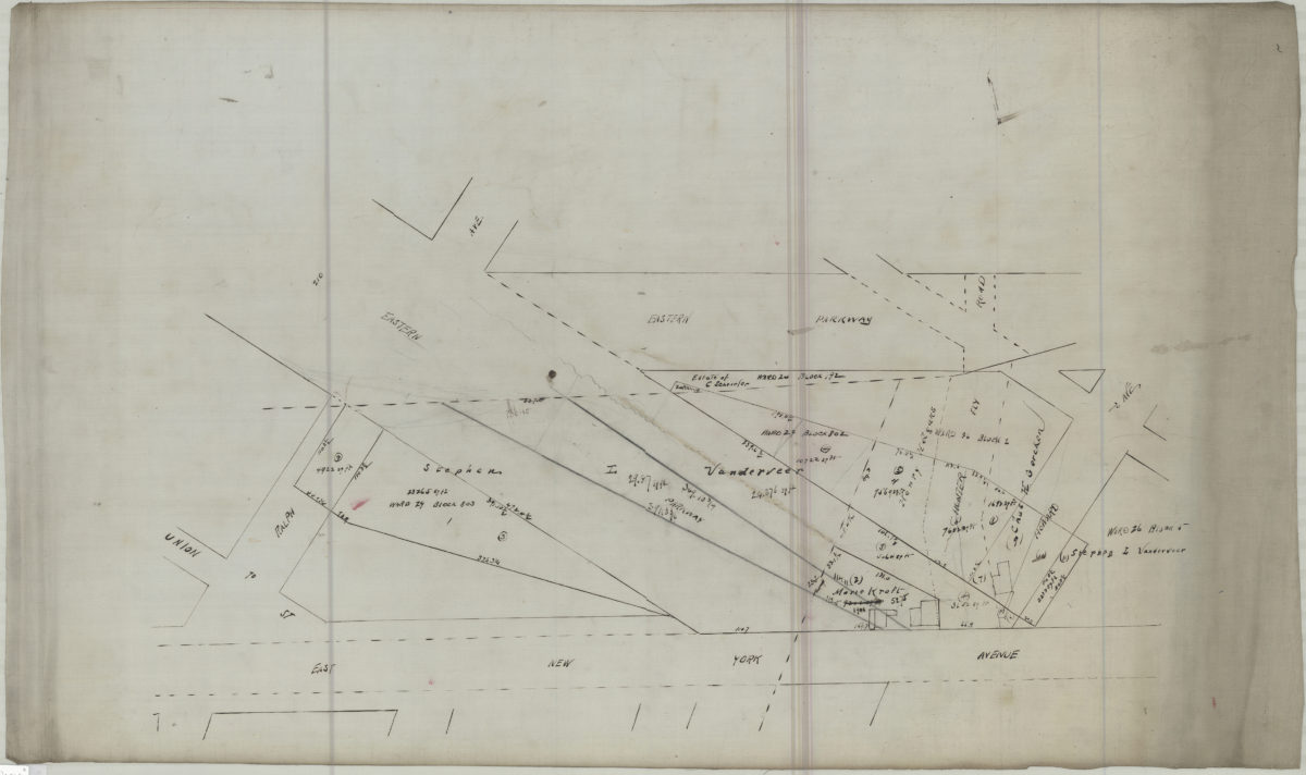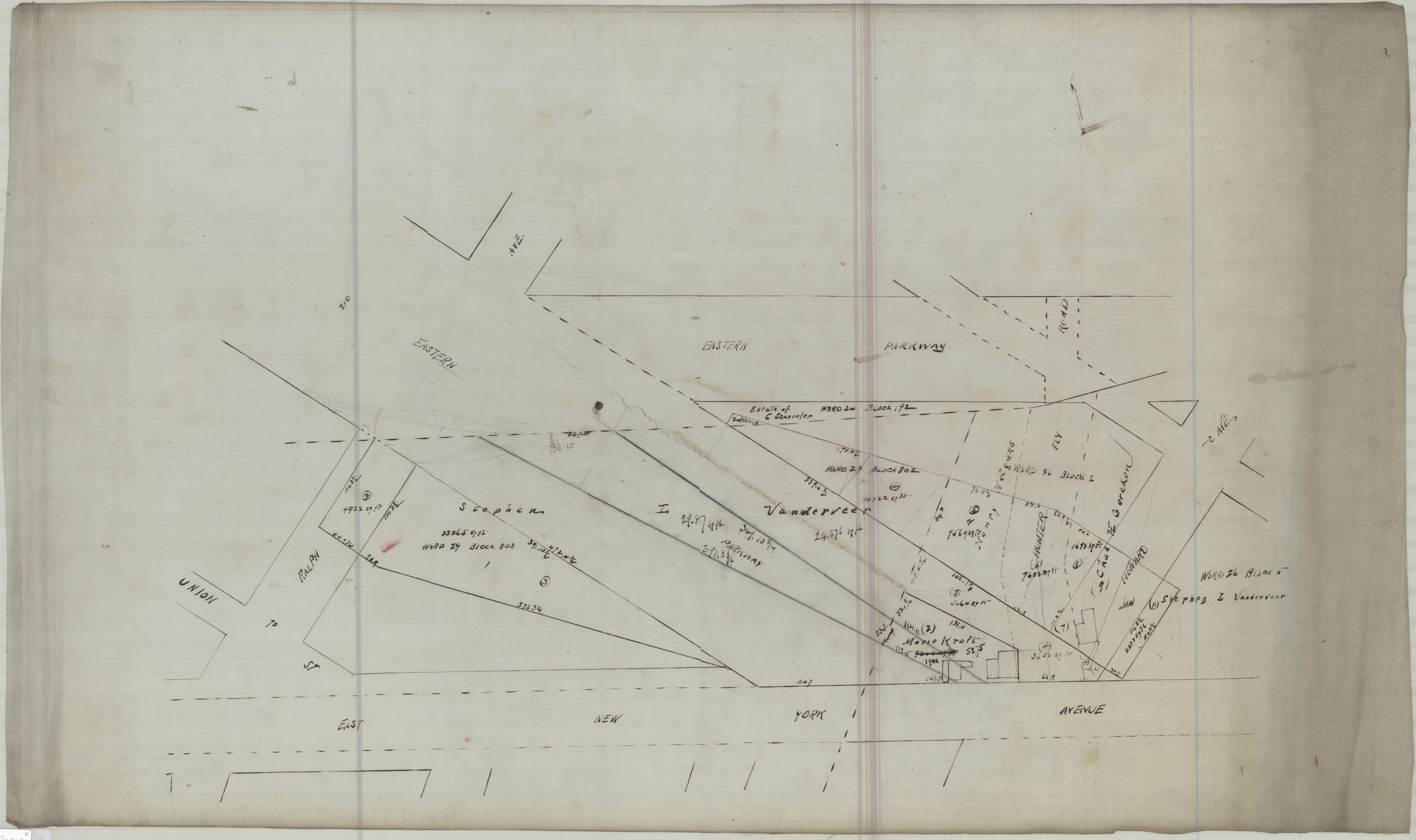
[Map of area bounded by Ralph Ave., East New York Ave., Howard Ave., and Eastern Pkwy] [18??]
Map No. B P-[18--?]c.Fl.Folio
Cadastral map covering area in modern-day Brownsville. Shows property (including buildings and dimensions), names of landowners, and Hunter Fly Road. Title devised by cataloger.
Map area shown
Relation
Full catalog recordSize
55 × 93 cmDownload
Low Resolution Image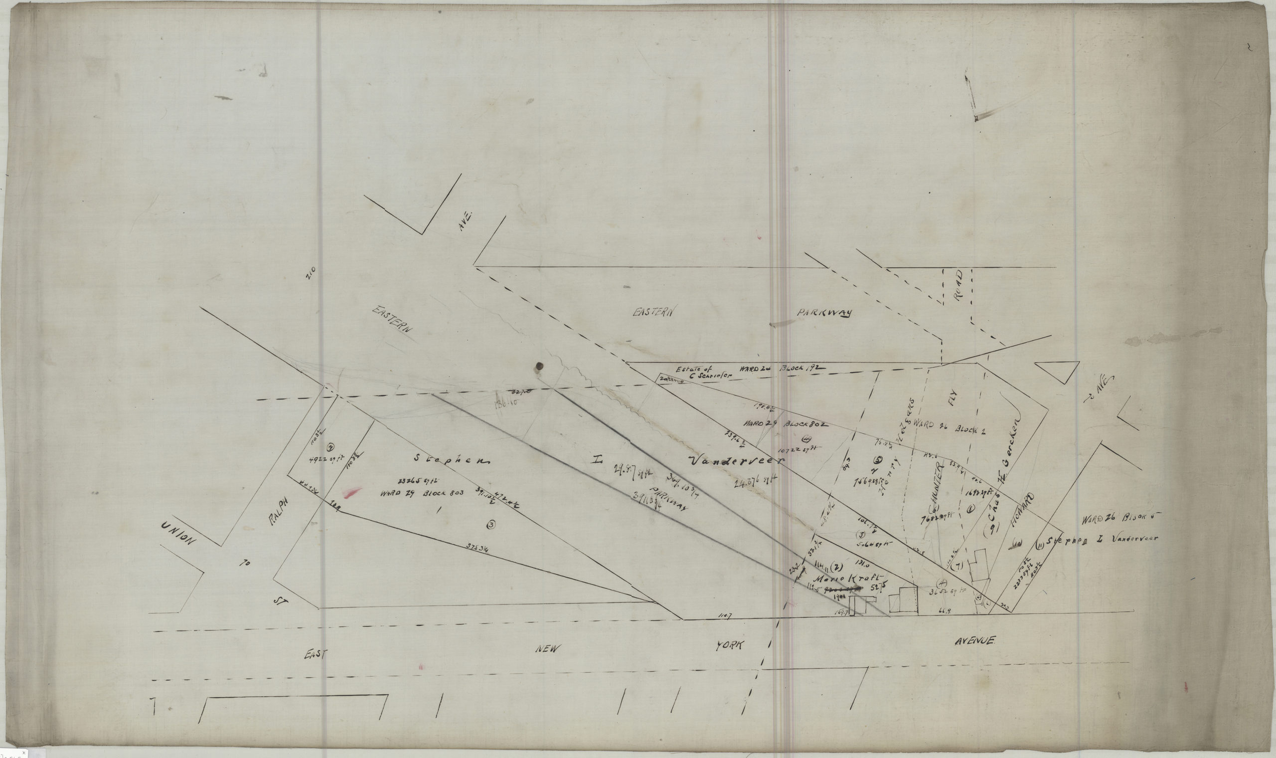
Creator
Publisher
Brooklyn Historical SocietyCitation
[Map of area bounded by Ralph Ave., East New York Ave., Howard Ave., and Eastern Pkwy]; [18??], Map Collection, B P-[18--?]c.Fl.Folio; Brooklyn Historical Society.Scale
Scale not givenLoading zoom image...