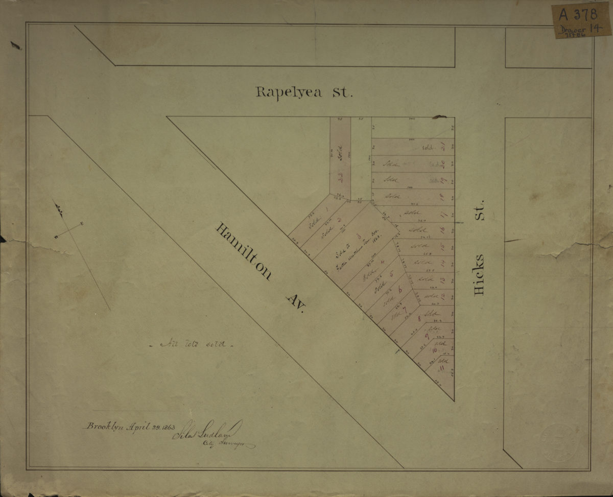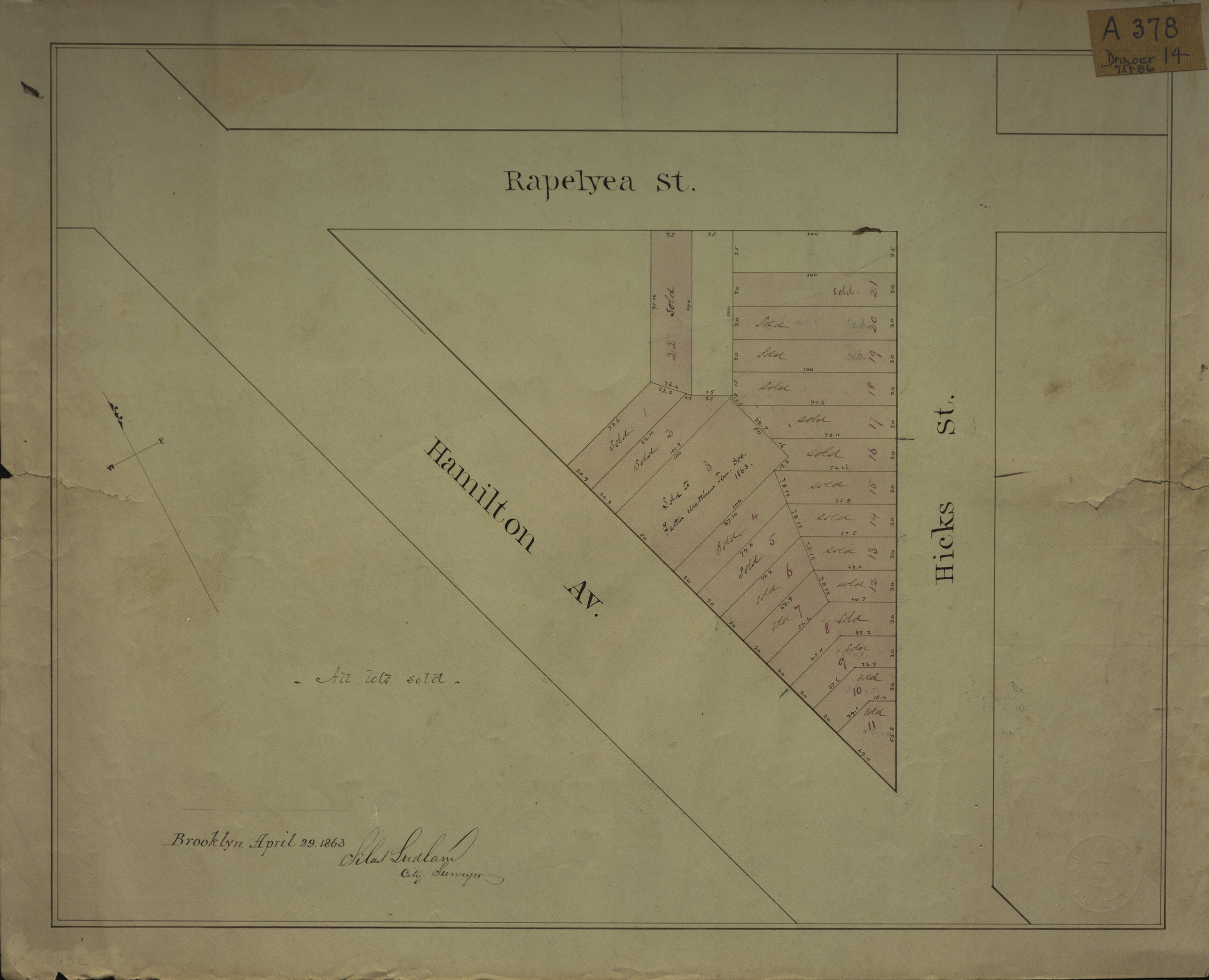
[Map of area bounded by Rapelyea St., Hamilton Ave., and Hicks St.]: Silas Ludlam, city surveyor April 29, 1863
Map No. B P-1863c.Fl
Cadastral map covering area in modern-day Carroll Gardens. Shows property (including lot numbers and dimensions). Title devised by cataloger. Oriented with north to the upper left.
Map area shown
Relation
Full catalog recordSize
34 × 43 cmDownload
Low Resolution Image
Creator
Ludlam, Silas,Publisher
Brooklyn Historical SocietyCitation
[Map of area bounded by Rapelyea St., Hamilton Ave., and Hicks St.]: Silas Ludlam, city surveyor; April 29, 1863, Map Collection, B P-1863c.Fl; Brooklyn Historical Society.Scale
Scale not givenLoading zoom image...