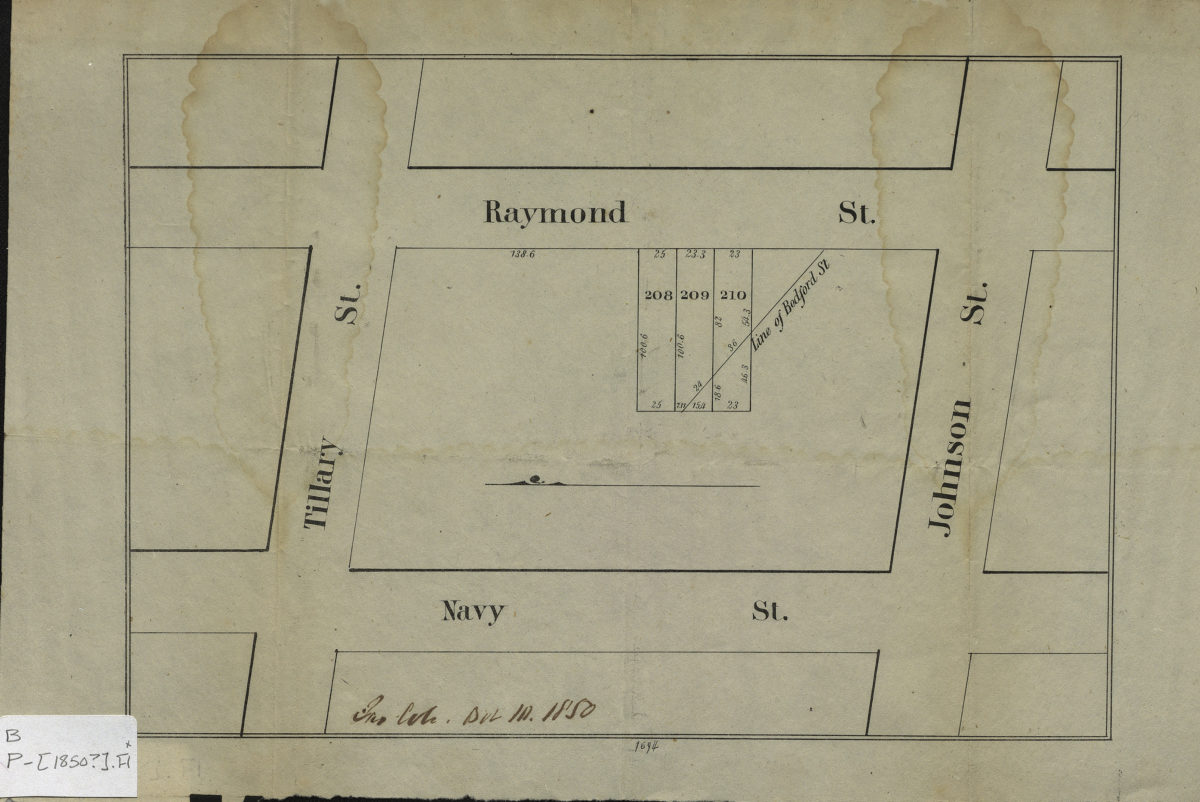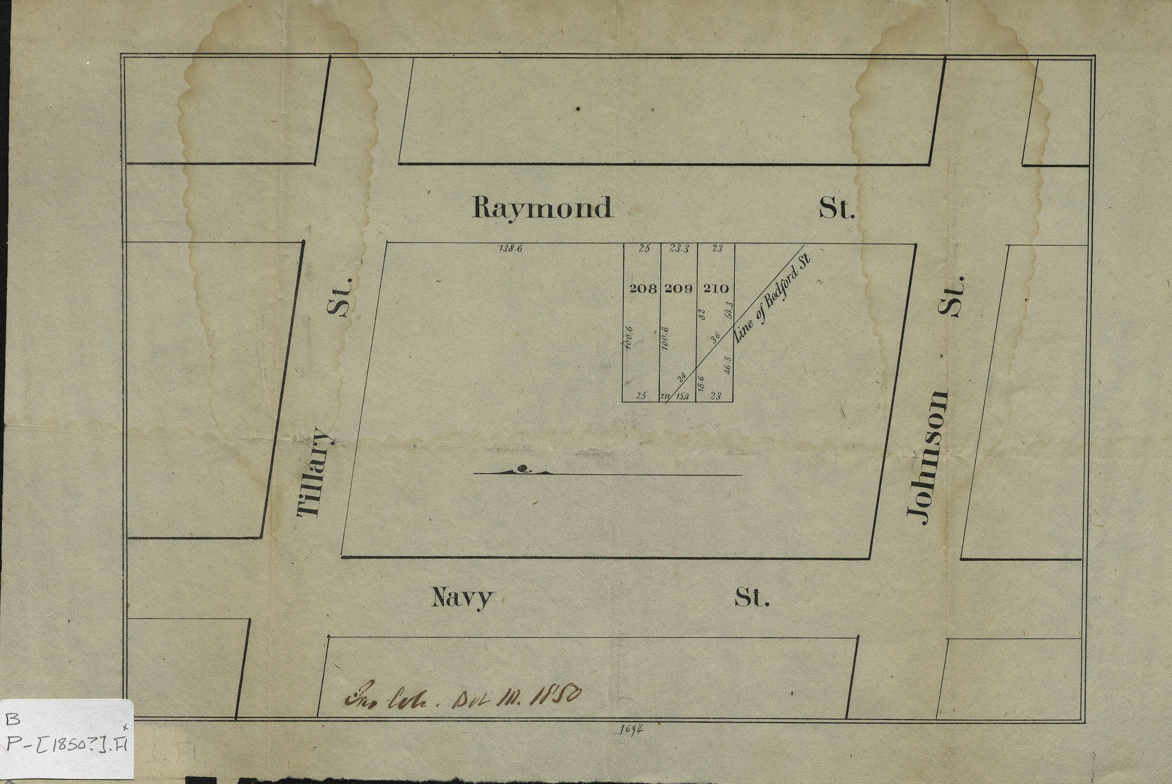
[Map of area bounded by Raymond St., Johnson St., Navy St., and Tillary St.]. [1850]
Map No. B P-[1850?].Fl
Cadastral map covering area in modern-day Fort Greene. Shows property (including lot numbers and dimensions). Title devised by cataloger. Extracted from a larger map? Oriented with north to the left. Date of publication conjectured from annotations. “1694”–Lower center margin. BHS copy annotated in ink and gray pencil.
Map area shown
Genre
Cadastral mapsRelation
Full catalog recordSize
17 × 25 cmDownload
Low Resolution Image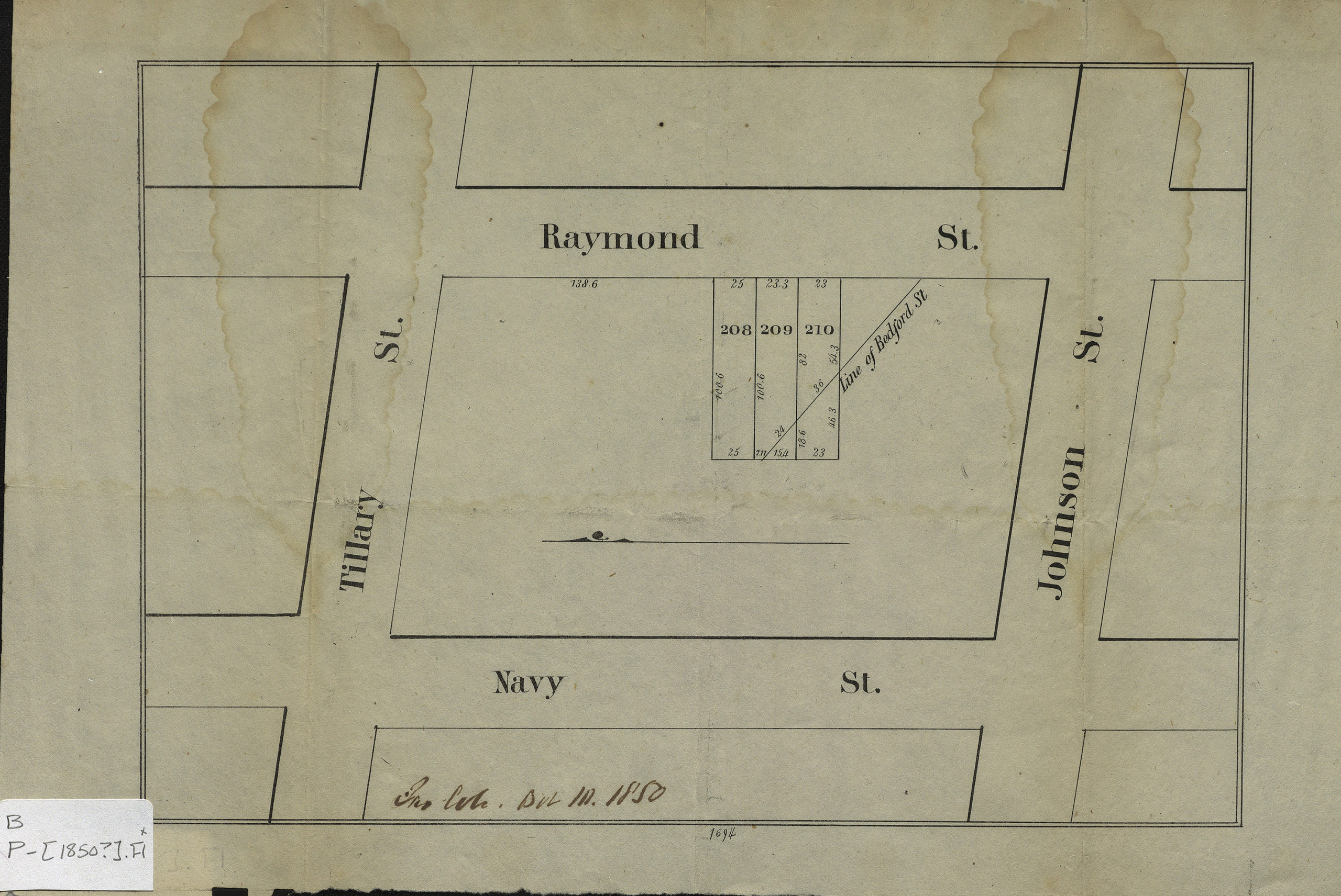
Creator
Publisher
Brooklyn Historical SocietyCitation
[Map of area bounded by Raymond St., Johnson St., Navy St., and Tillary St.].; [1850], Map Collection, B P-[1850?].Fl; Brooklyn Historical Society.Scale
Scale not givenLoading zoom image...