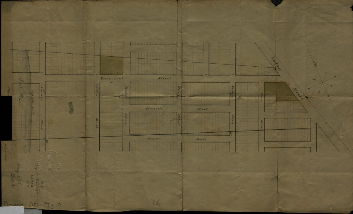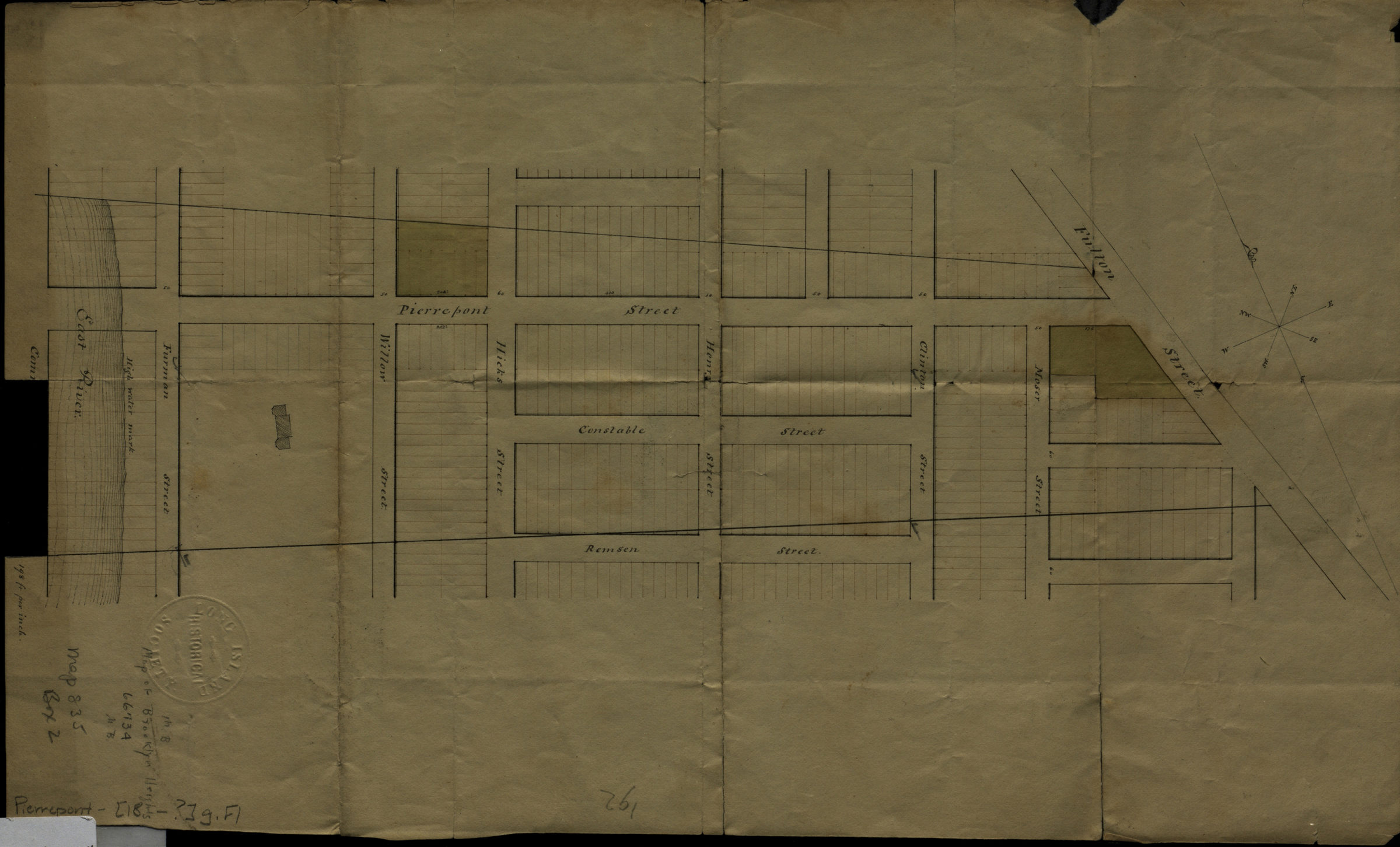
[Map of area bounded by Remsen St., Fulton St., Pierrepont St. and Commerce St.]. [18??]
Map No. Pierrepont-[18--?]g.Fl
Cadastral map covering area in modern-day Brooklyn Heights. Shows property (including lots and buildings). Title devised by cataloger. Oriented with north to the upper left.
Map area shown
Relation
Full catalog recordSize
24 × 40 cmDownload
Low Resolution Image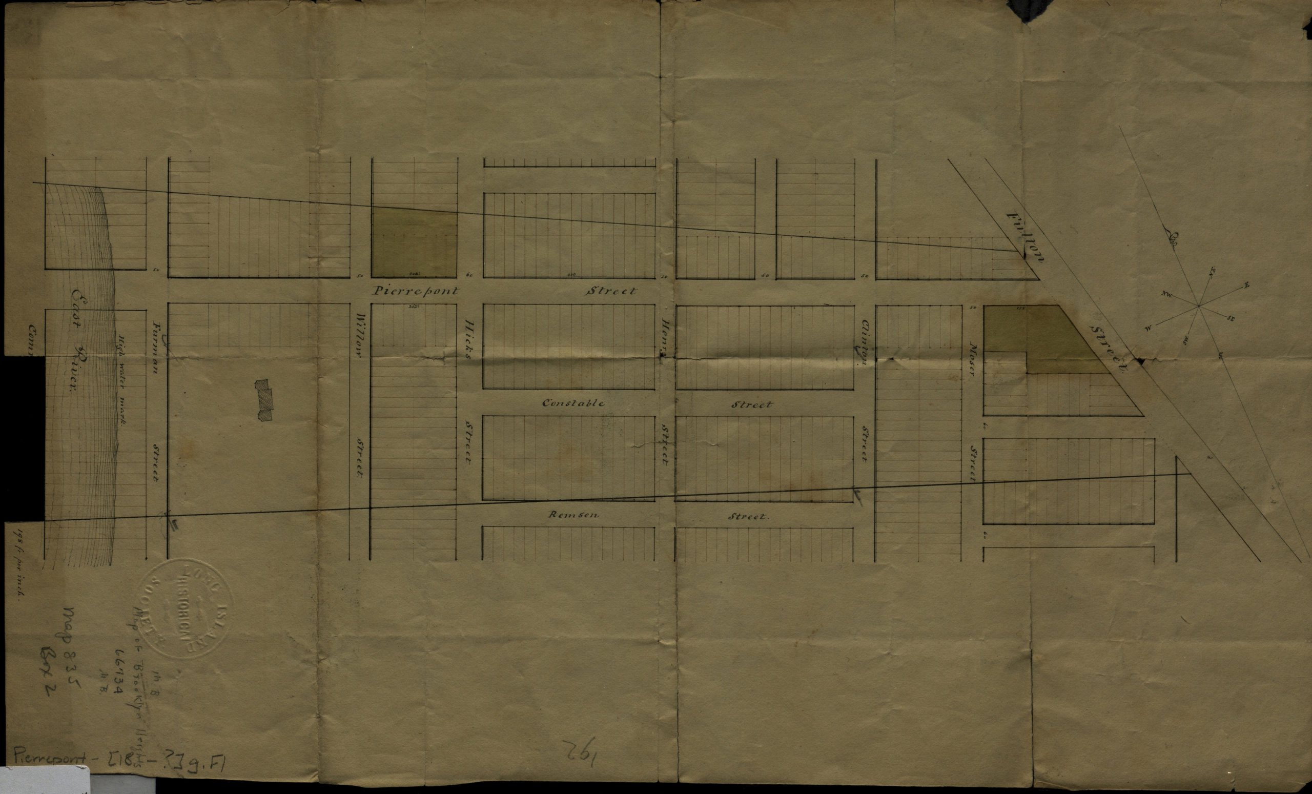
Creator
Publisher
Brooklyn Historical SocietyCitation
[Map of area bounded by Remsen St., Fulton St., Pierrepont St. and Commerce St.].; [18??], Map Collection, Pierrepont-[18--?]g.Fl; Brooklyn Historical Society.Scale
Scale [1:2,376] 1 in to 1Loading zoom image...