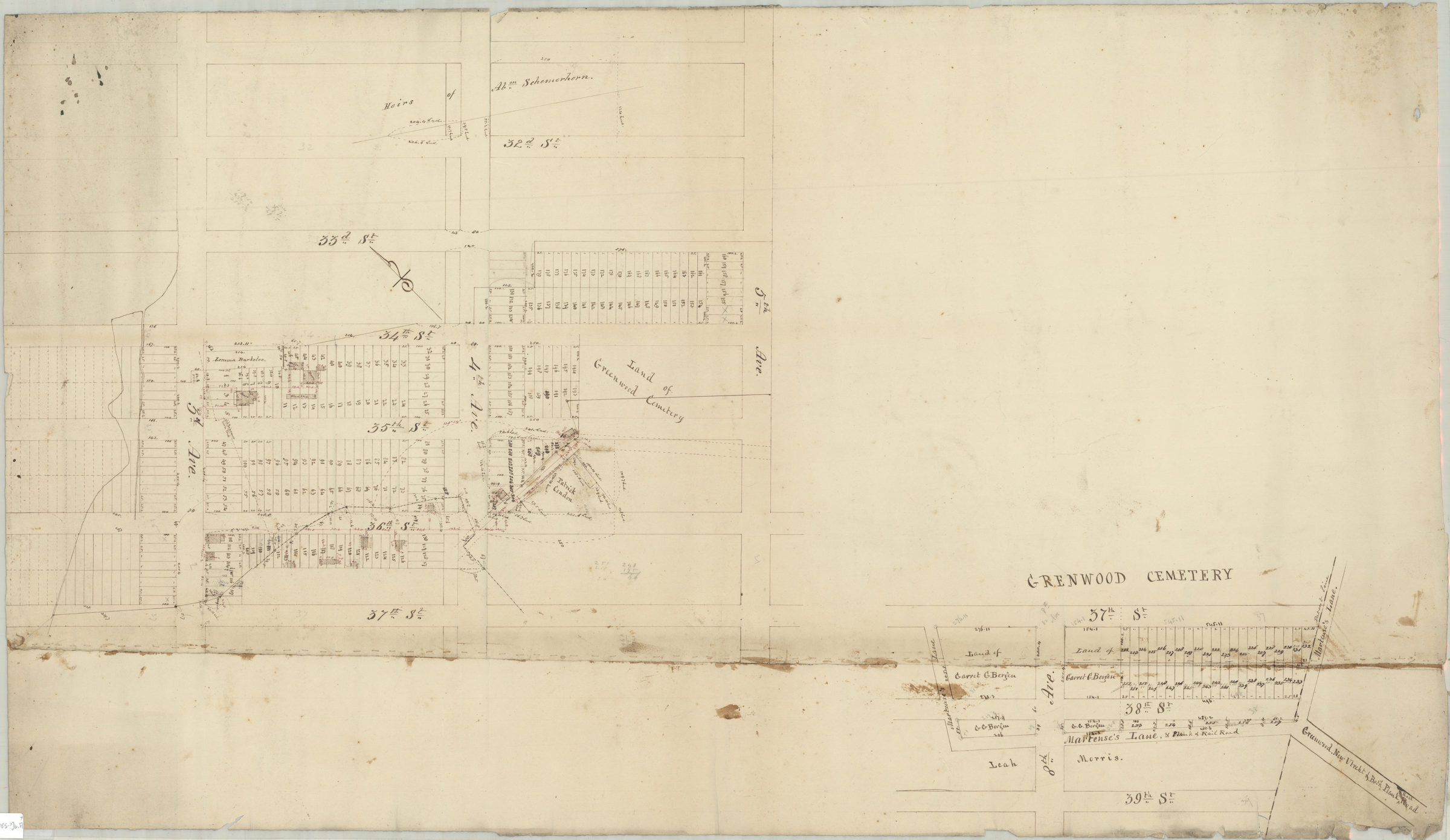
[Map of area near Greenwood Cemetery] [185?]
Map No. Bergen-[185-?]b.Fl
Cadastral map covering area north from 39th St. to 31st St. and east from 2nd Ave. to Greenwood Cemetery (modern-day Sunset Park). Shows property (including lot numbers and dimensions), and names of landowners. Title devised by cataloger. Oriented with north to the upper left. Likely attributed to T.G. Bergen, based on handwriting on piece. “John G. Bergen”–Verso. Cataloger unable to determine Bergen’s relationship to map.
Subjects
Places
Map area shown
Relation
Full catalog recordSize
59 × 100 cmDownload
Low Resolution Image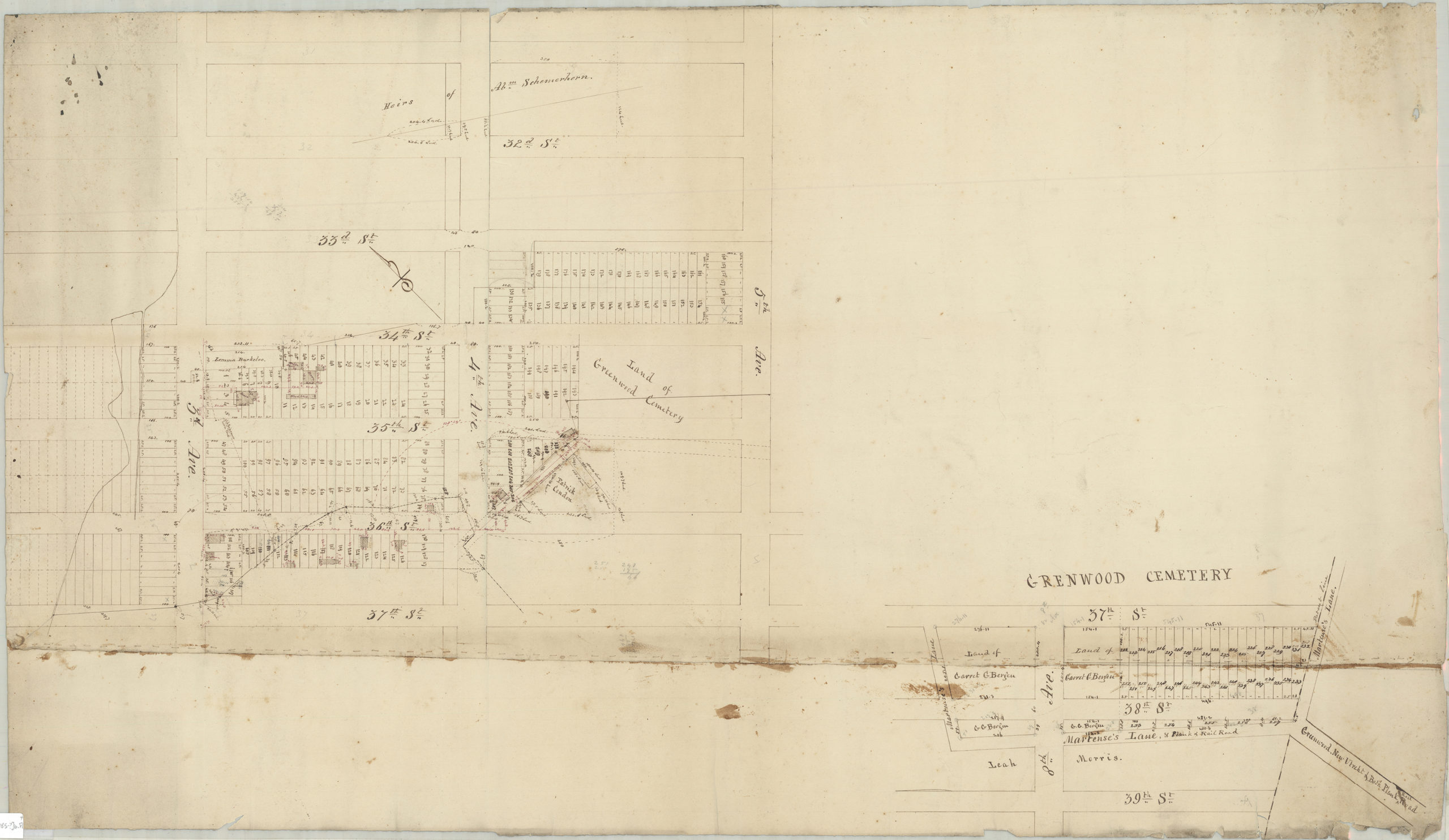
Creator
Bergen, Teunis G.,Publisher
Brooklyn Historical SocietyCitation
[Map of area near Greenwood Cemetery]; [185?], Map Collection, Bergen-[185-?]b.Fl; Brooklyn Historical Society.Scale
Scale not givenLoading zoom image... 