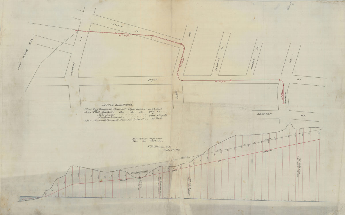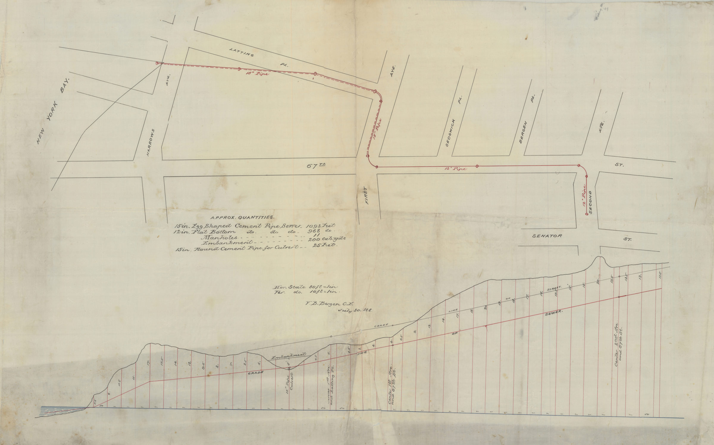
[Map of area north from Senator St. to Latting Pl. and east from New York Bay to 2nd Ave.]: V.B. Bergen, C.E. July 30, 1888
Map No. Bergen-1888.Fl
Sewer map covering area in modern-day Bay Ridge. Titled devised by cataloger. Oriented with north to the upper left. Includes list of pipe quantities and diagram showing grade lines of sewers and streets.
Map area shown
Relation
Full catalog recordSize
52 × 84 cmDownload
Low Resolution Image
Creator
Bergen, Van Brunt,Publisher
Brooklyn Historical SocietyCitation
[Map of area north from Senator St. to Latting Pl. and east from New York Bay to 2nd Ave.]: V.B. Bergen, C.E.; July 30, 1888, Map Collection, Bergen-1888.Fl; Brooklyn Historical Society.Scale
Scale [1:960] in to 80 ftLoading zoom image...