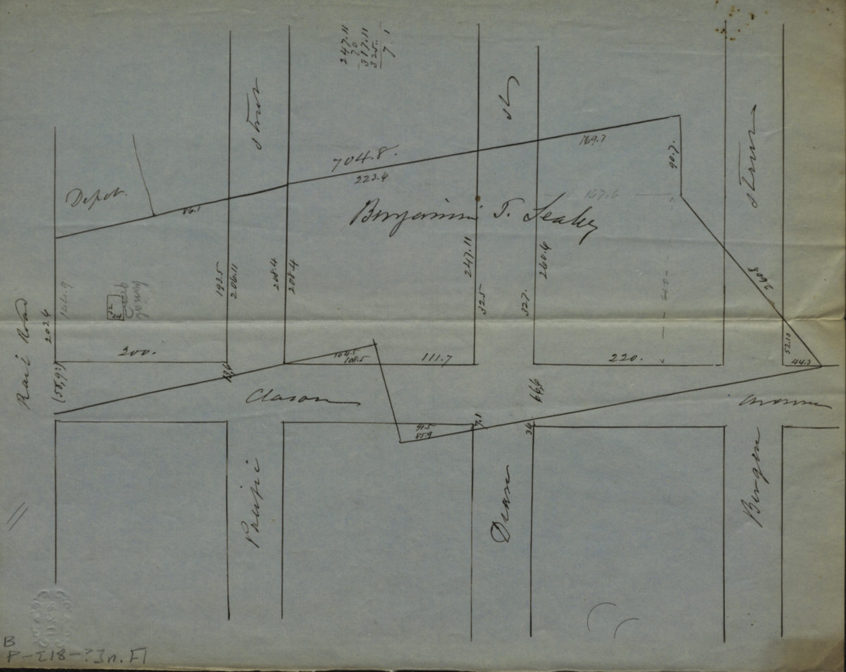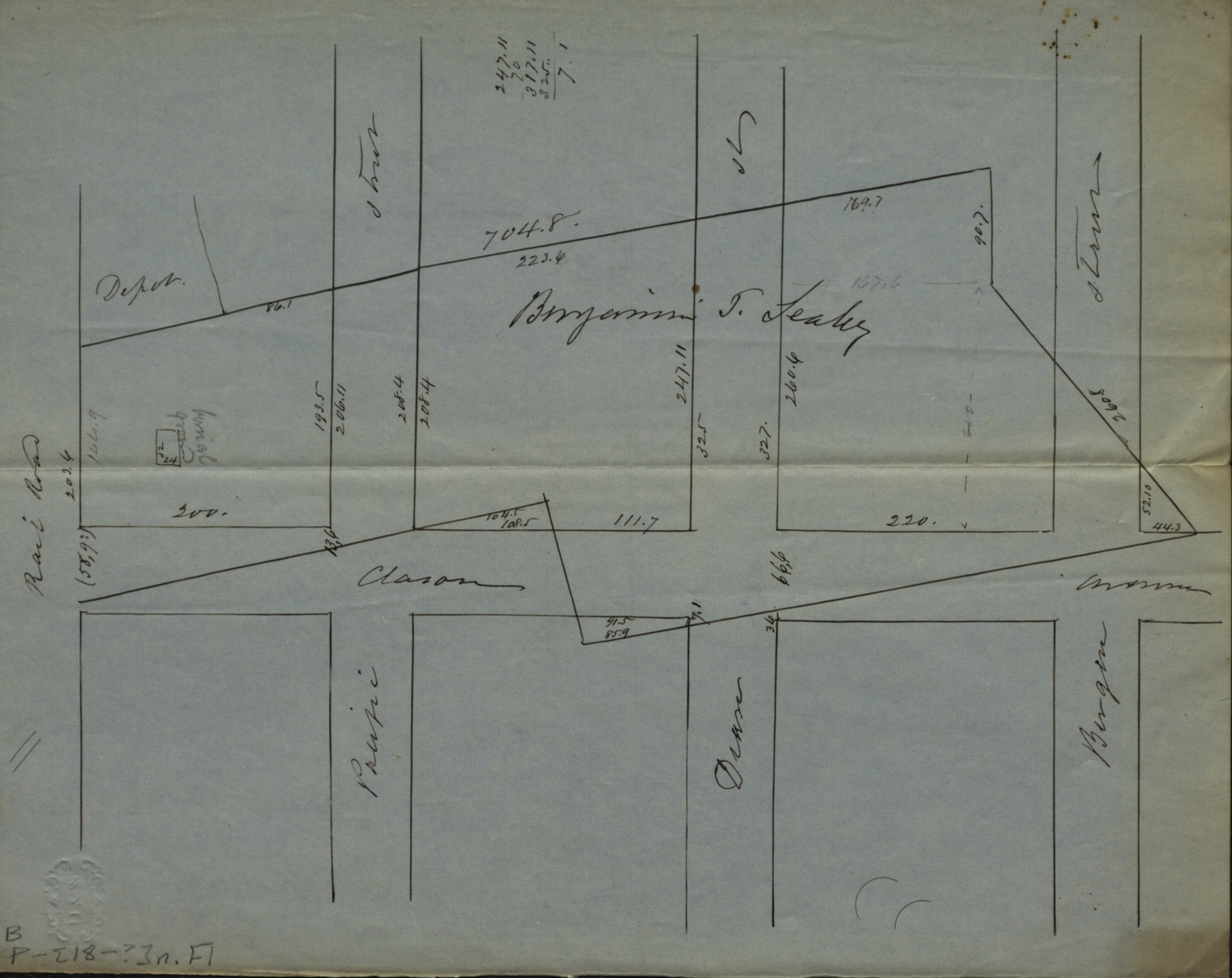
[Map of Atlantic Ave., Pacific St., Dean St., and Bergen St. at Classon Ave.]. [18??]
Map No. B P-[18--?]d.Fl
Cadastral map covering area in modern-day Bedford-Stuyvesant. Shows property (including dimensions and buildings), and names of landowners. Title devised by cataloger. Oriented with north to left.
Map area shown
Relation
Full catalog recordSize
20 × 25 cmDownload
Low Resolution ImageCreator
Publisher
Brooklyn Historical SocietyCitation
[Map of Atlantic Ave., Pacific St., Dean St., and Bergen St. at Classon Ave.].; [18??], Map Collection, B P-[18--?]d.Fl; Brooklyn Historical Society.Scale
Scale not givenLoading zoom image...