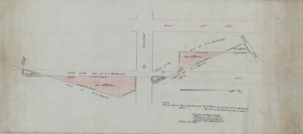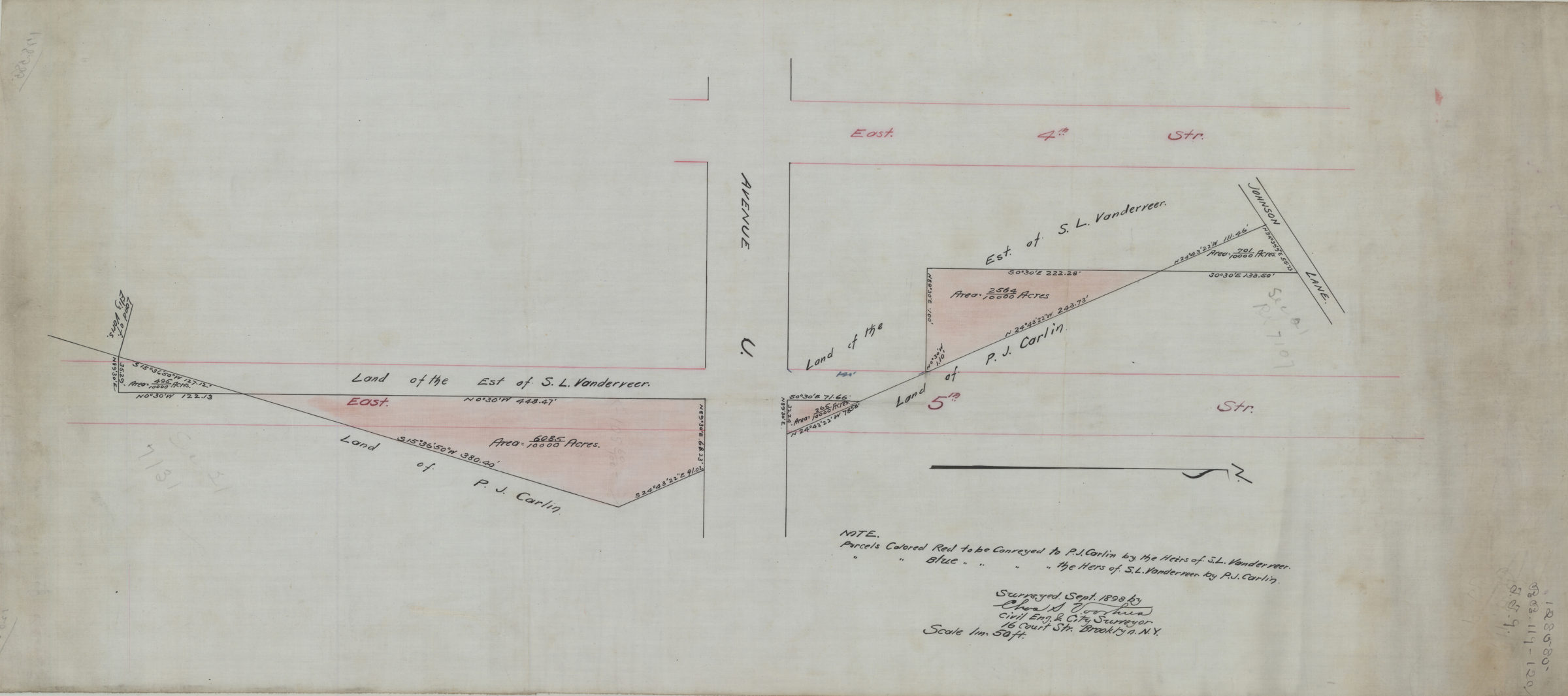
[Map of Ave. U between E. 4th St. and E. 5th St.]: surveyed … by Chas. S. Voorhies, civil eng. & city surveyor September 1898
Map No. B P-1898.Fl
Cadastral map covering area in modern-day Gravesend. Shows property (including parcels and measurements), and names of landowners. Title devised by cataloger. Oriented with north to the right. Includes key.
Map area shown
Relation
Full catalog recordSize
35 × 79 cmDownload
Low Resolution Image
Creator
Voorhies, Chas S.,Publisher
Brooklyn Historical SocietyCitation
[Map of Ave. U between E. 4th St. and E. 5th St.]: surveyed … by Chas. S. Voorhies, civil eng. & city surveyor; September 1898, Map Collection, B P-1898.Fl; Brooklyn Historical Society.Scale
Scale [1:600] 1 in to 50Loading zoom image...