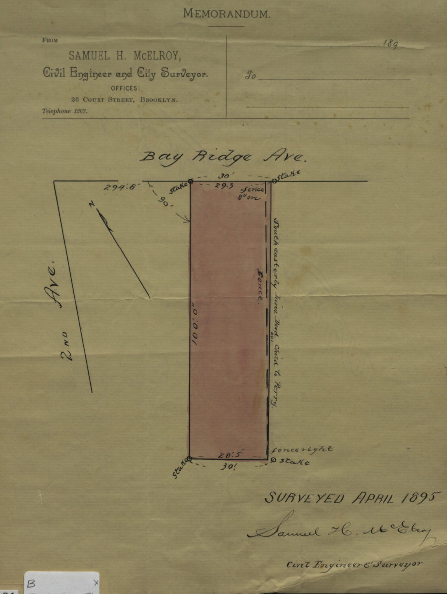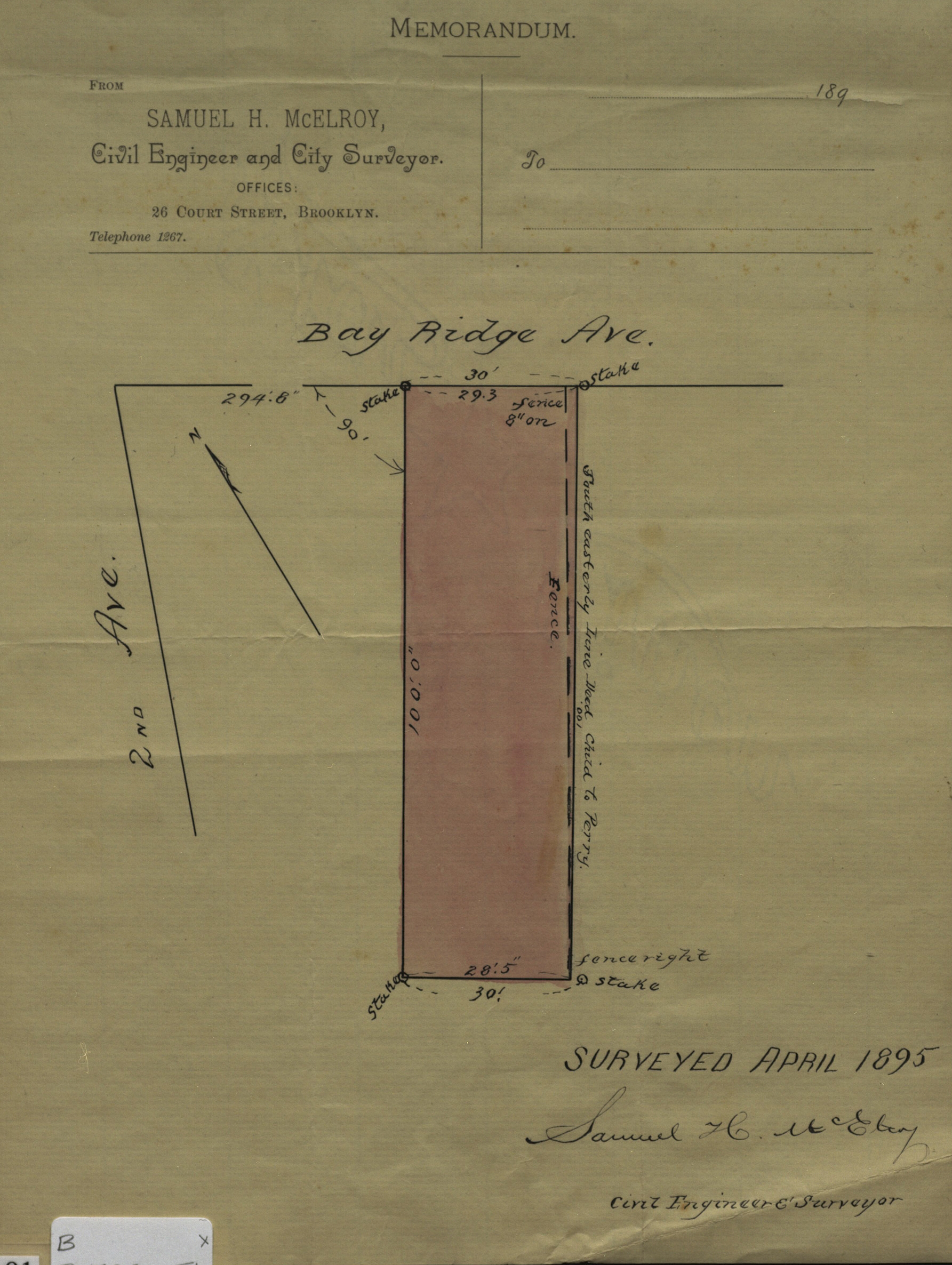
[Map of Bay Ridge Ave. at 2nd Ave.]: surveyed … [by] Samuel H. McElroy, civil engineer & surveyor April 1895
Map No. B P-1895a.Fl
Cadastral map covering area in modern-day Bay Ridge. Shows property (including dimensions). Title devised by cataloger. Oriented with north to the upper left. Written on McElroy’s stationary includes letterhard at top of sheet. Watermark: Star Linen.
Map area shown
Relation
Full catalog recordSize
28 × 21 cmDownload
Low Resolution ImageCreator
McElroy, Samuel,Publisher
Brooklyn Historical SocietyCitation
[Map of Bay Ridge Ave. at 2nd Ave.]: surveyed … [by] Samuel H. McElroy, civil engineer & surveyor; April 1895, Map Collection, B P-1895a.Fl; Brooklyn Historical Society.Scale
Scale not givenLoading zoom image...