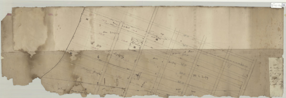
Map of Bay Ridge [18??]
Map No. Bergen-[18--?]s.Fl
Cadastral map of Bay Ridge, covering approximately from 59th Street to 66th Street west of New York Bay. Shows property, landowners and structures. Verso title. Attributed to Teunis G. Bergen, based on handwriting on piece. Bottom torn with major losses. Includes text fragment.
Map area shown
Relation
Full catalog recordSize
32 × 100 cmDownload
Low Resolution Image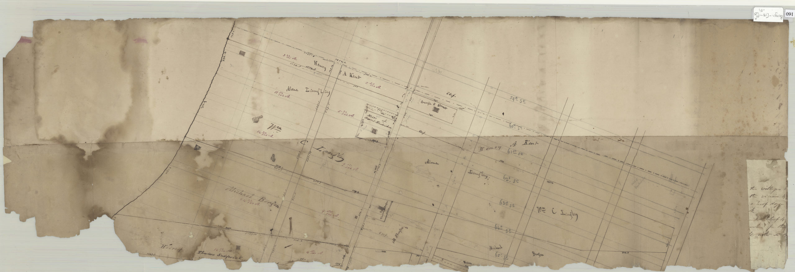
Creator
Bergen, Teunis G.,Publisher
Brooklyn Historical SocietyCitation
Map of Bay Ridge; [18??], Map Collection, Bergen-[18--?]s.Fl; Brooklyn Historical Society.Scale
Scale not givenLoading zoom image...