[Map of Bay St.]. [186?]
Map No. Bergen-[186-?]c.Fl
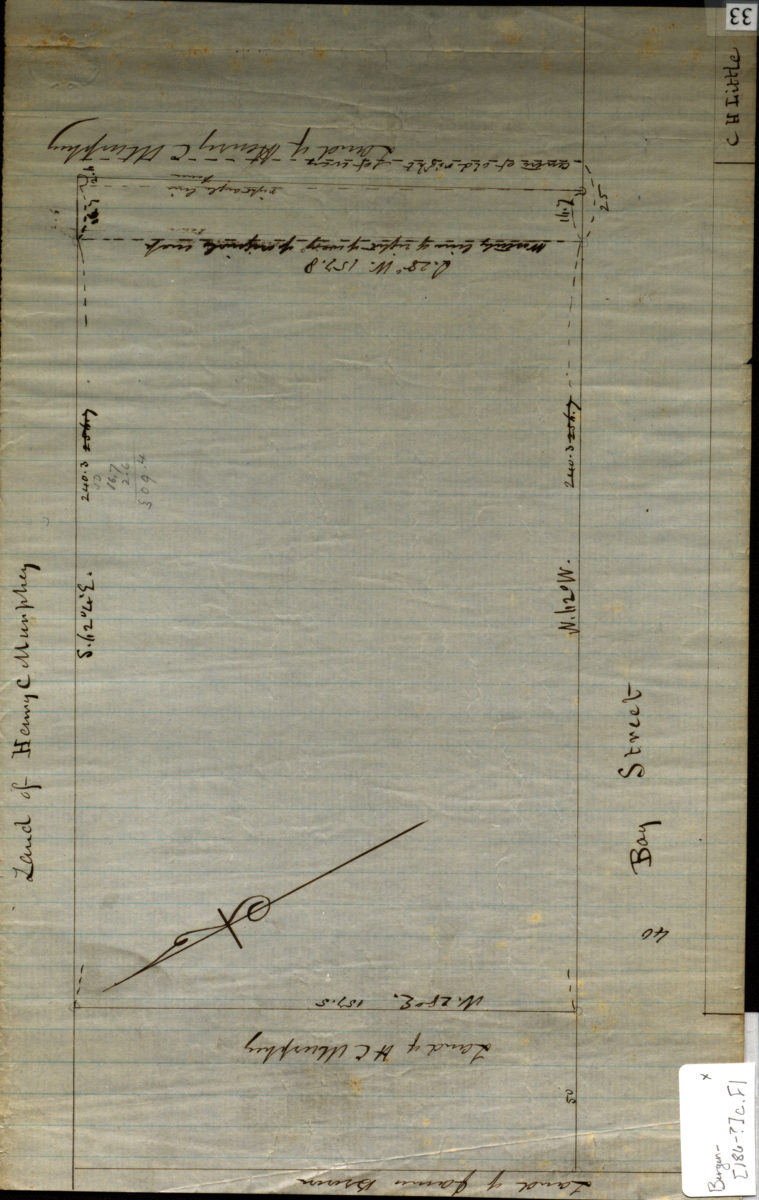
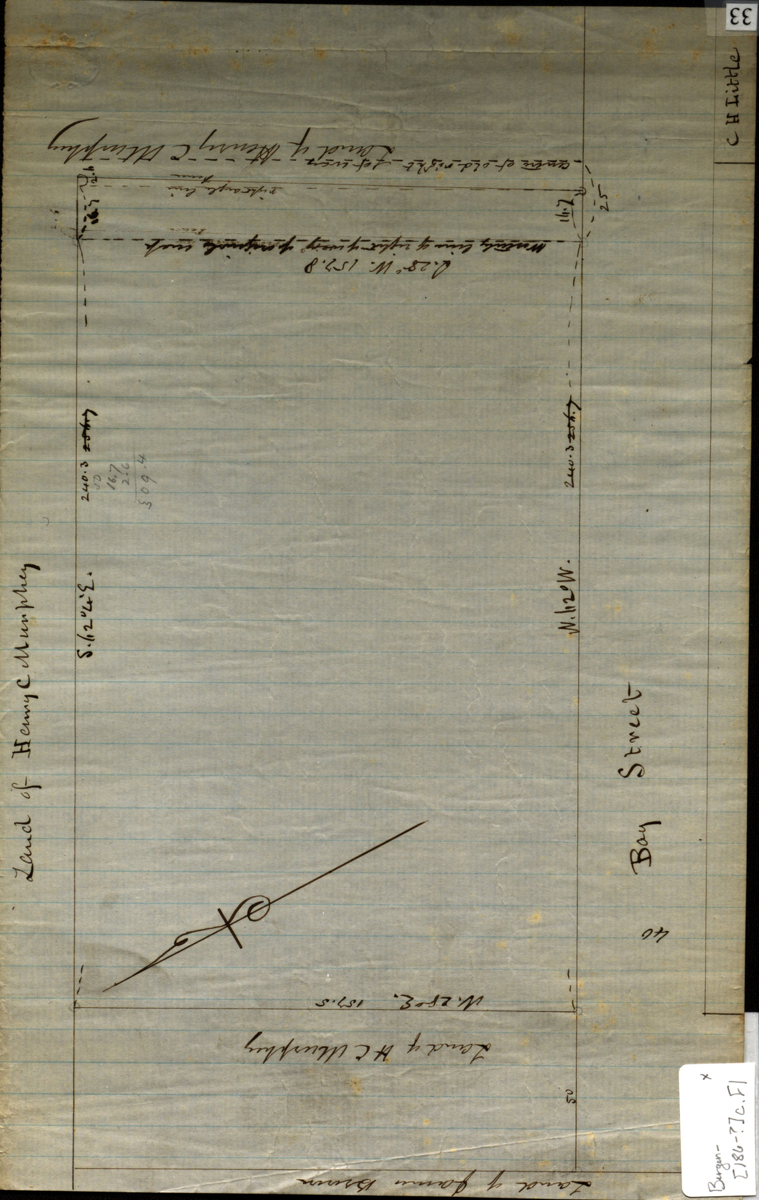
Cadastral map covering area in modern-day Red Hook. Shows property and names of landowners. Title devised by cataloger. Likely attributed to T.G. Bergen, based on handwriting on piece. Oriented with north to the upper left.
Map area shown
Relation
Full catalog recordSize
20 × 32 cmDownload
Low Resolution Image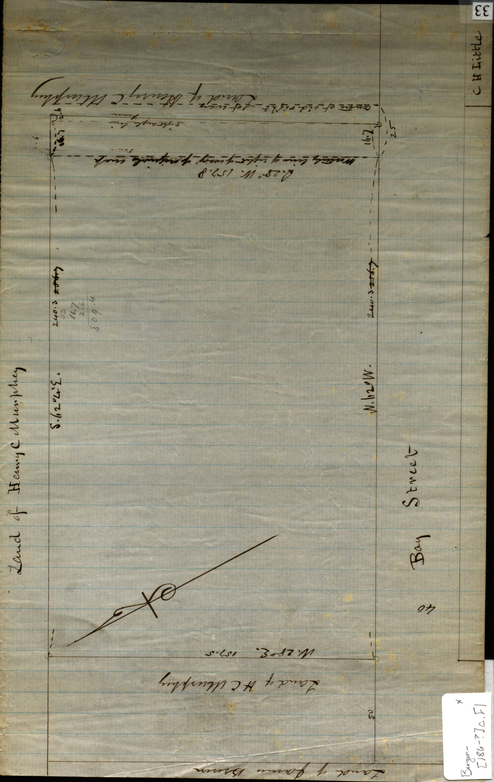
Creator
Bergen, Teunis G.,Publisher
Brooklyn Historical SocietyCitation
[Map of Bay St.].; [186?], Map Collection, Bergen-[186-?]c.Fl; Brooklyn Historical Society.Scale
Scale not givenLoading zoom image...