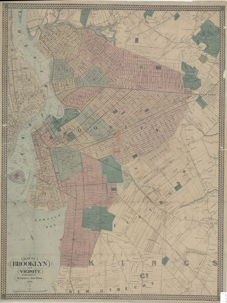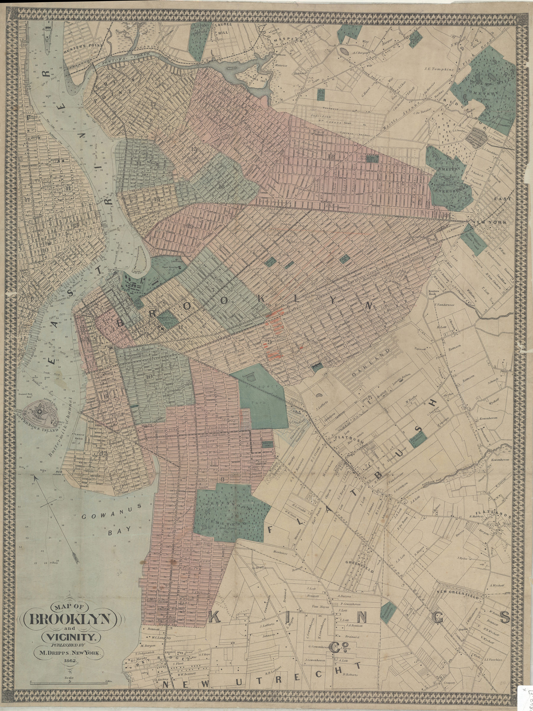
Map of Brooklyn and vicinity 1862
Map No. B A-1862.Fl
Covers Brooklyn south to 60th St., north to Green Point, and east to the Cemetery of the Evergreens. Also shows Governors Island and portions of southern Queens, Lower Manhattan, New Utrecht, Flatbush, and East New York. Shows wards, property owners, ferry lines, and piers. Depths shown by soundings and isolines. Oriented with north to the upper left. Includes decorative border. BHS copy annotated in orange pencil.
Map area shown
Genre
Bathymetric mapsRelation
Full catalog recordSize
63 × 47 cmDownload
Low Resolution Image
Creator
Dripps, M.,Publisher
Brooklyn Historical SocietyCitation
Map of Brooklyn and vicinity; 1862, Map Collection, B A-1862.Fl; Brooklyn Historical Society.Scale
Scale [ca. 1:22,528]Loading zoom image...