Map of Brooklyn City Railroad in New Utrecht [18??]
Map No. Bergen-[18--?]d.Fl
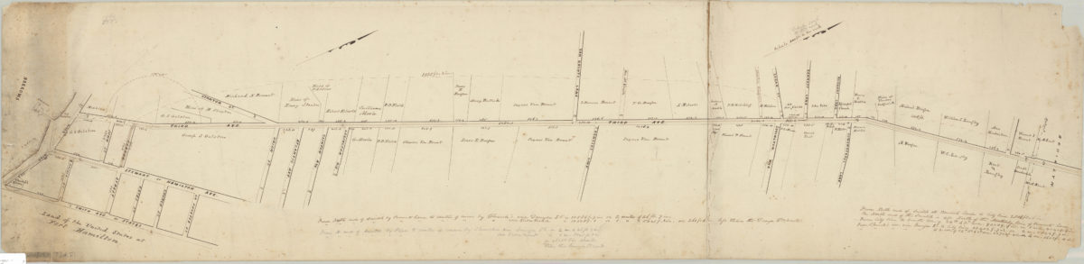
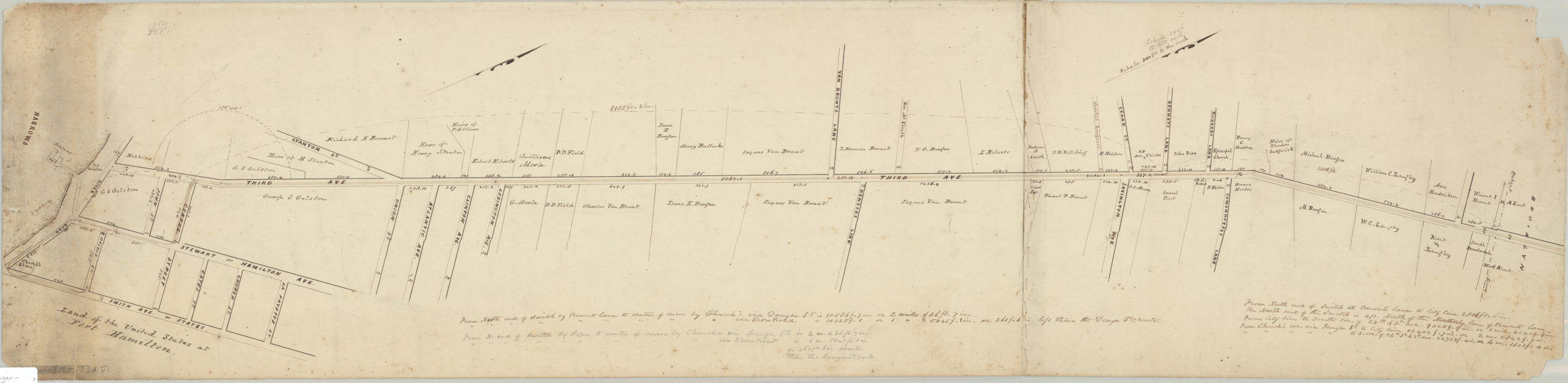
Cadastral map covering 3rd Ave. east from the waterfront to approximately 60th St. (modern-day Bay Ridge, Fort Hamilton, and Sunset Park). Shows the 3rd Ave. Railroad Line, property, and names of landowners. Verso title. Likely attributed to T.G. Bergen, based on handwriting on piece. Oriented with north to the upper right. Includes notes.
Subjects
Places
Map area shown
Relation
Full catalog recordSize
27 × 111 cmDownload
Low Resolution ImageCreator
Bergen, Teunis G.,Publisher
Brooklyn Historical SocietyCitation
Map of Brooklyn City Railroad in New Utrecht; [18??], Map Collection, Bergen-[18--?]d.Fl; Brooklyn Historical Society.Scale
Scale [1:3,600] 1 in to 3Loading zoom image...