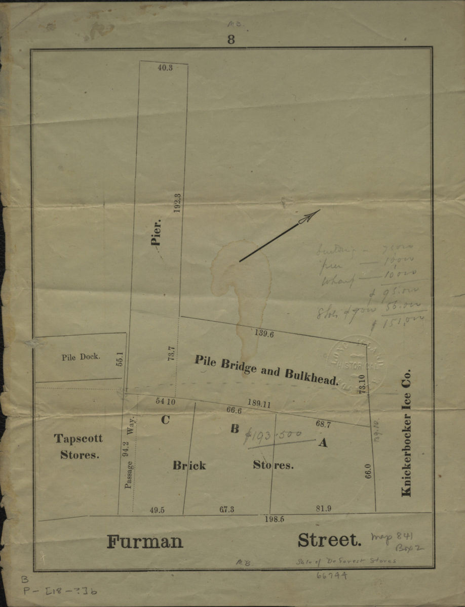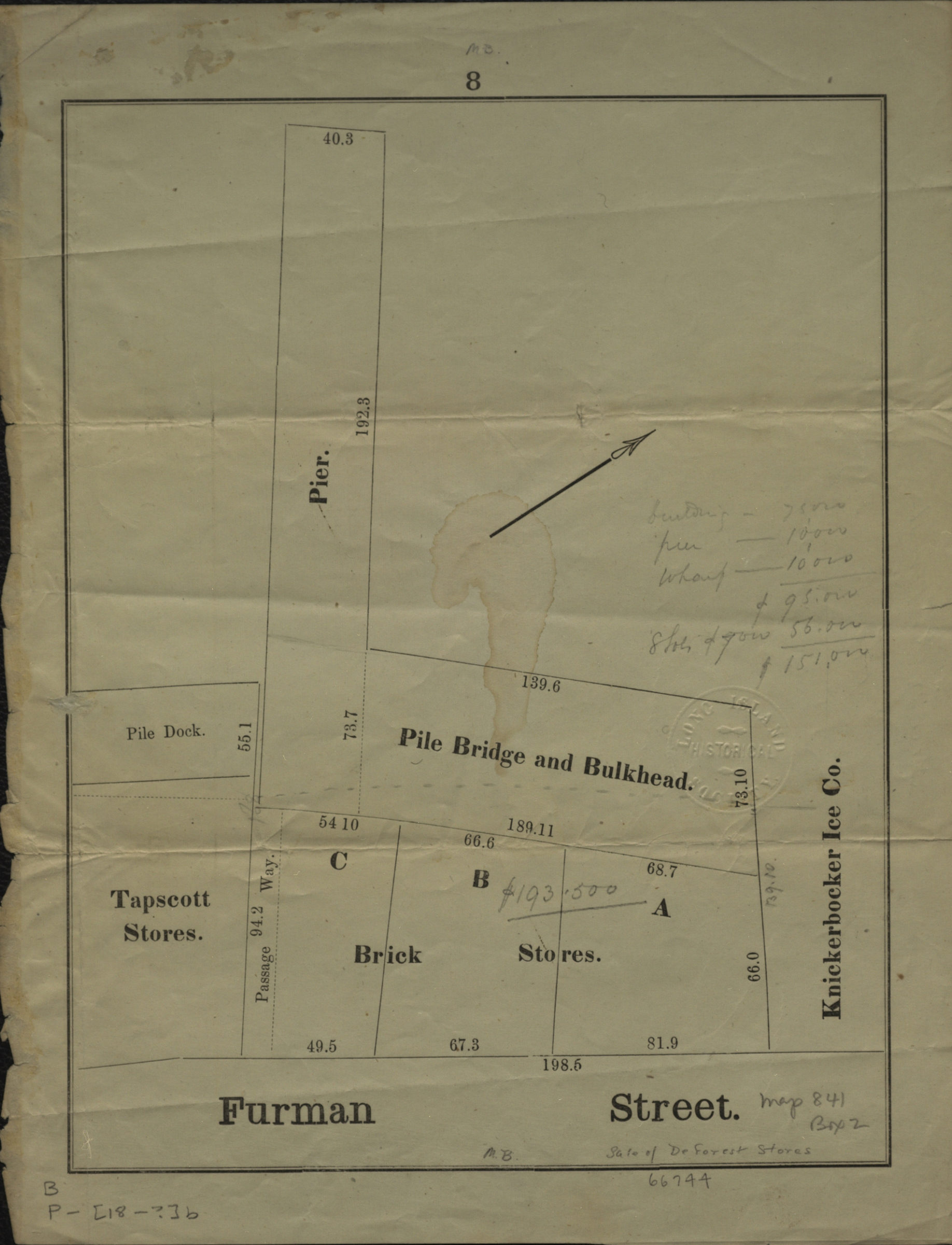
[Map of Brooklyn dock properties] [18??]
Map No. B P-[18--?]b.Fl
Cadastral map showing dock properties, likely in modern-day Brooklyn Heights. Includes dimensions and names of landowners. Title devised by cataloger. Oriented with north to the upper right. “8”–Upper center margin.
Map area shown
Genre
Cadastral mapsRelation
Full catalog recordSize
26 × 20 cmDownload
Low Resolution Image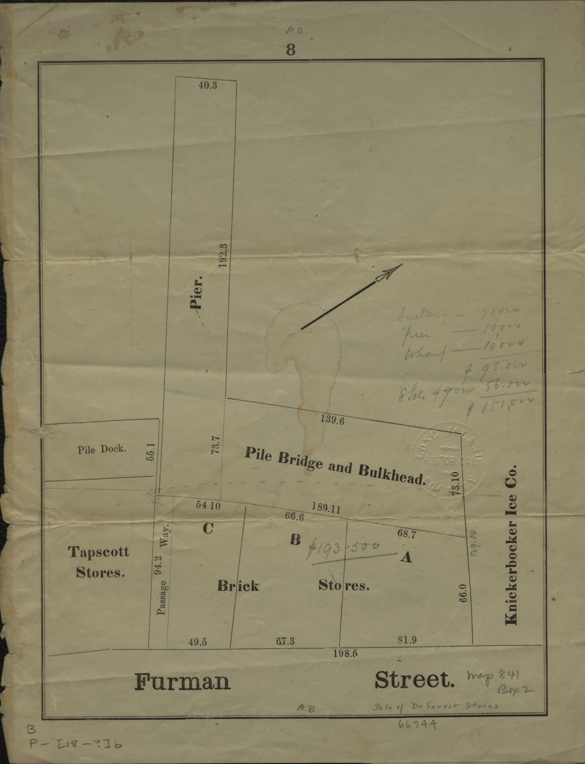
Creator
Publisher
Brooklyn Historical SocietyCitation
[Map of Brooklyn dock properties]; [18??], Map Collection, B P-[18--?]b.Fl; Brooklyn Historical Society.Scale
Scale not givenLoading zoom image...