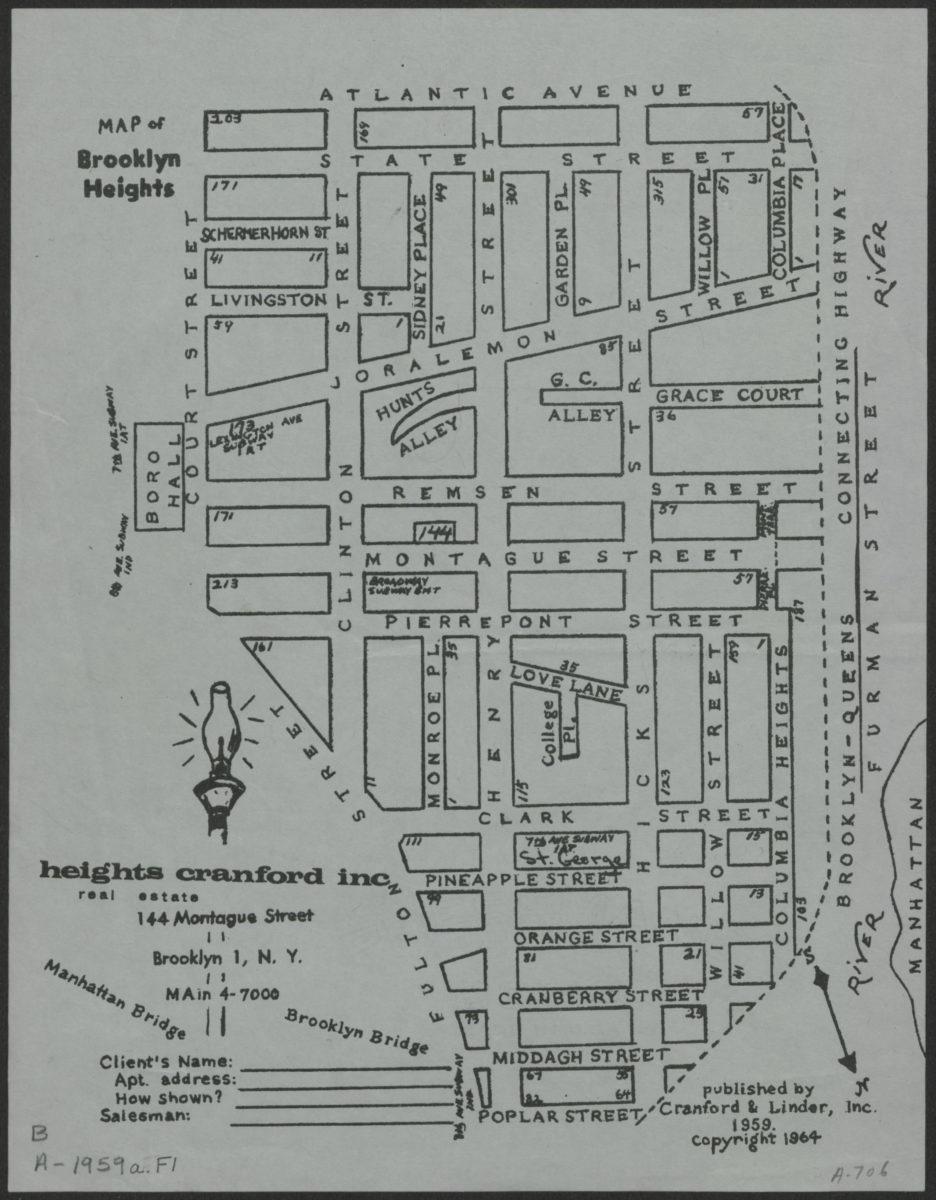
Map of Brooklyn Heights [1964; 1964]
Map No. B A-1959a.Fl
Realtor’s street map covers Brooklyn Heights. Shows streets. At bottom of sheet: “Heights Cranford, Inc., real estate, 155 Montague Street, Brooklyn, N.Y.” Oriented with north to the lower right.
Map area shown
Genre
MapRelation
Full catalog recordSize
28 × 22 cmDownload
Low Resolution Image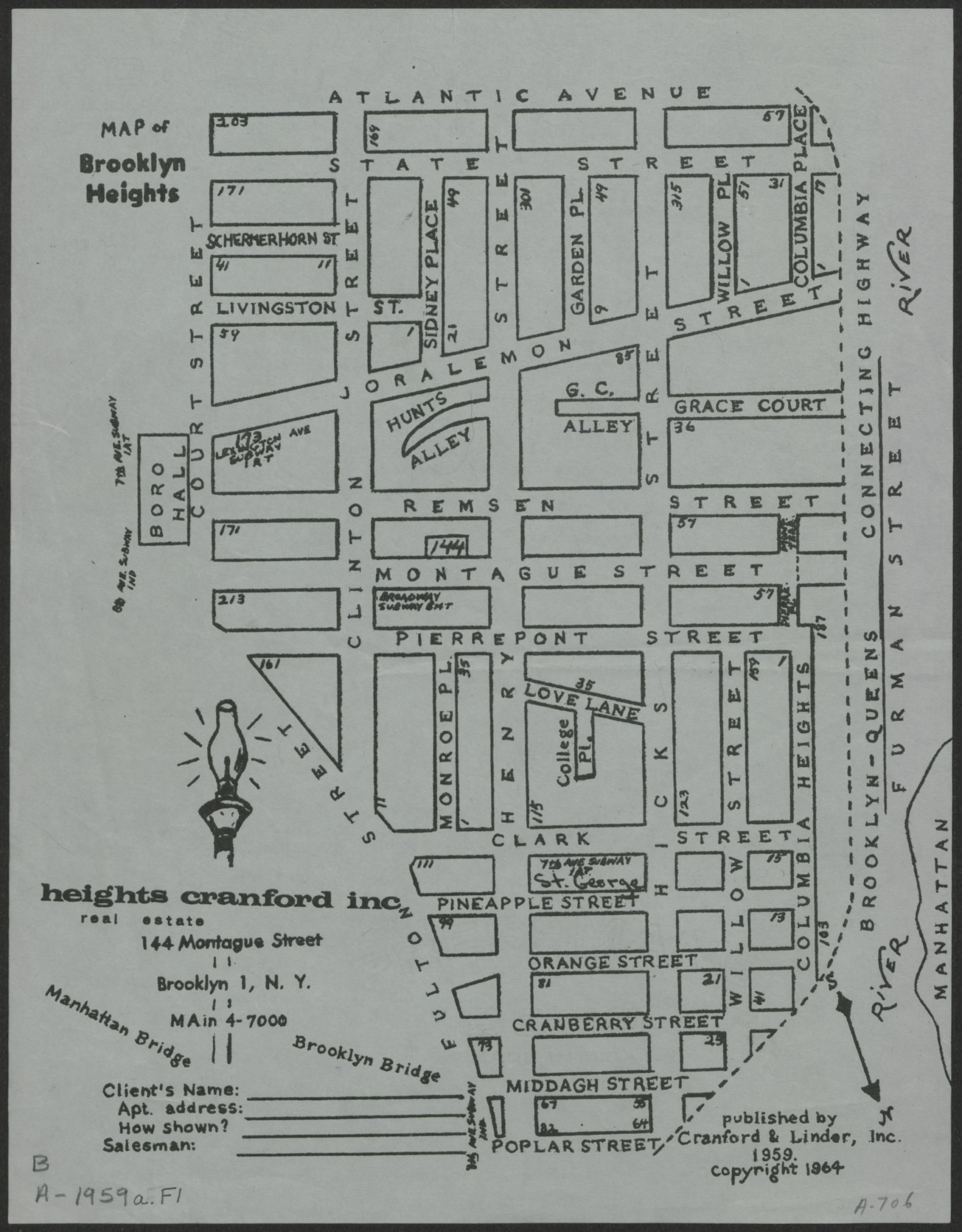
Creator
Publisher
Brooklyn Historical SocietyCitation
Map of Brooklyn Heights; [1964; 1964], Map Collection, B A-1959a.Fl; Brooklyn Historical Society.Scale
Scale not givenLoading zoom image...