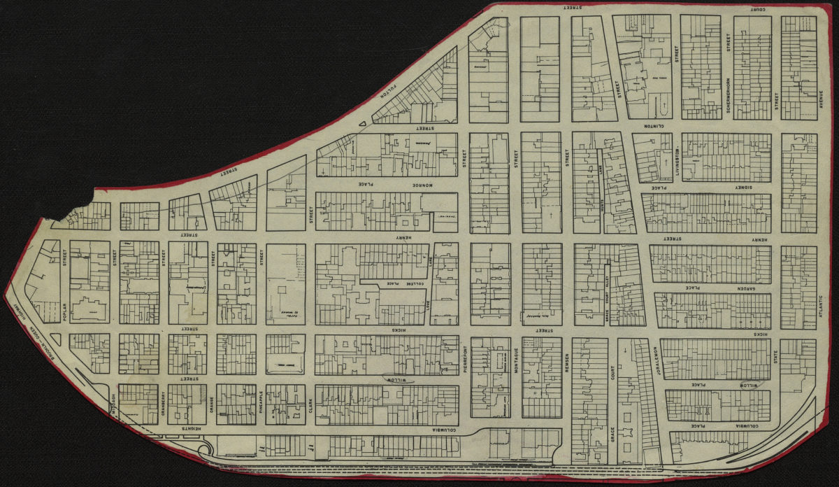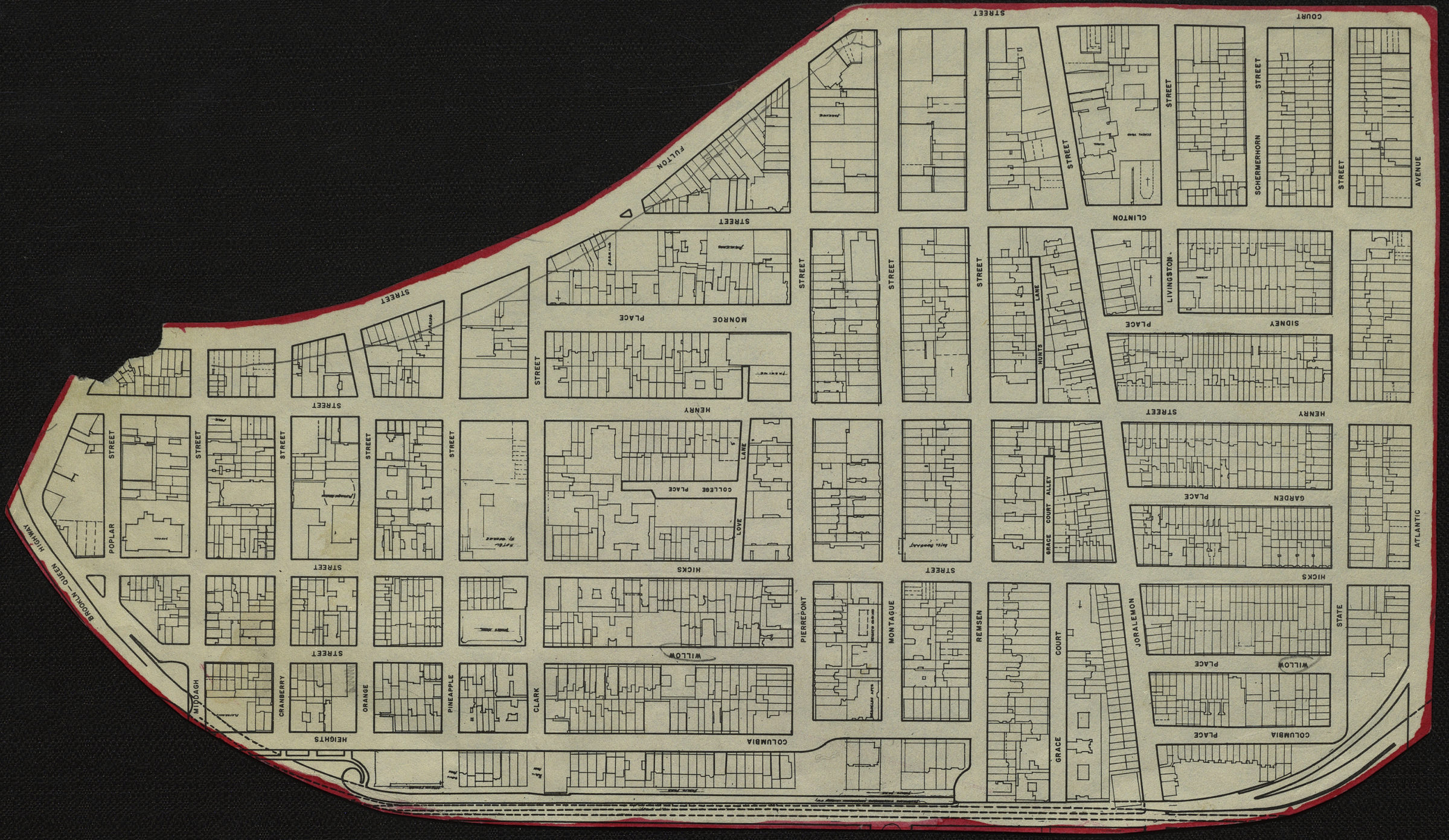
[Map of Brooklyn Heights] [19??]
Map No. B A-[19--?]g.Fl
Cadastral map covering Brooklyn Heights north from Atlantic Ave. to Poplar St. and west from Court St. to the Promenade. Shows lots. Title devised by cataloger. Extracted from a larger map? Irregularly shaped. Outlined in red.
Map area shown
Genre
Cadastral mapsRelation
Full catalog recordSize
15 × 26 cmDownload
Low Resolution Image
Creator
Publisher
Brooklyn Historical SocietyCitation
[Map of Brooklyn Heights]; [19??], Map Collection, B A-[19--?]g.Fl; Brooklyn Historical Society.Scale
Scale not givenLoading zoom image...