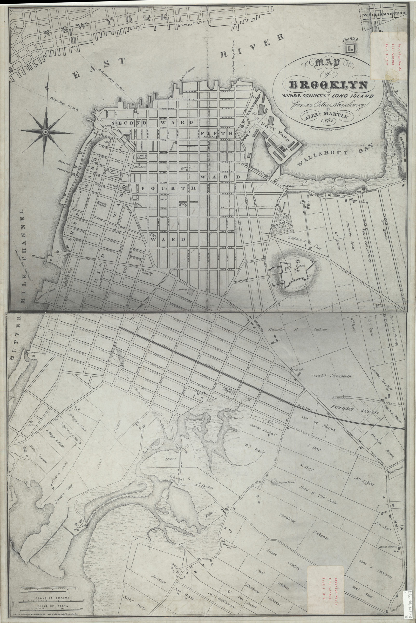
Map of Brooklyn, Kings County, Long Island: from an entire new survey: by Alexr. Martin [19??]
Map No. B A-1834 (19--?).Fl
Covers area north from Gowanus to the Brooklyn Navy Yard. Shows wards, churches, schools, hospitals, cemeteries, railroads, ferry lines, and names of landowners. Relief shown by hachures.
Map area shown
Genre
MapRelation
Full catalog recordSize
81 × 53 cmDownload
Low Resolution Image
Creator
Martin, Alexander,Publisher
Brooklyn Historical SocietyCitation
Map of Brooklyn, Kings County, Long Island: from an entire new survey: by Alexr. Martin; [19??], Map Collection, B A-1834 (19--?).Fl; Brooklyn Historical Society.Scale
Scale [ca. 1:5,647]Loading zoom image... 