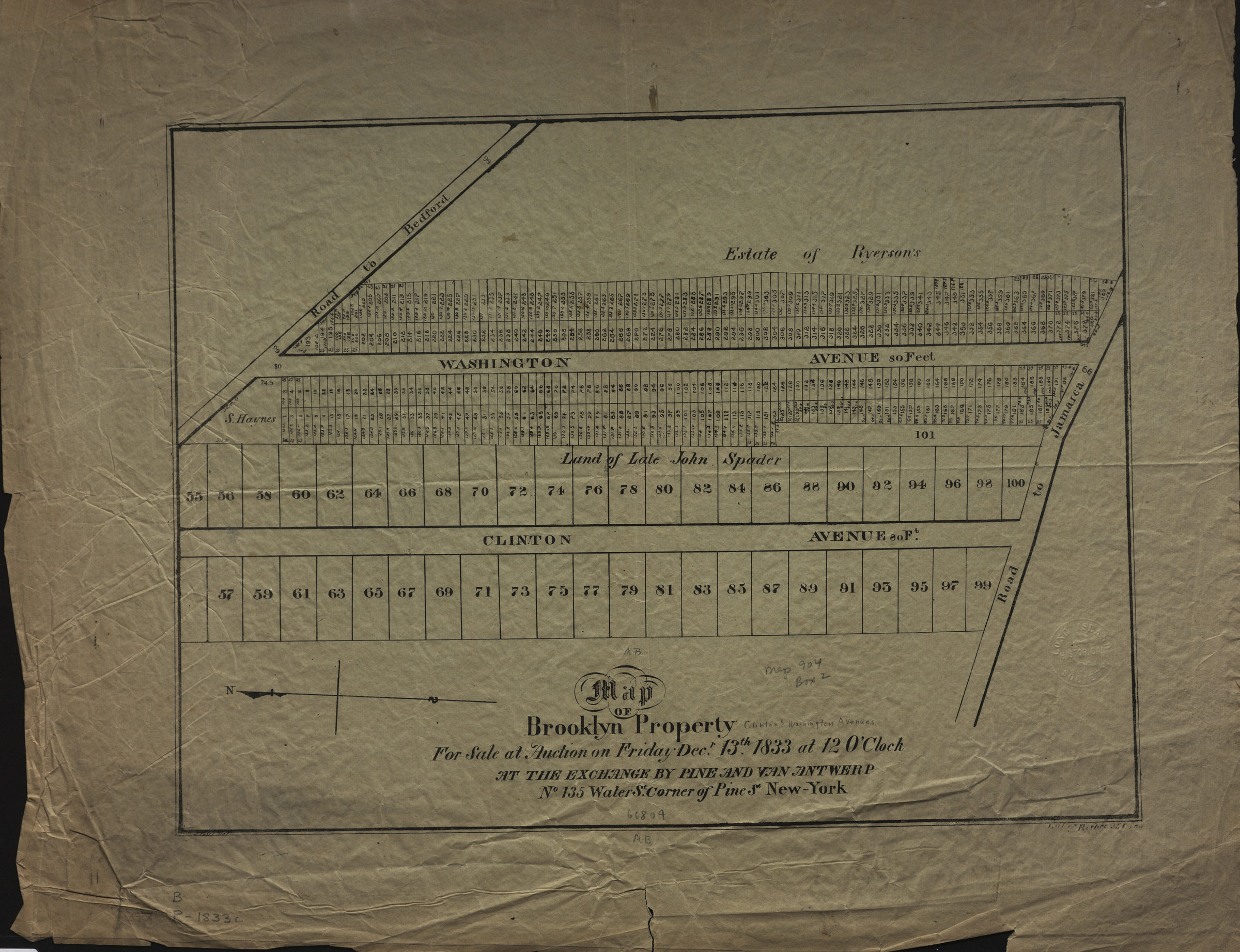
Map of Brooklyn property for sale at auction on Friday, Decr. 13th, 1833, at 12 o’clock at the Exchange, by Pine and Van Antwerp, no. 135 Water St., corner of Pine St., New-York: J. Price, del [1833]
Map No. B P-[1833]a.Fl
Cadastral map covering area north of the Road to Jamaica (now Fulton St.) between Clinton Ave. and Washington Ave. (modern-day Clinton Hill). Shows property (including lot numbers and dimensions), and names of landowners. Oriented with north to the left. BHS copy imperfect text in lower right margin illegible due to fading.
Map area shown
Genre
Cadastral mapsRelation
Full catalog recordSize
32 × 43 cmDownload
Low Resolution Image
Creator
Price, J.,Publisher
Brooklyn Historical SocietyCitation
Map of Brooklyn property for sale at auction on Friday, Decr. 13th, 1833, at 12 o’clock at the Exchange, by Pine and Van Antwerp, no. 135 Water St., corner of Pine St., New-York: J. Price, del; [1833], Map Collection, B P-[1833]a.Fl; Brooklyn Historical Society.Scale
Scale not givenLoading zoom image... 