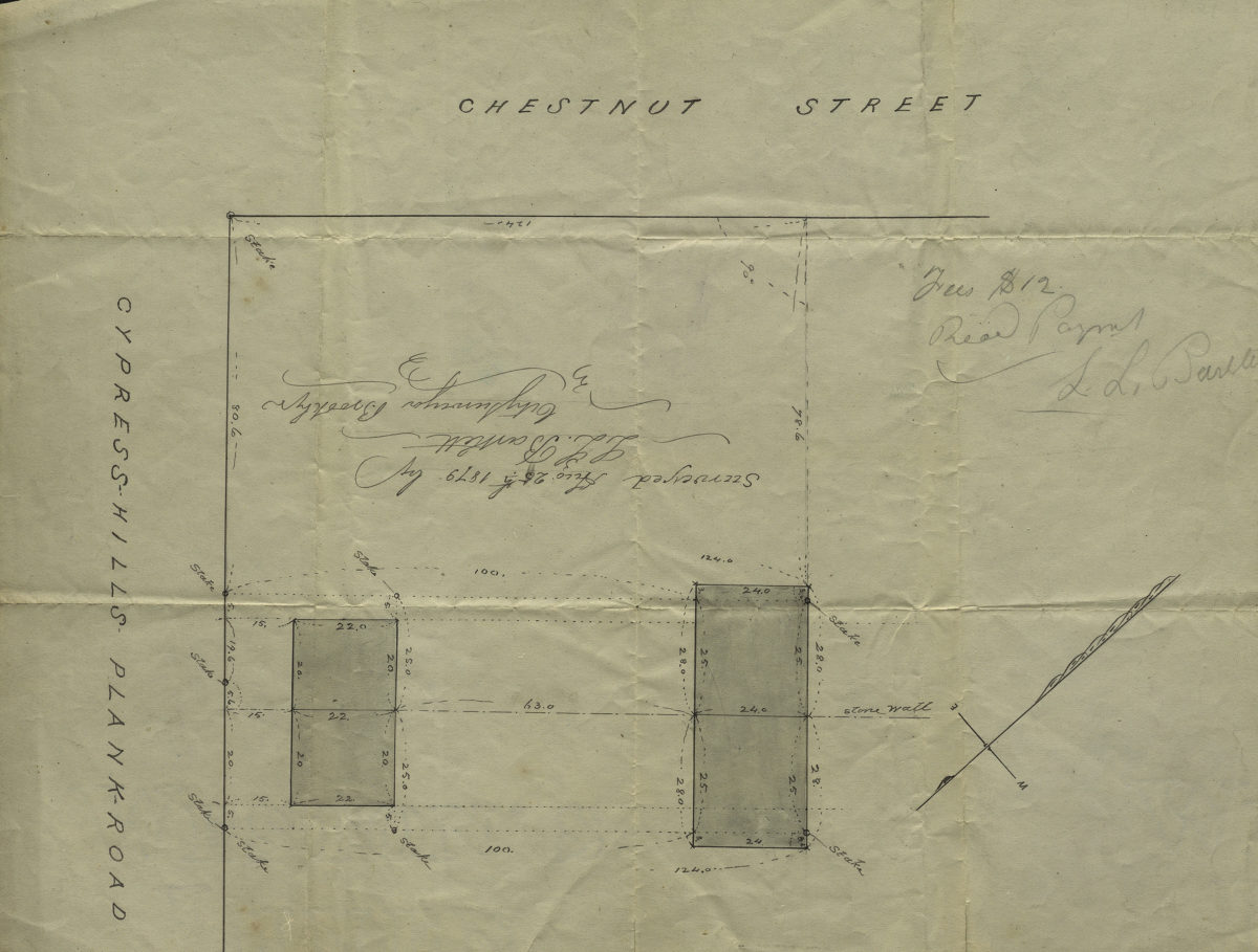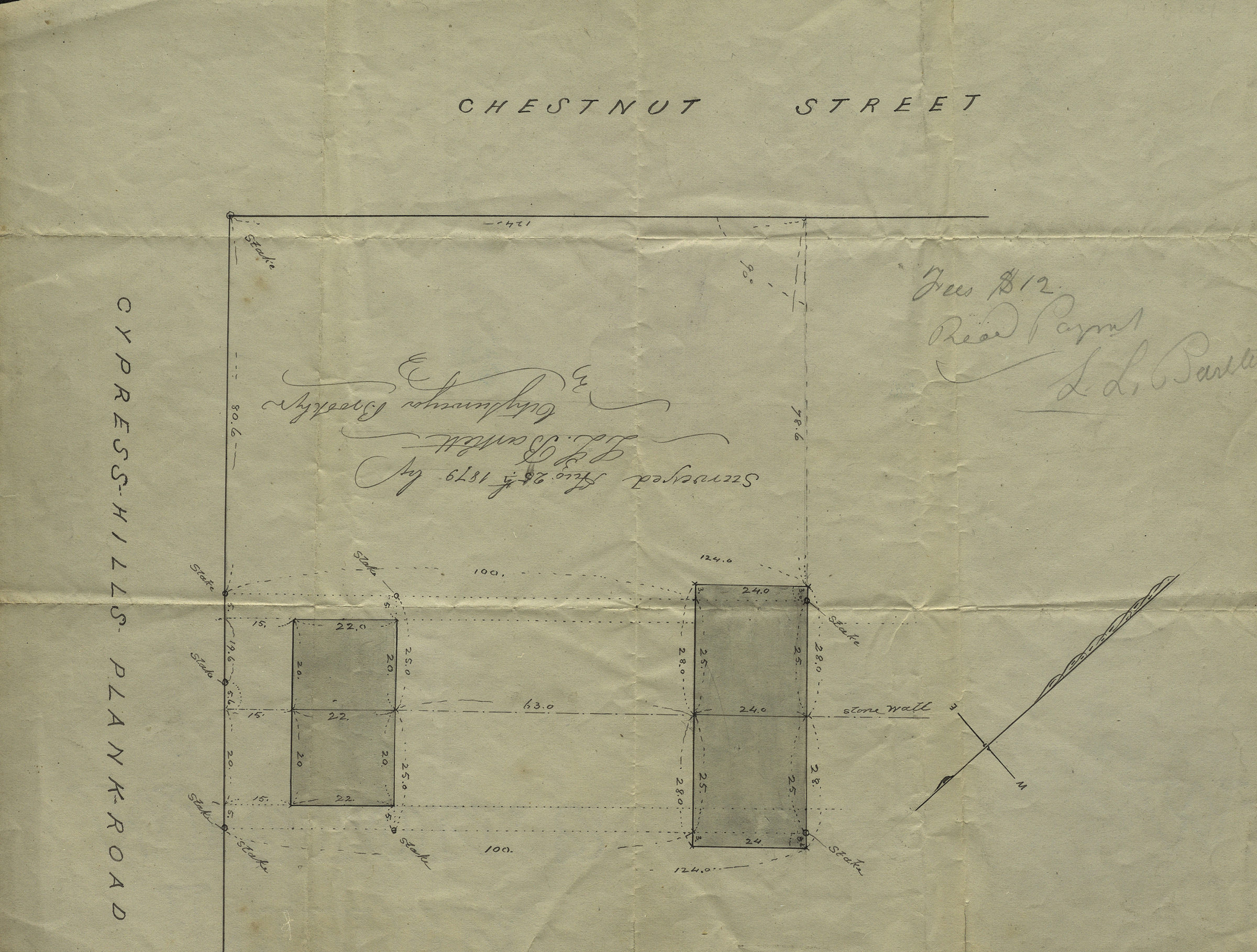
[Map of Chestnut St. and Cypress Hills Plank Road]: surveyed by L.L. Bartlett, city surveyor August 25, 1879
Map No. B A-1879c.Fl
Survey map covering area in modern-day Cypress Hills. Title devised by cataloger. Oriented with north to the upper right. Watermarked.
Map area shown
Genre
Manuscript mapsRelation
Full catalog recordSize
22 × 28 cmDownload
Low Resolution Image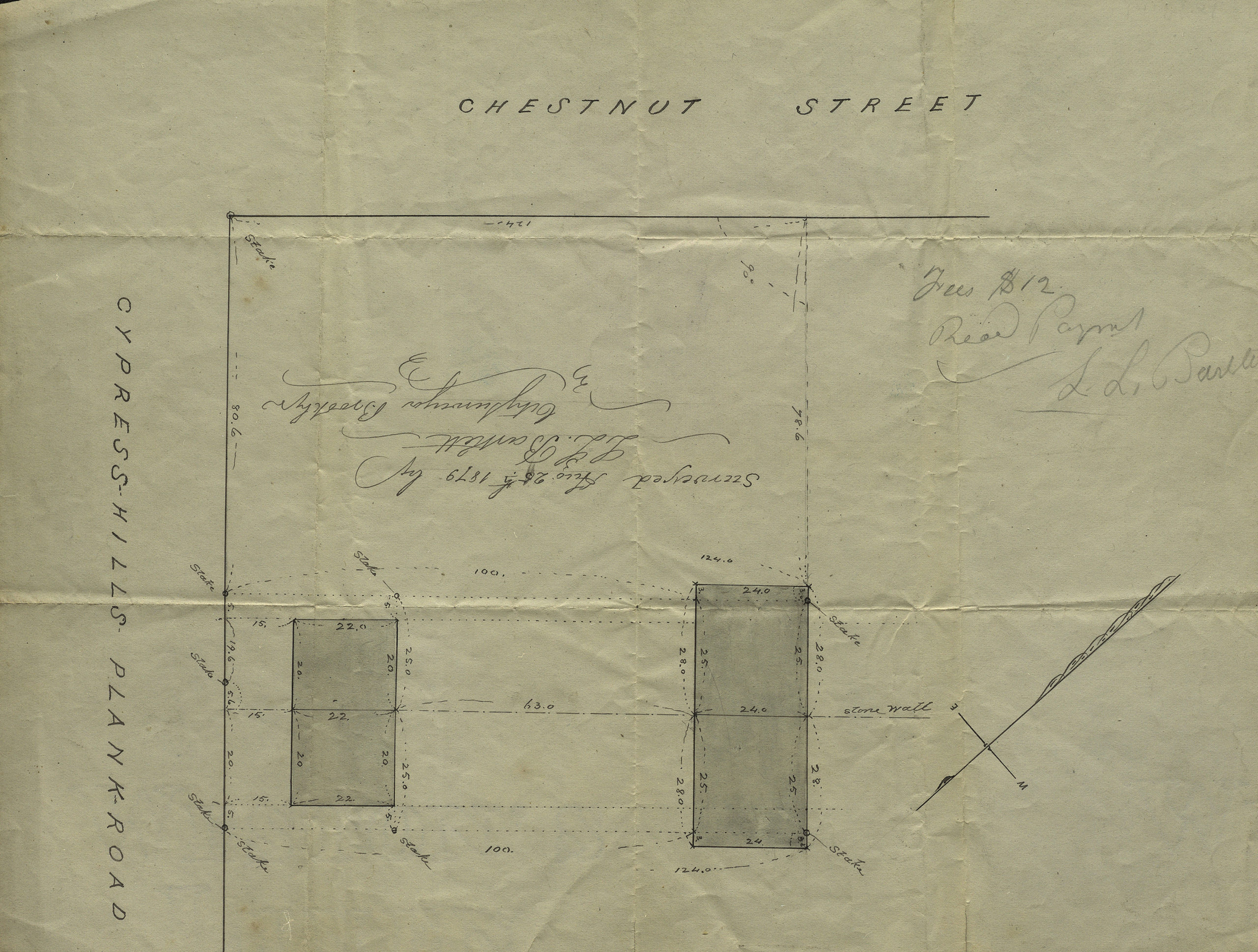
Creator
Bartlett, L. L.,Publisher
Brooklyn Historical SocietyCitation
[Map of Chestnut St. and Cypress Hills Plank Road]: surveyed by L.L. Bartlett, city surveyor; August 25, 1879, Map Collection, B A-1879c.Fl; Brooklyn Historical Society.Scale
Scale not givenLoading zoom image...