
[Map of Church Ave. between E. 18th St. and Nostrand Ave.]. [18??]
Map No. B A-[18--?].Fl.O
Survey map covering area in modern-day Flatbush. Title devised by cataloger.
Map area shown
Genre
Manuscript mapsRelation
Full catalog recordSize
35 × 142 cmDownload
Low Resolution Image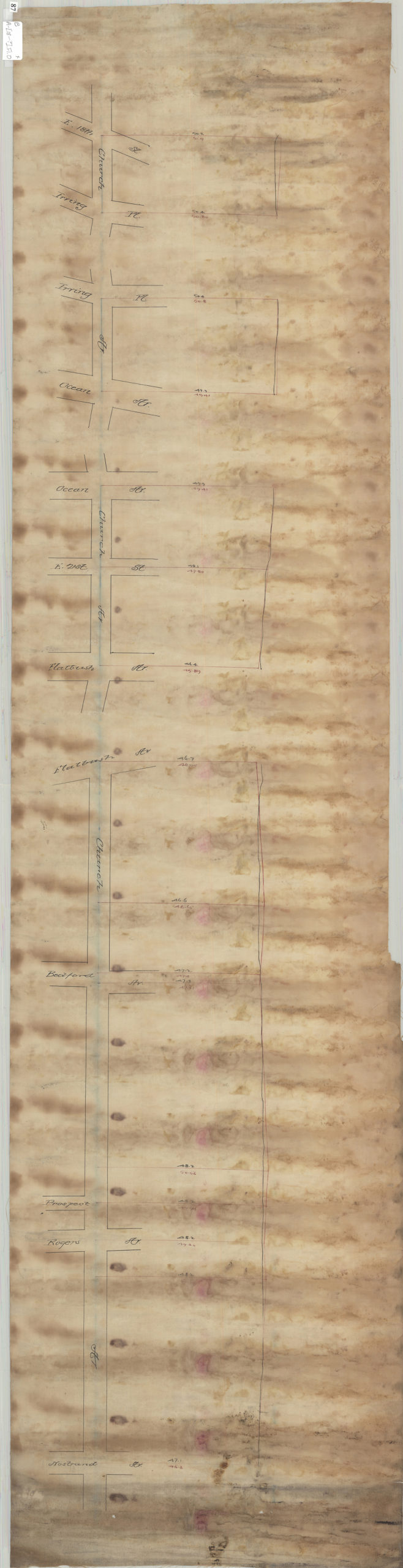
Creator
Publisher
Brooklyn Historical SocietyCitation
[Map of Church Ave. between E. 18th St. and Nostrand Ave.].; [18??], Map Collection, B A-[18--?].Fl.O; Brooklyn Historical Society.Scale
Scale not givenLoading zoom image... 