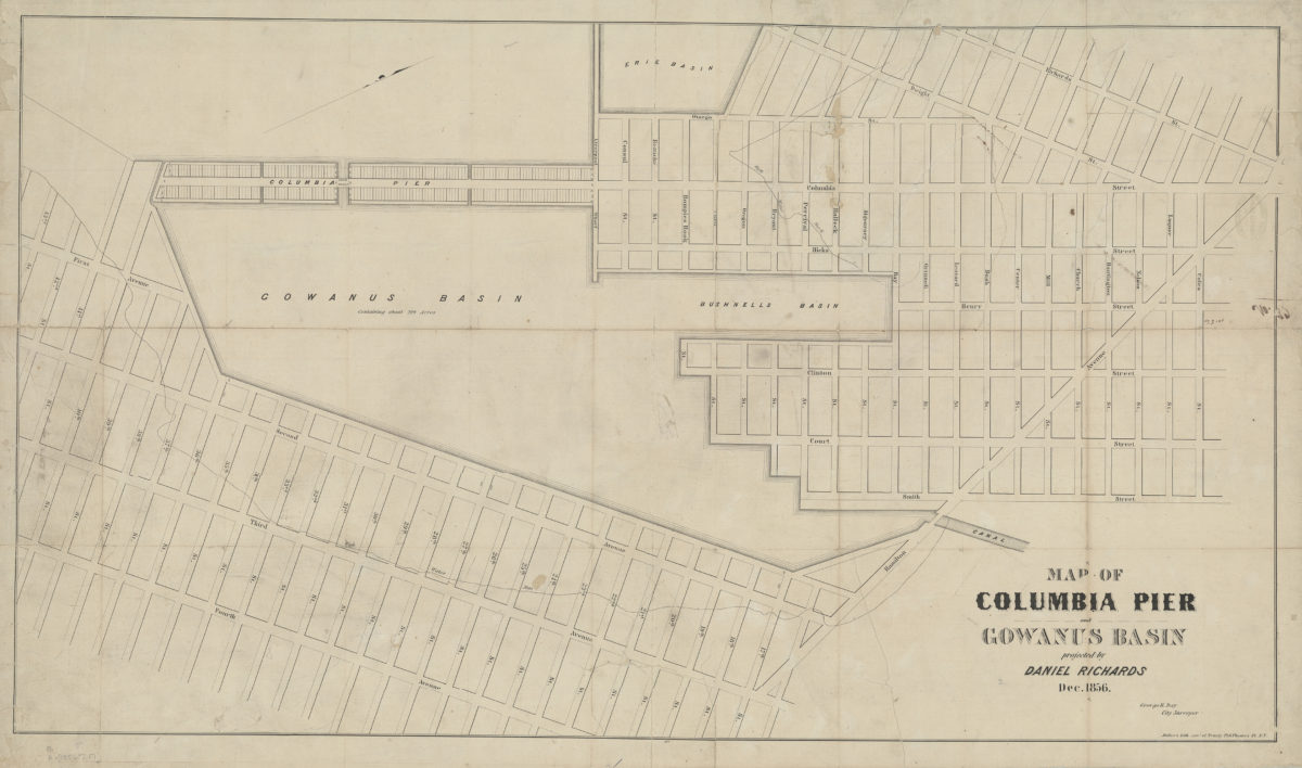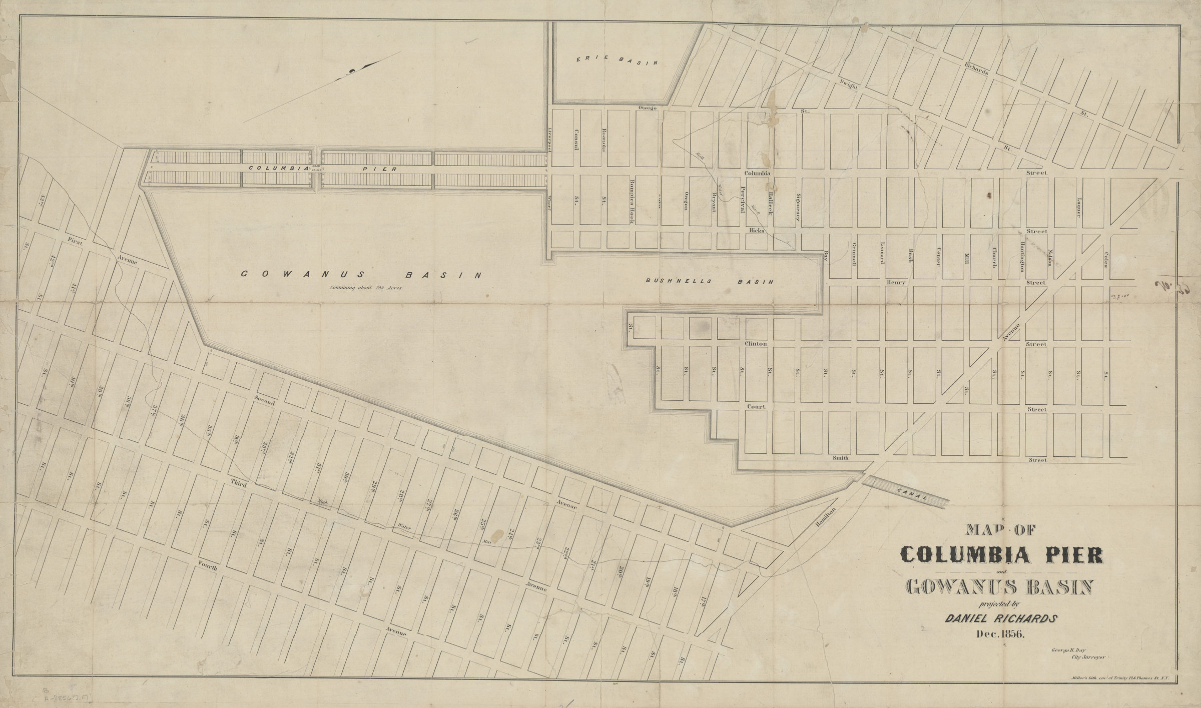
Map of Columbia Pier and Gowanus Basin: projected by Daniel Richards, Dec. 1856 ; George H. Day, city surveyor [1856]
Map No. B A-[1856?].Fl
Covers Brooklyn from Richards St. to 4th Ave., and Coles St. south to 43rd St. Also shows Erie Basin, Bushnell’s Basin, high water marks, and surrounding streets. Oriented with north to the upper right.
Map area shown
Genre
Thematic mapsRelation
Full catalog recordSize
59 × 104 cmDownload
Low Resolution Image
Creator
Richards, Daniel,Publisher
Brooklyn Historical SocietyCitation
Map of Columbia Pier and Gowanus Basin: projected by Daniel Richards, Dec. 1856 ; George H. Day, city surveyor; [1856], Map Collection, B A-[1856?].Fl; Brooklyn Historical Society.Scale
Scale not givenLoading zoom image...