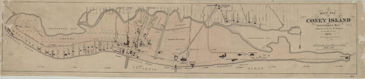
Map of Coney Island and Sheepshead Bay 1879
Map No. B A-1879b.Fl
Cadastral map also covering modern-day Brighton Beach. Shows property (including lot numbers and buildings), names of landowners, hotels, and race tracks. “Entered according to Act of Congress in the Year 1879 by M. Dripps.”
Subjects
Places
Map area shown
Genre
Cadastral mapsRelation
Full catalog recordSize
19 × 94 cmDownload
Low Resolution ImageCreator
Dripps, M.,Publisher
Brooklyn Historical SocietyCitation
Map of Coney Island and Sheepshead Bay; 1879, Map Collection, B A-1879b.Fl; Brooklyn Historical Society.Scale
Scale 1:9,240Loading zoom image...