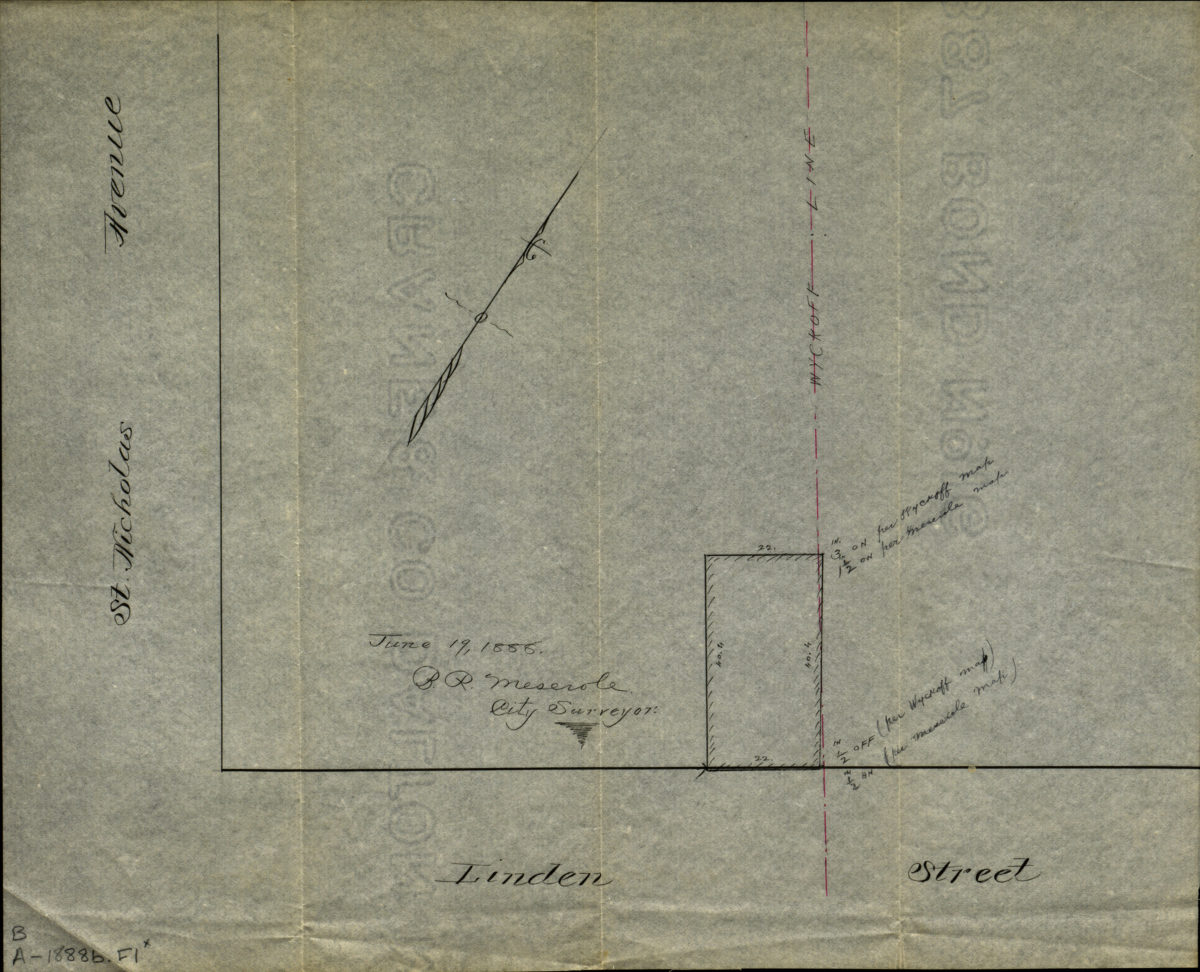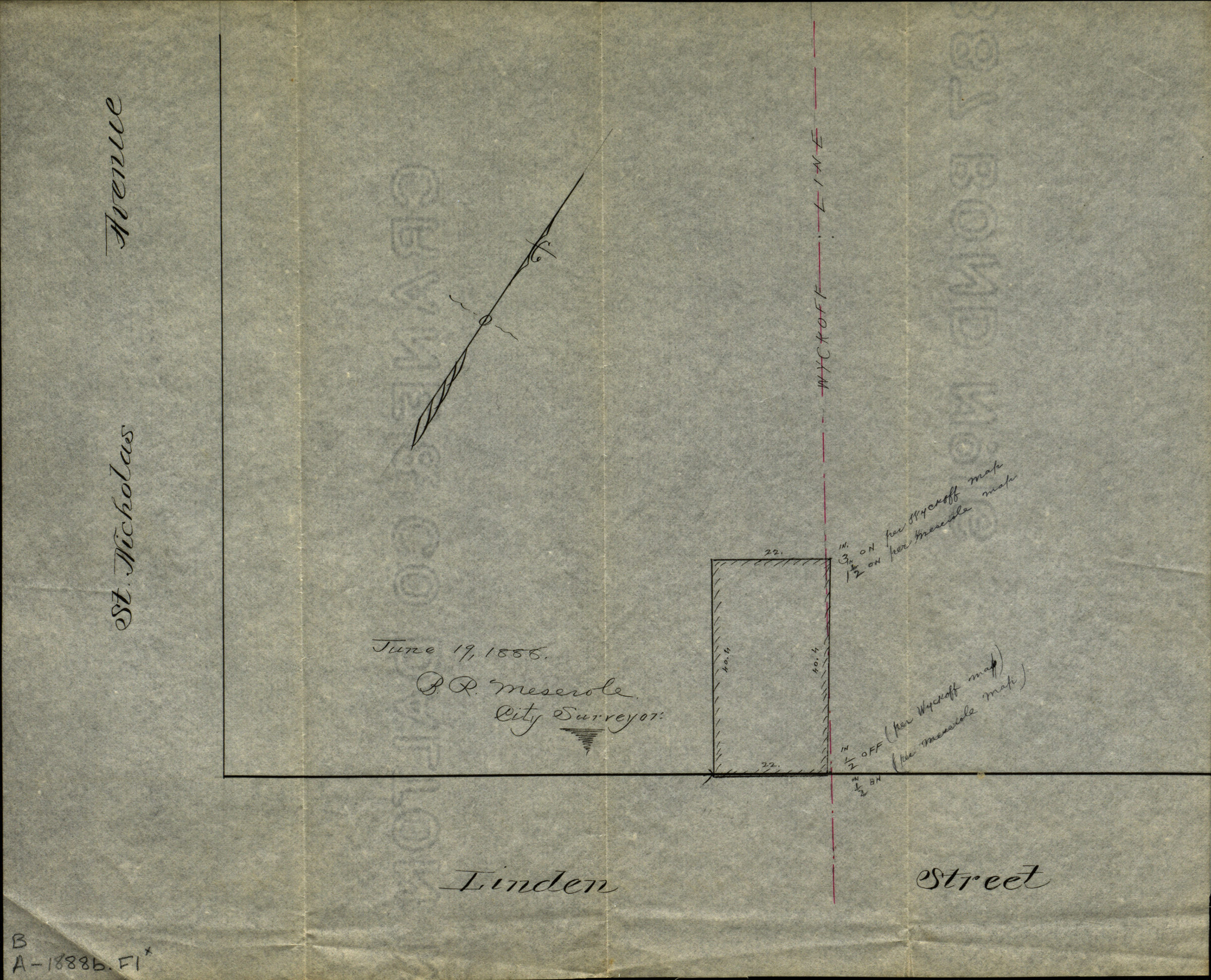
[Map of corner of Linden Street and St. Nicholas Avenue] 1888
Map No. B A-1888b.Fl
Cadastral map showing property on Wyckoff line. Covers the corner of the block at Linden Street and Saint Nicholas Avenue.
Map area shown
Relation
Full catalog recordSize
23 × 29 cmDownload
Low Resolution Image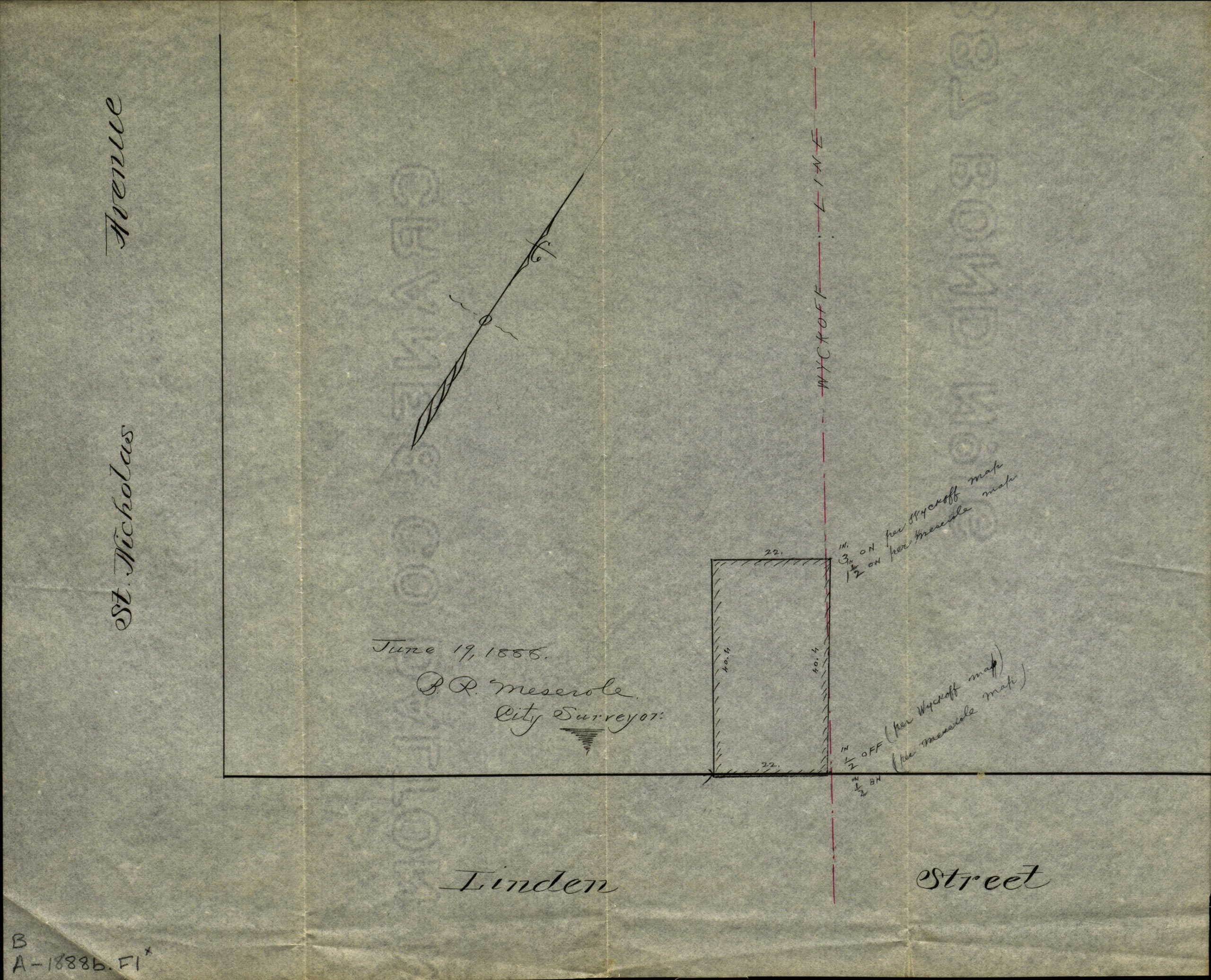
Creator
Meserole, B.R., Meserole, B.R.,Publisher
Brooklyn Historical Society, Brooklyn Historical SocietyCitation
[Map of corner of Linden Street and St. Nicholas Avenue]; 1888, Map Collection, B A-1888b.Fl; Brooklyn Historical Society.Scale
Scale not givenLoading zoom image...