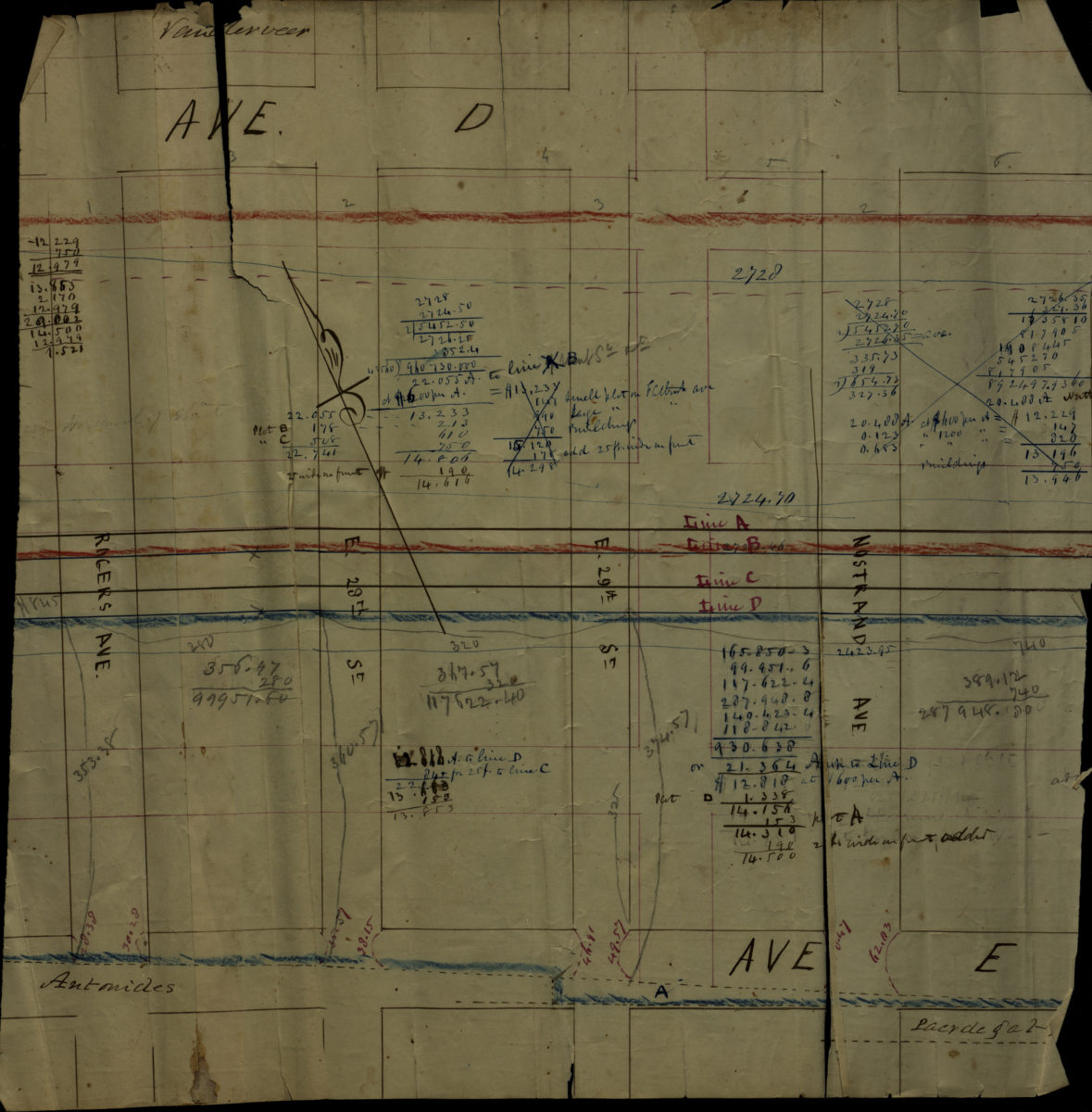
Map of Cortelyou Farm lots, Garret Vanderveer, Flatbush [18??]
Map No. Bergen-[18--?]g.Fl
Cadastral map covering area north from Ave. E to Ave. D and east from Rogers Ave. to Nostrand Ave. (modern-day East Flatbush). Verso title. Likely attributed to T.G. Bergen, based on handwriting on piece. Oriented with north to the upper left.
Subjects
Places
Map area shown
Relation
Full catalog recordSize
36 × 35 cmDownload
Low Resolution Image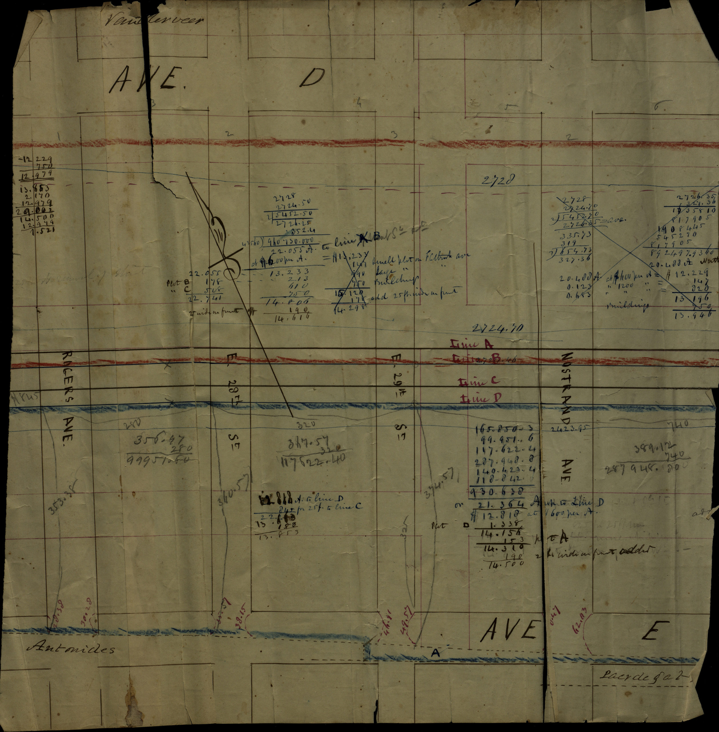
Creator
Bergen, Teunis G.,Publisher
Brooklyn Historical SocietyCitation
Map of Cortelyou Farm lots, Garret Vanderveer, Flatbush; [18??], Map Collection, Bergen-[18--?]g.Fl; Brooklyn Historical Society.Scale
Scale not givenLoading zoom image...