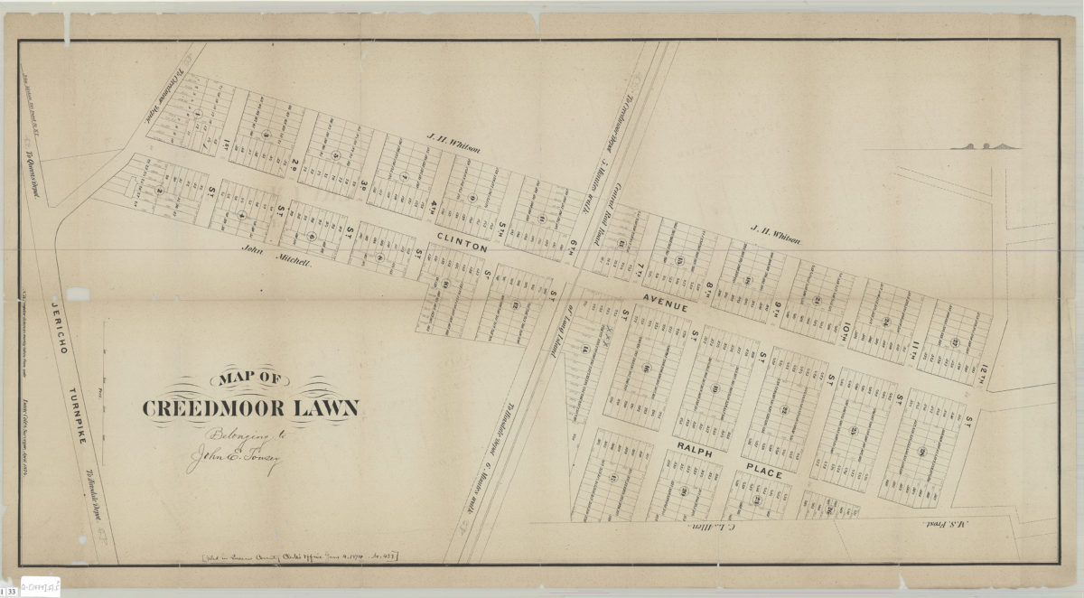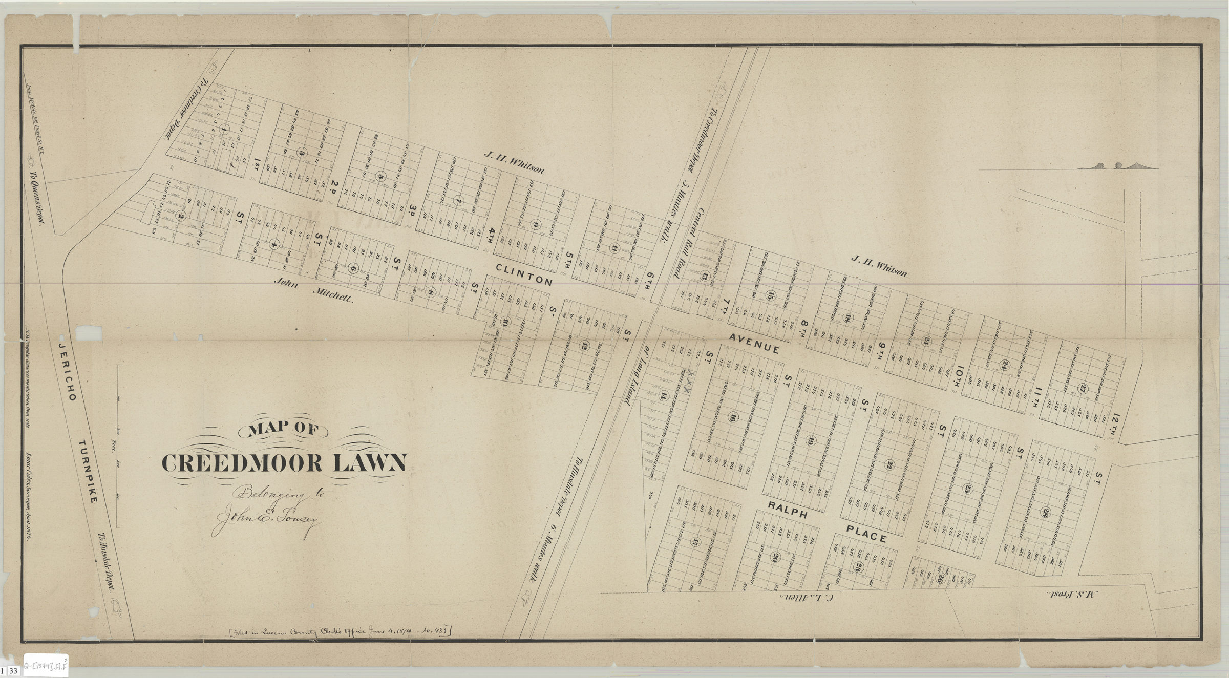
Map of Creedmoor Lawn: Isaac Coles, surveyor, April 1874 [1874]
Map No. Q-[1874].Fl.Folio
Cadastral map covering area in modern-day Bellerose, Queens. Shows property (including lot numbers and dimensions), names of lanowners, railroads, and directions of railroad depots. Oriented with north to the right. “[Filed in Queens County Clerk’s Office June 4, 1874. No. 433]”–Annotated on BHS copy. “Belonging to John E. Tousey”–Annotated on BHS copy directly following title.
Map area shown
Genre
Cadastral mapsRelation
Full catalog recordSize
46 × 92 cmDownload
Low Resolution Image
Creator
Coles, Isaac,Publisher
Brooklyn Historical SocietyCitation
Map of Creedmoor Lawn: Isaac Coles, surveyor, April 1874; [1874], Map Collection, Q-[1874].Fl.Folio; Brooklyn Historical Society.Scale
Scale [ca. 1:1,200]Loading zoom image...