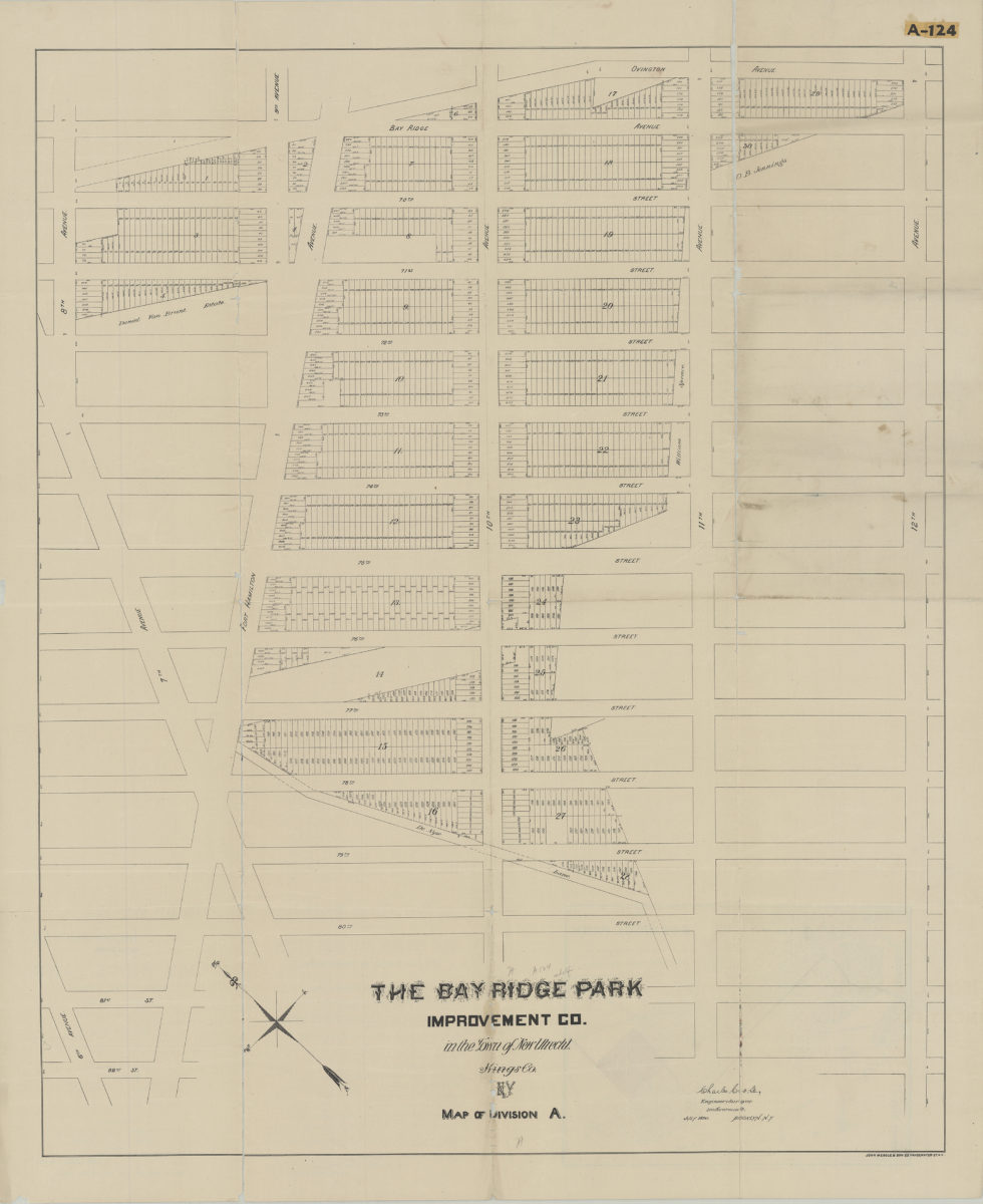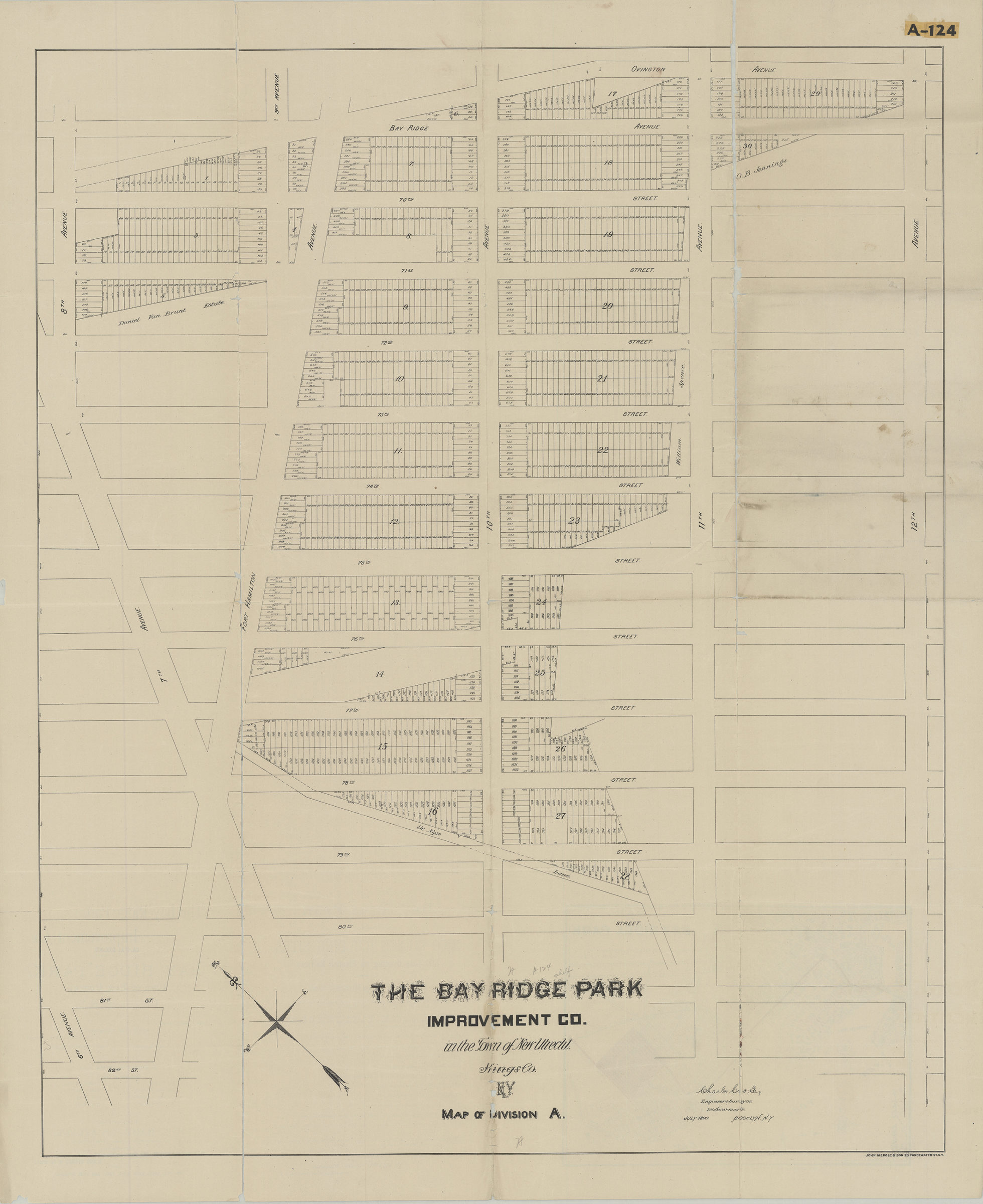
Map of Division A: Charles Crooke, engineer & surveyor [1890]
Map No. B P-[1890].Fl.Folio
Cadastral map covering area bounded by 80th St., 8th Ave., Ovington Ave., and 12th Ave. (modern-day Dyker Heights and Fort Hamilton). Does not cover modern-day Bay Ridge. Shows property (including lot numbers and dimensions), and names of landowners. Oriented with north to the upper left. On verso: Location map and text.
Subjects
Places
Map area shown
Genre
Cadastral mapsRelation
Full catalog recordSize
66 × 80 cmDownload
Low Resolution Image
Creator
Crooke, Charles,Publisher
Brooklyn Historical SocietyCitation
Map of Division A: Charles Crooke, engineer & surveyor; [1890], Map Collection, B P-[1890].Fl.Folio; Brooklyn Historical Society.Scale
Scale not givenLoading zoom image...