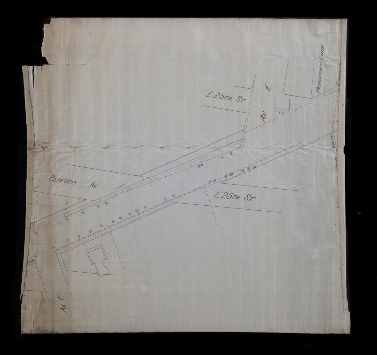
[Map of E. 25th St. and Bedford Ave. between Ave. F and Paerdegat Ln] [18??]
Map No. B A-[18--?].Fl.RA
Covers area in modern-day Flabush. Shows town line between Brooklyn and Flatbush. Title devised by cataloger. Oriented with north to the left. Composed of 2 segements.
Map area shown
Genre
Manuscript mapsRelation
Full catalog recordSize
68 × 73 cmDownload
Low Resolution Image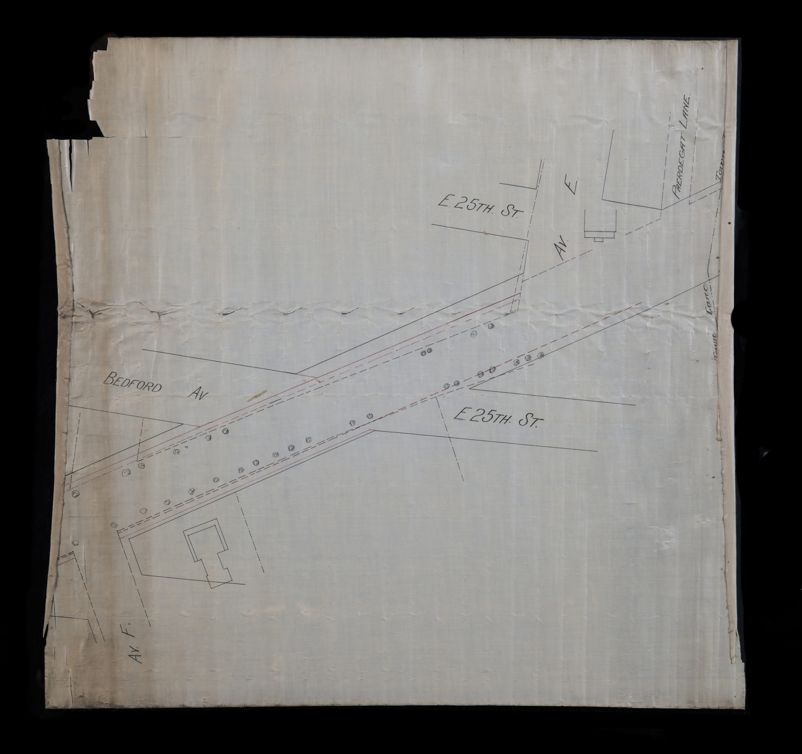
Creator
Publisher
Brooklyn Historical SocietyCitation
[Map of E. 25th St. and Bedford Ave. between Ave. F and Paerdegat Ln]; [18??], Map Collection, B A-[18--?].Fl.RA; Brooklyn Historical Society.Scale
Scale not givenLoading zoom image...