[Map of East New York Ave.]. [18??]
Map No. B P-[18--?].Fl.O
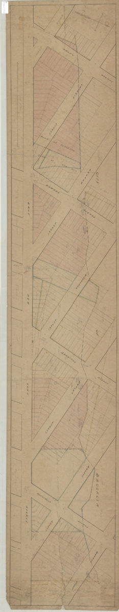
Cadastral map covering East New York Ave. from Ralph Ave. to Warrent St. (modern-day East New York). Shows property (including lots and dimensions), and names of landowners. Title devised by cataloger. Oriented with north to the upper right.
Map area shown
Relation
Full catalog recordSize
32 × 179 cmDownload
Low Resolution ImageCreator
Publisher
Brooklyn Historical SocietyCitation
[Map of East New York Ave.].; [18??], Map Collection, B P-[18--?].Fl.O; Brooklyn Historical Society.Scale
Scale not givenLoading zoom image...