
[Map of Flatbush Ave. at Alton Pl. and Overbaugh Pl.]. [18??]
Map No. B P-[18--?]l.Fl
Cadastral map covering area in modern-day Flatlands. Shows property (including lots, dimensions, and buildings), electric railroads, and burial grounds. Oriented with north to the lower right.
Map area shown
Relation
Full catalog recordSize
47 × 51 cmDownload
Low Resolution Image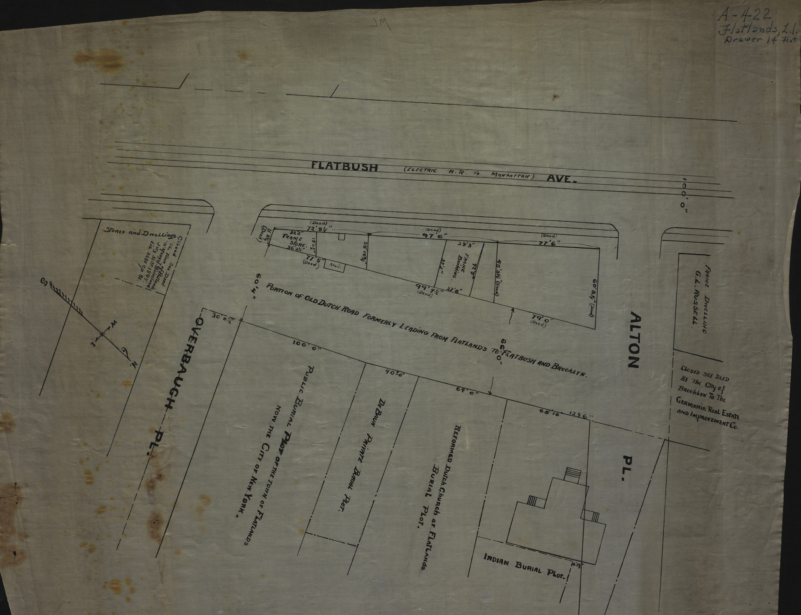
Creator
Publisher
Brooklyn Historical SocietyCitation
[Map of Flatbush Ave. at Alton Pl. and Overbaugh Pl.].; [18??], Map Collection, B P-[18--?]l.Fl; Brooklyn Historical Society.Scale
Scale not givenLoading zoom image... 