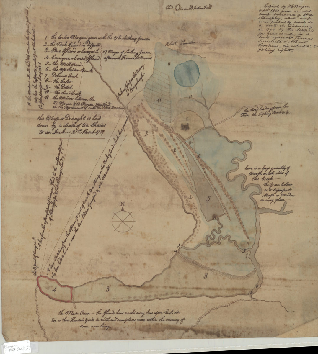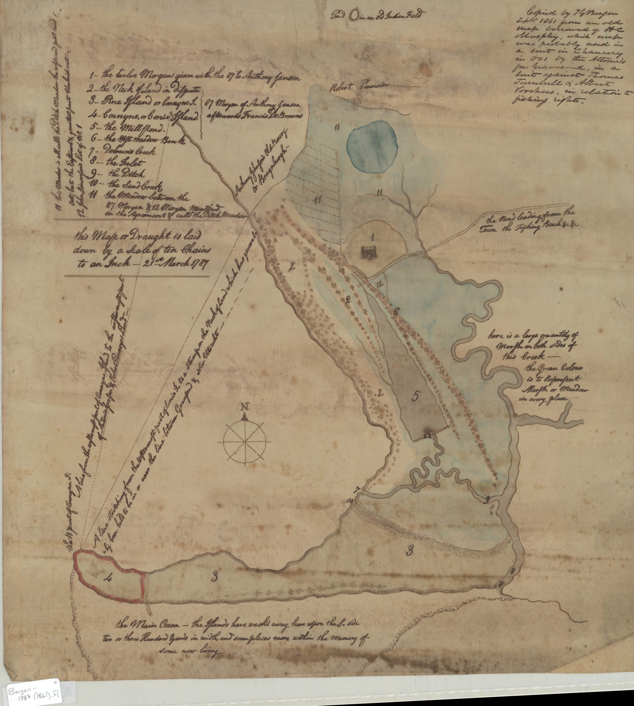
[Map of Gravesend and Coney Island] Sept. 1861
Map No. Bergen-1787 (1861).Fl
Cadastral map. Shows property, names of landowners, and landscape features. Relief shown pictorially. Title devised by cataloger. “Copied by TG Bergen Sept. 1861 from an old map borrowed of HC Murphy, which map was probably used in a suit in Chancery in 1801 by the Attornies [sic] for Gravesend, in a suit against Thomas Turutrell & Albert Voorhies, in relation to fishing rights.” Original map created Mar. 21st, 1787. Includes text and index.
Subjects
Places
Map area shown
Relation
Full catalog recordSize
50 × 47 cmDownload
Low Resolution Image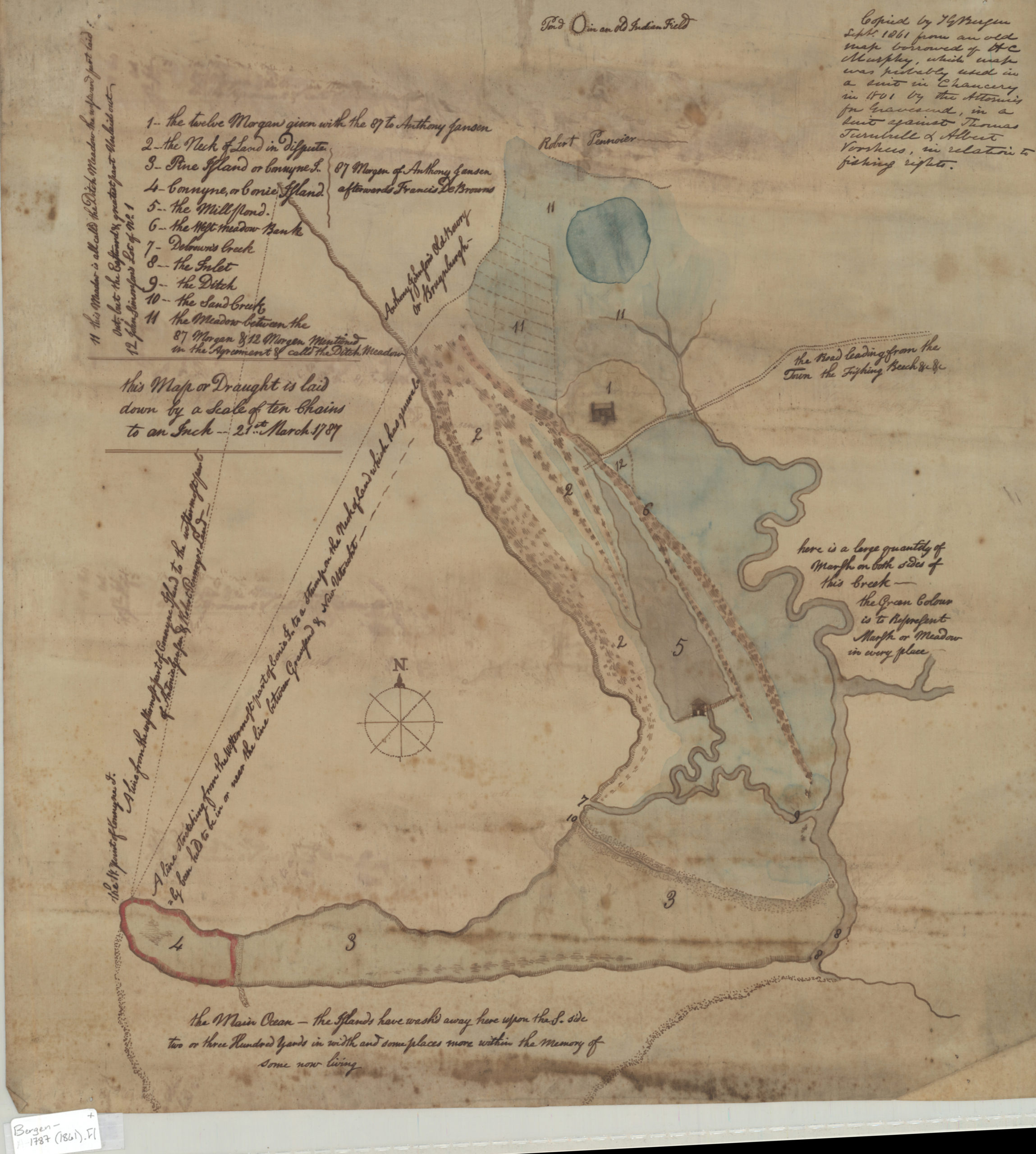
Creator
Bergen, Teunis G.,Publisher
Brooklyn Historical SocietyCitation
[Map of Gravesend and Coney Island]; Sept. 1861, Map Collection, Bergen-1787 (1861).Fl; Brooklyn Historical Society.Scale
Scale [1:7,920] 1 in to 1Loading zoom image...