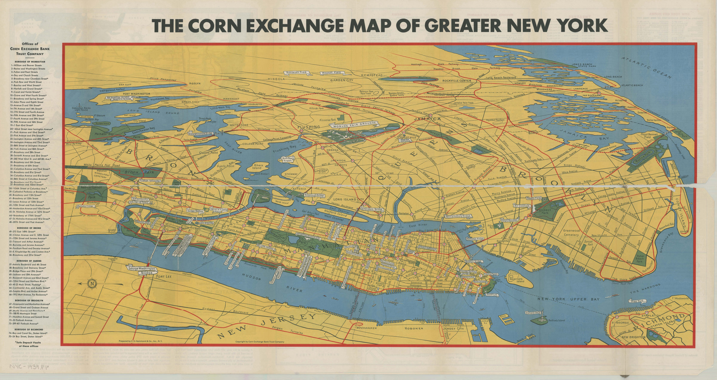

Map of greater New York: New York World’s Fair, 1939: prepared by C.S. Hammond & Co., inc ; copyright by Corn Exchange Bank Trust Company [1939]
Map No. NYC-1939b.Fl
Panel title. Bird’s-eye view of the New York region showing major tourist attractions and auto routes to the 1939 World’s Fair. Includes index of Corn Exchange Bank offices. On verso: lists of tourist attractions and 2 ancillary maps: General plan, New York World’s Fair, 1929 and Rapid transit map of greater New York showing all subways and elevated lines.
Map area shown
Relation
Full catalog recordSize
42 × 87 cmDownload
Low Resolution Image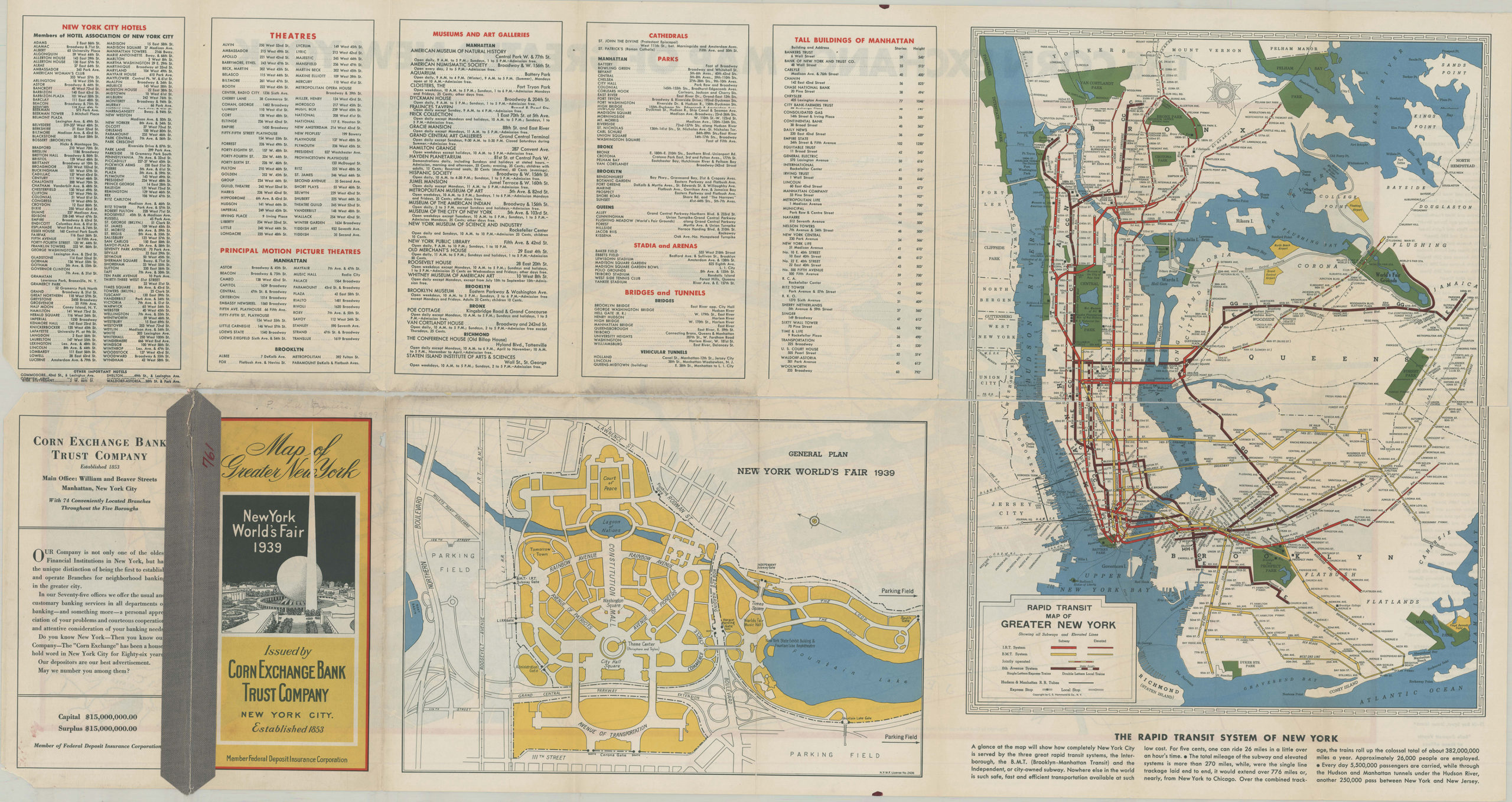
Creator
C.S. Hammond & Company,Publisher
Brooklyn Historical SocietyCitation
Map of greater New York: New York World’s Fair, 1939: prepared by C.S. Hammond & Co., inc ; copyright by Corn Exchange Bank Trust Company; [1939], Map Collection, NYC-1939b.Fl; Brooklyn Historical Society.Scale
Scale not givenLoading zoom image... 