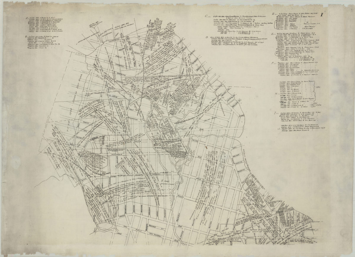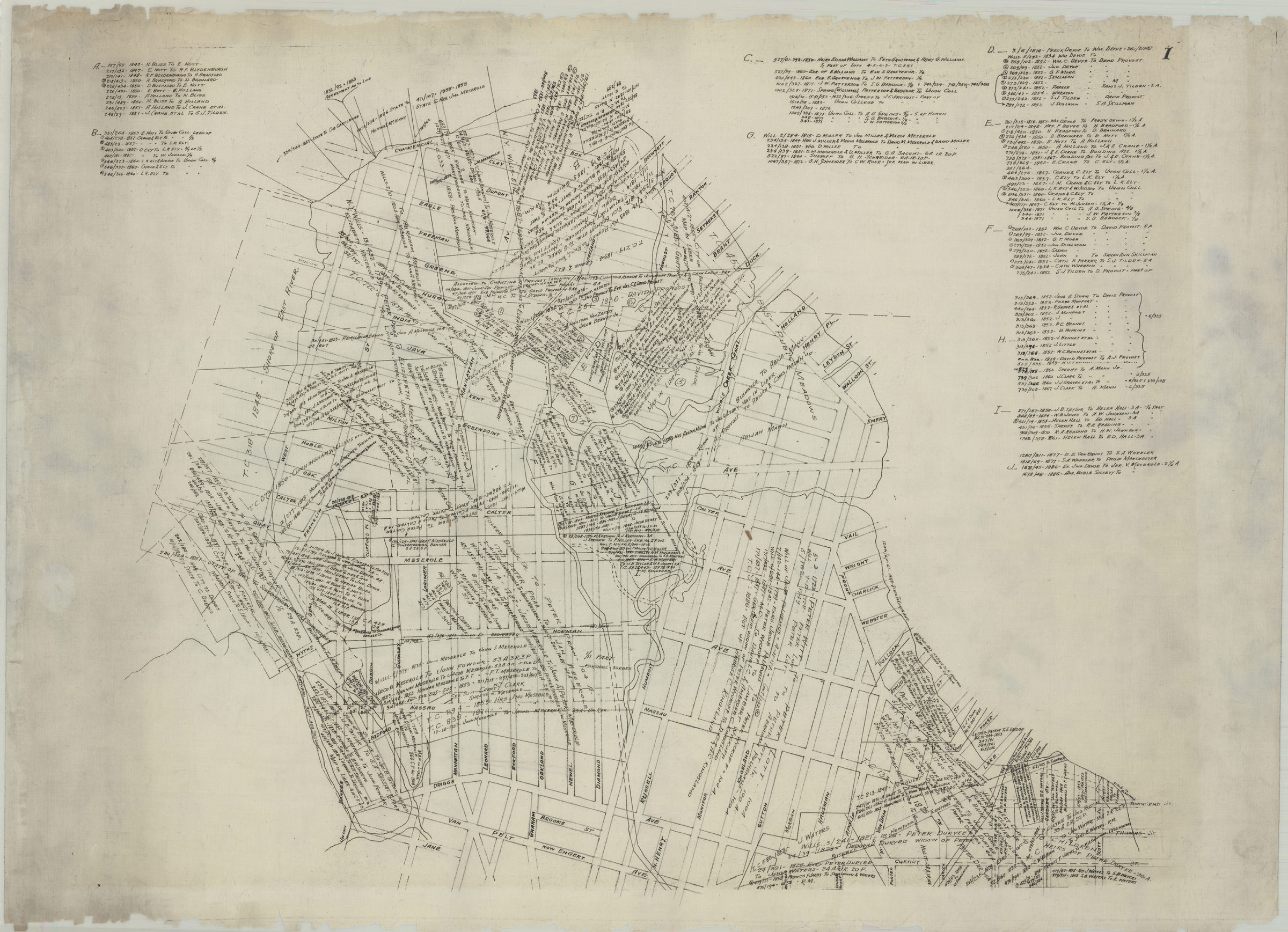
[Map of Greenpoint showing land transfers] circa 1885
Map No. B P-[188-?].Fl
Title devised by cataloger. Includes historical notes and index to land transfers.
Subjects
Places
Map area shown
Genre
MapRelation
Full catalog recordSize
52 × 73 cmDownload
Low Resolution Image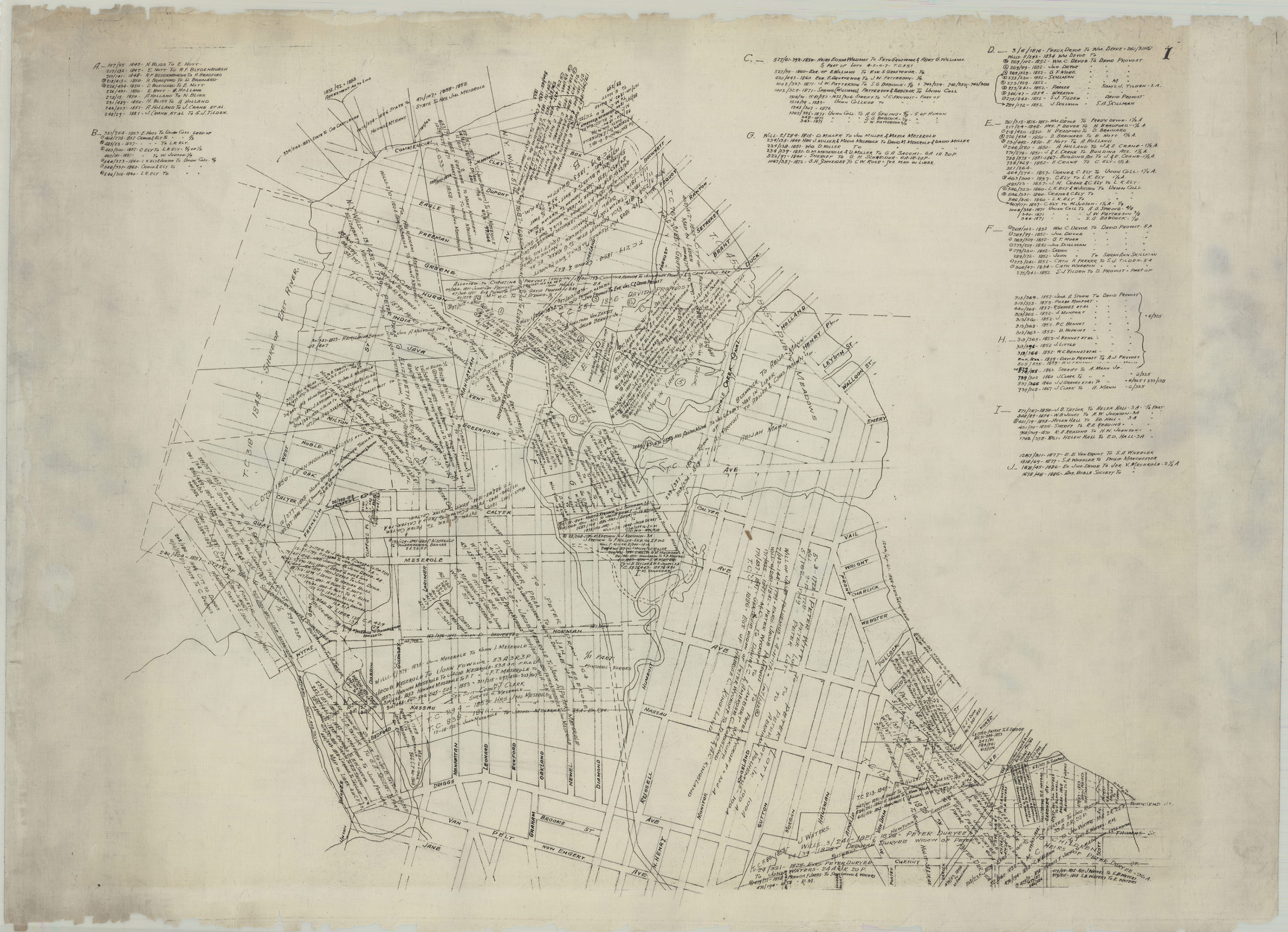
Creator
Publisher
Brooklyn Historical SocietyCitation
[Map of Greenpoint showing land transfers]; circa 1885, Map Collection, B P-[188-?].Fl; Brooklyn Historical Society.Scale
Scale not givenLoading zoom image...