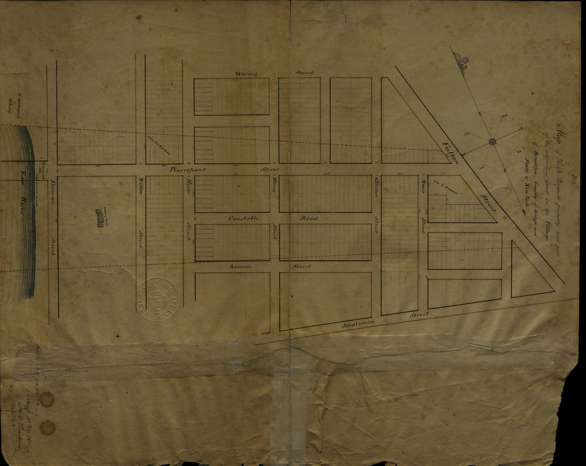

Map of H.B. Pierpont’s property and part of the adjoining land in the village of Brooklyn, county of Kings, and state of New York: Wm. C. Pierrepont February 12, 1825
Map No. Pierrepont-1825.Fl
Cadastral map covering area north from Joralemon St. to Waring St. and east from the East River to Fulton St. (modern-day Brooklyn Heights). Shows property (including lots and buildings). Oriented with north the left. H.B. Pierrepont mentioned in title likely refers to Hezekiah Beers Pierrepont, but could also be Henry B. Pierrepont cataloger unable to determine which.
Map area shown
Relation
Full catalog recordSize
40 × 32 cmDownload
Low Resolution Image
Creator
Pierrepont, W. C., Pierrepont, W. C.,Publisher
Brooklyn Historical Society, Brooklyn Historical SocietyCitation
Map of H.B. Pierpont’s property and part of the adjoining land in the village of Brooklyn, county of Kings, and state of New York: Wm. C. Pierrepont; February 12, 1825, Map Collection, Pierrepont-1825.Fl; Brooklyn Historical Society.Scale
Scale [1:2,400] 1 in to 2Loading zoom image... 