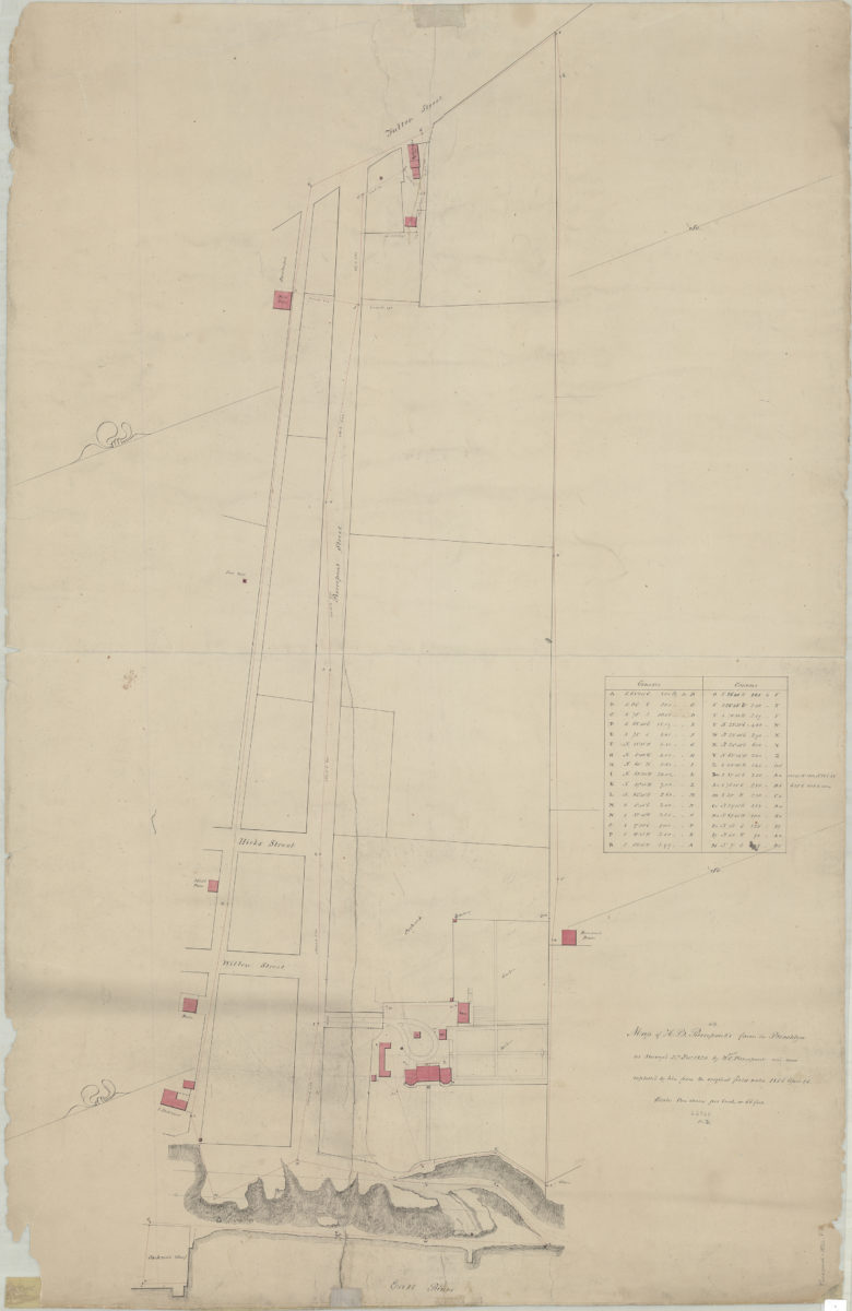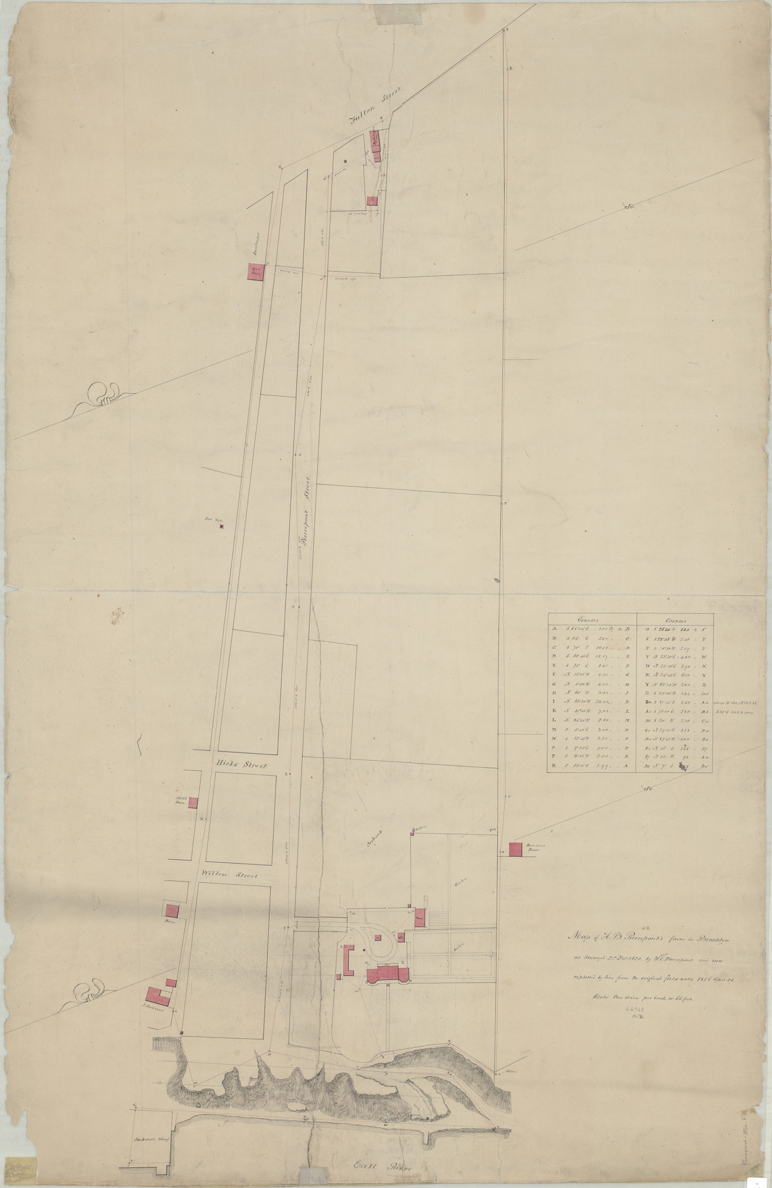
Map of H.B. Pierrepont’s farm in Brooklyn: as surveyed 21st May 1820: by W.C. Pierrepont, and now replotted by him from the original field notes, 1856 April 26 April 26, 1856
Map No. Pierrepont-1856.Fl
Cadastral map covering Pierrepont St. east to Fulton St. (modern-day Brooklyn Heights). Shows property (including buildings), names of landowners, Jackson’s Wharf, and bluffs overlooking the East River. Relief shown by hachures. Oriented with north to the left. Includes chart of “Courses.”
Subjects
Places
Map area shown
Relation
Full catalog recordSize
108 × 70 cmDownload
Low Resolution Image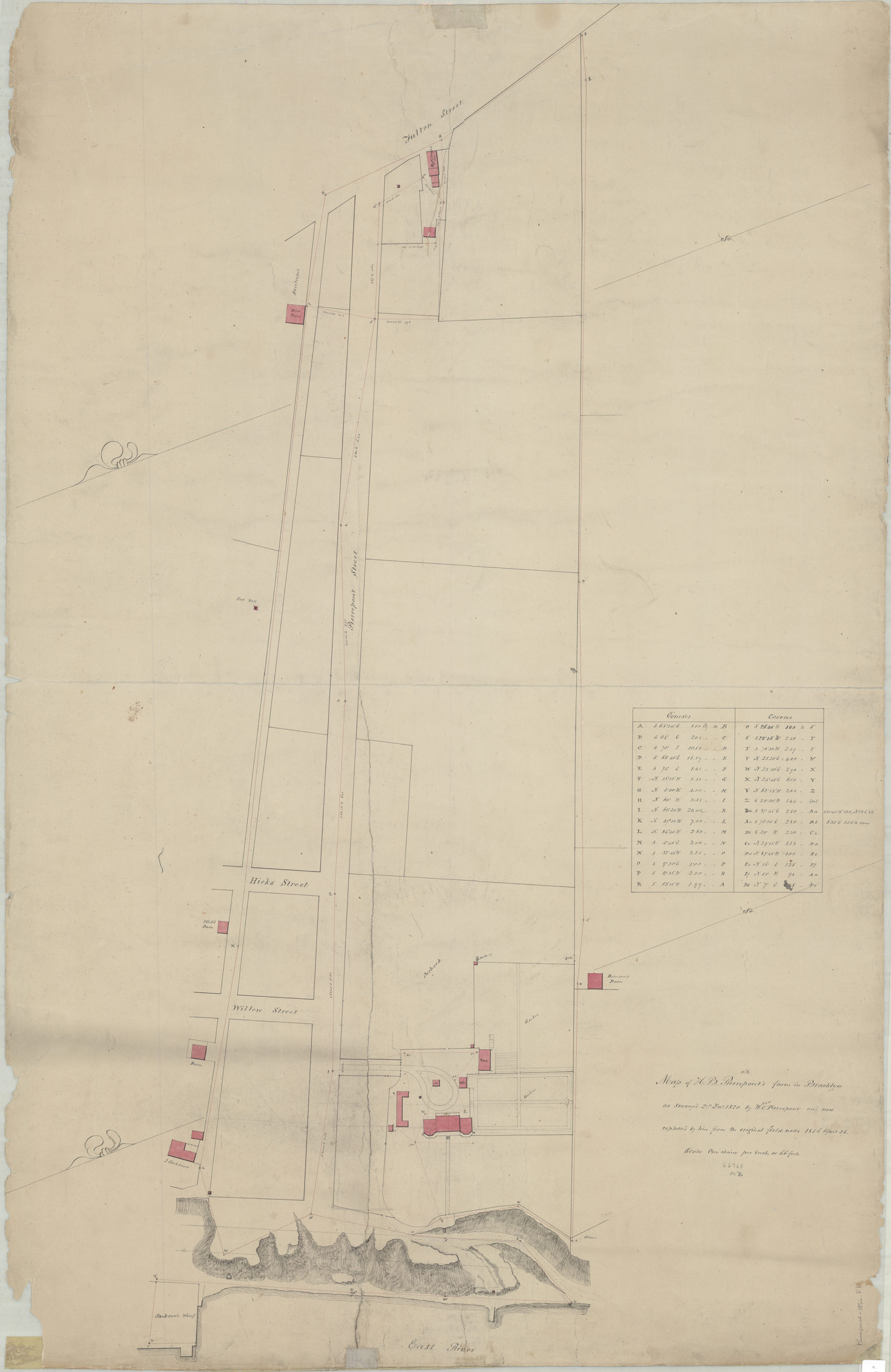
Creator
Pierrepont, W. C.,Publisher
Brooklyn Historical SocietyCitation
Map of H.B. Pierrepont’s farm in Brooklyn: as surveyed 21st May 1820: by W.C. Pierrepont, and now replotted by him from the original field notes, 1856 April 26; April 26, 1856, Map Collection, Pierrepont-1856.Fl; Brooklyn Historical Society.Scale
Scale [1:792] One chain pLoading zoom image...