[Map of Hans Bergen’s land at Brooklyn Ferry] [ca. 1876]
Map No. Bergen-[1876].Fl
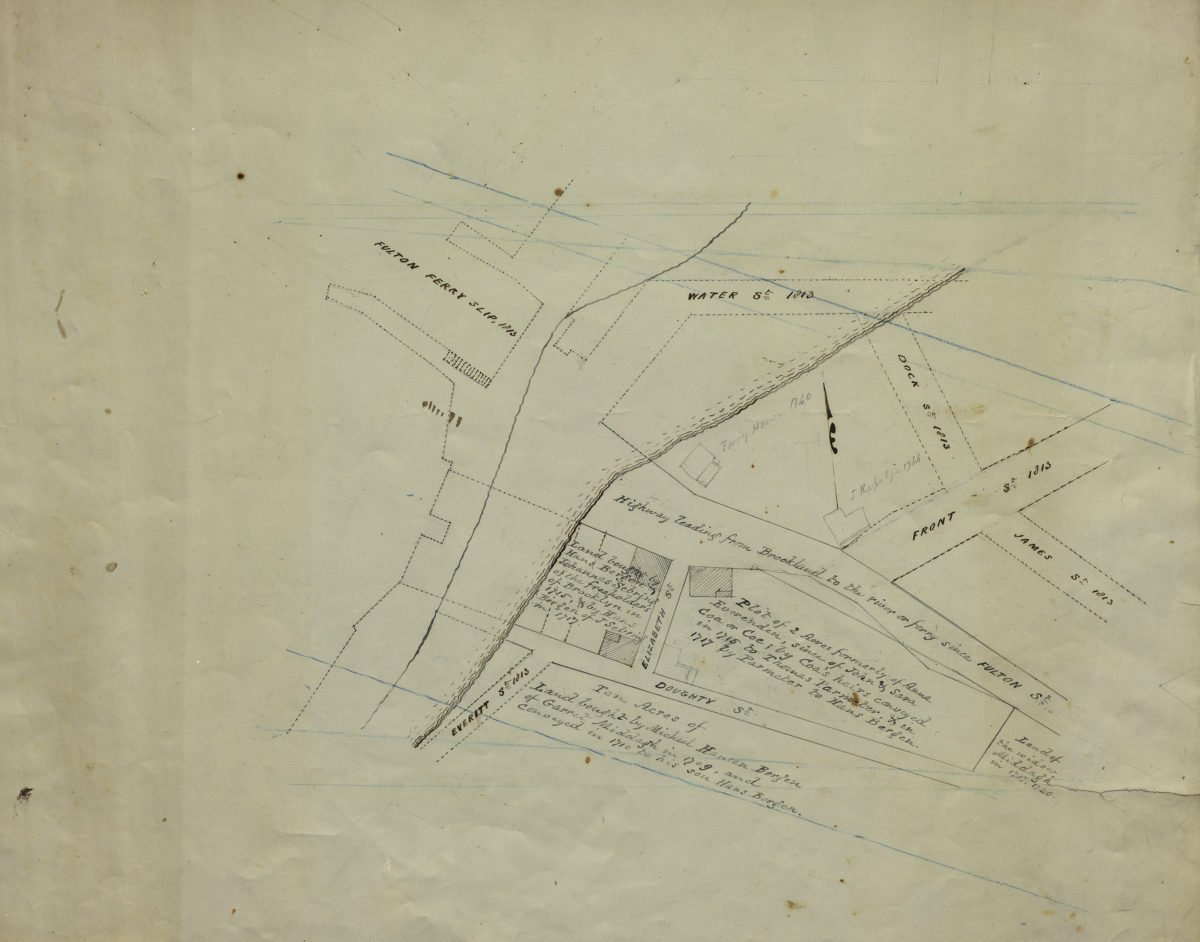
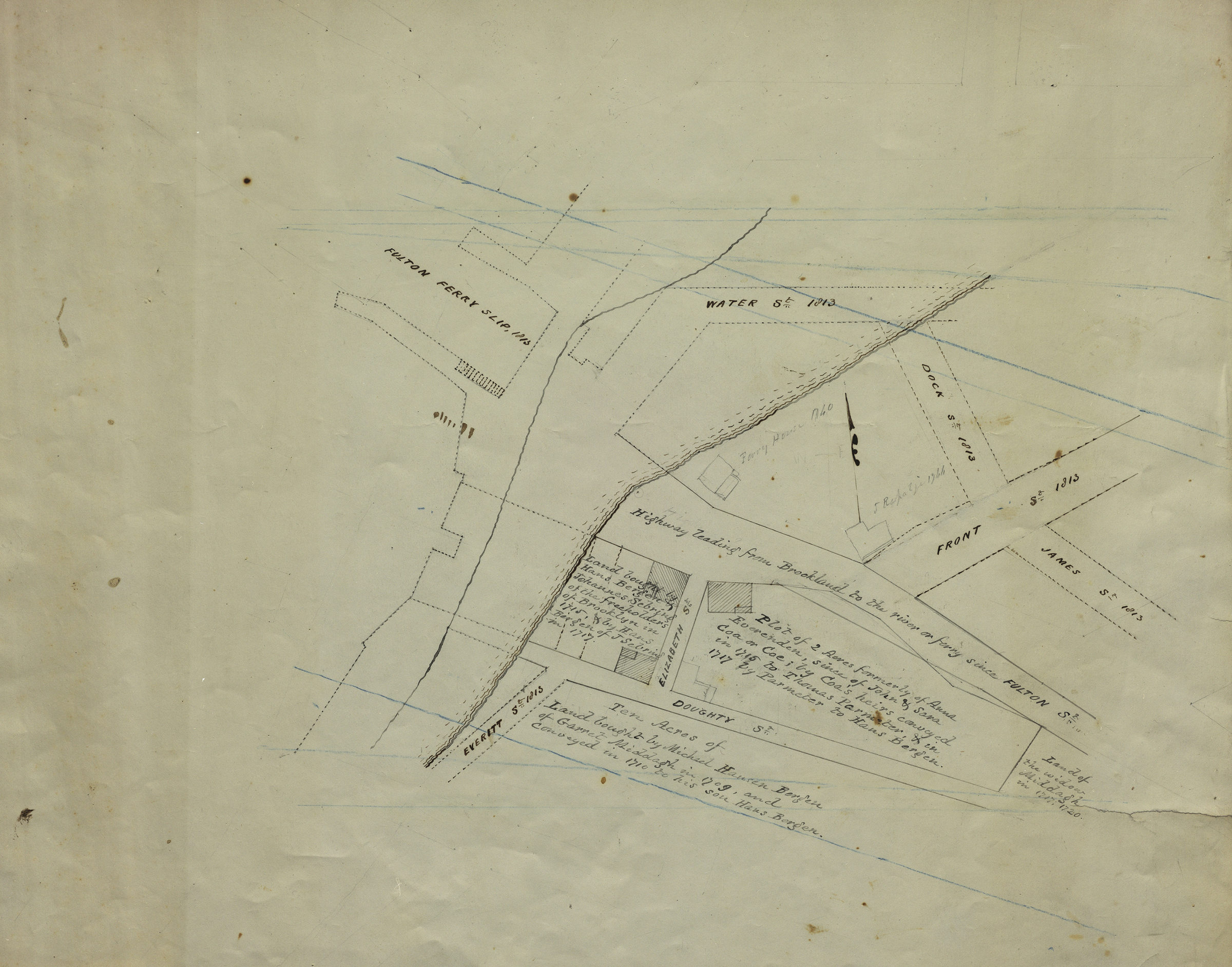
Cadastral map showing holdings of Hans Bergen ca. 1717 imposed on map of streets and waterline ca. 1813 near Fulton Ferry Slip. Title devised by cataloger based on similarity to an illustration facing p. 210, in Bergen family, or the descendants of Hans Hansen Bergen one of the early settlers of New York and Brooklyn, L.I. / by Teunis G. Bergen (Albany, N.Y. : Joel Munsell, 1876). Likely attributed to Teunis G. Bergen based on handwriting. Includes text. Date of situation stated in text.
Subjects
Places
Map area shown
Relation
Full catalog recordSize
36 × 42 cmDownload
Low Resolution Image
Creator
Bergen, Teunis G.,Publisher
Brooklyn Historical SocietyCitation
[Map of Hans Bergen’s land at Brooklyn Ferry]; [ca. 1876], Map Collection, Bergen-[1876].Fl; Brooklyn Historical Society.Scale
Scale not givenLoading zoom image...