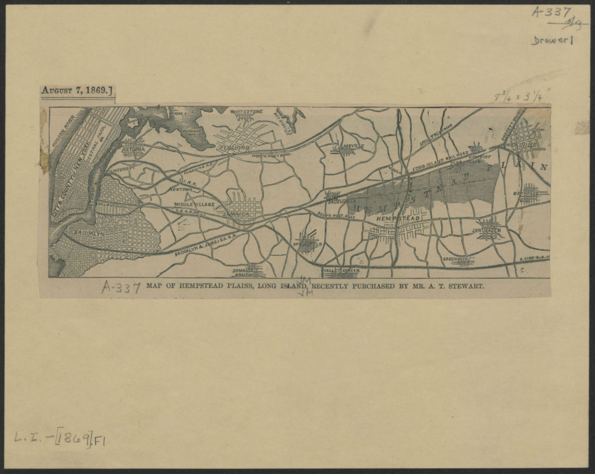
Map of Hempstead Plains, Long Island, recently purchased by Mr. A.T. Stewart [1869]
Map No. L.I.-[1869].Fl
Covers Long Island east to Bethpage also covers Wards Island and a portion of Manhattan. Shows towns and railroads. Extracted from unknown newspaper. “August 7, 1869.”
Map area shown
Genre
MapRelation
Full catalog recordSize
21 × 26 cmDownload
Low Resolution Image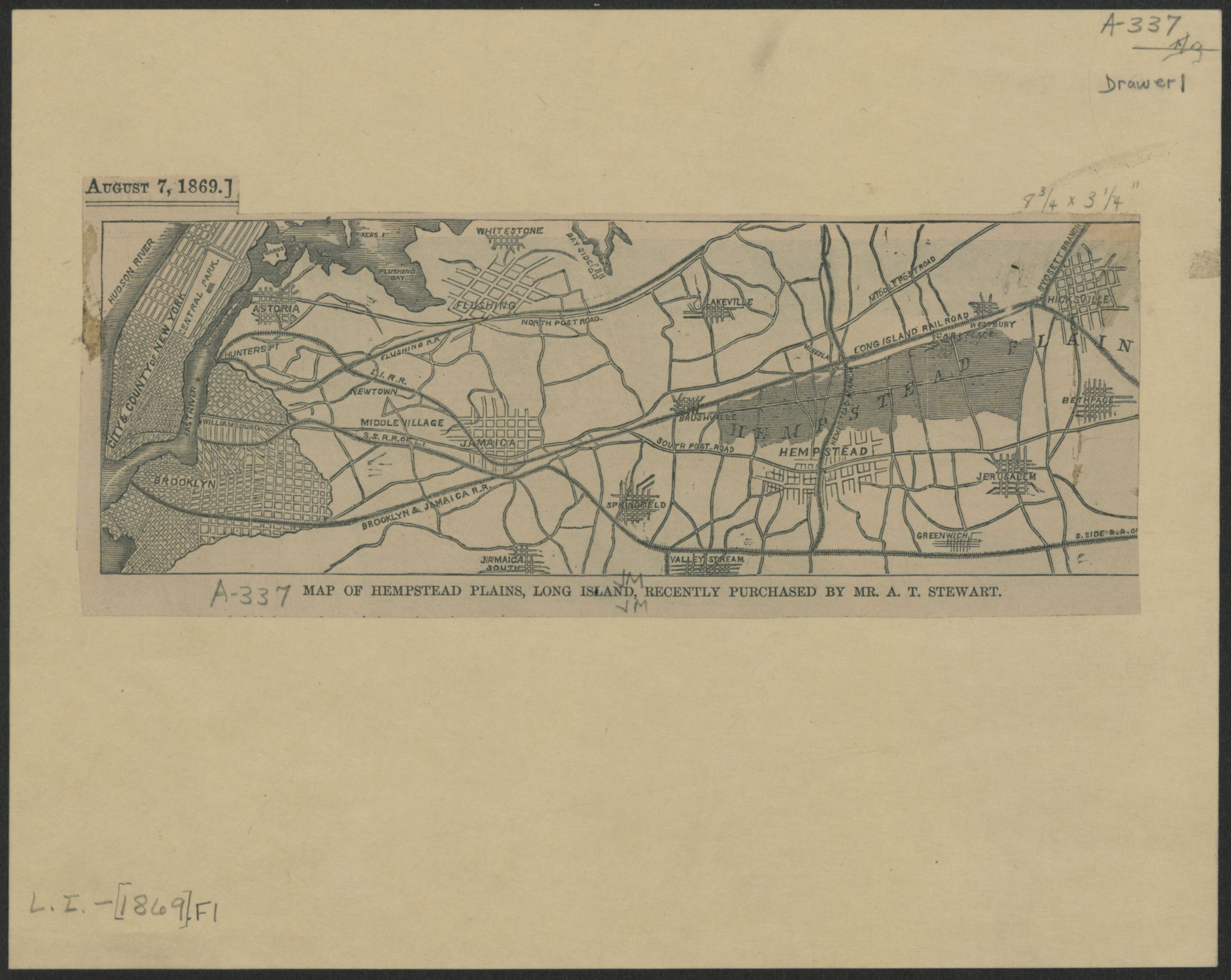
Creator
Publisher
Brooklyn Historical SocietyCitation
Map of Hempstead Plains, Long Island, recently purchased by Mr. A.T. Stewart; [1869], Map Collection, L.I.-[1869].Fl; Brooklyn Historical Society.Scale
Scale not givenLoading zoom image...