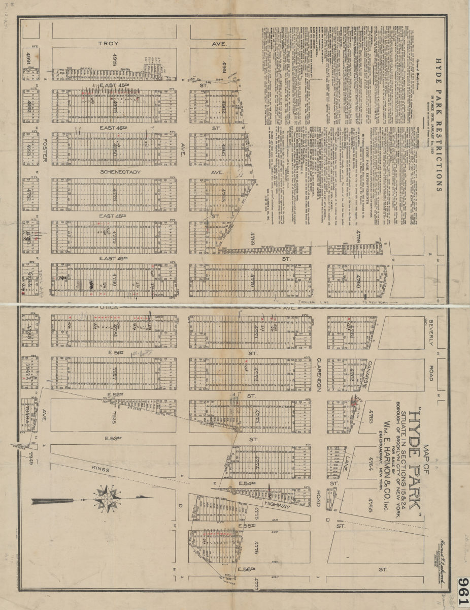
Map of Hyde Park situate[d] in sections 15 & 24, Borough of Brooklyn, City of New York: for sale by Wm. E. Harmon & Co 1919
Map No. B P-1919.Fl
Cadastral map covering the area bounded by Beverly Road, Kings Highway, Foster Avenue, and Troy Avenue in modern-day East Flatbush. Shows property for sale including block and lot numbers as well as property dimensions. Includes text “Hyde Park restrictions in force until January 10, 1923 (section on and north of Foster Avenue).” “Howard T. Lockwood, Civil Engineer & City Surveyor.” “6-20-19.”
Map area shown
Genre
Cadastral mapsRelation
Full catalog recordSize
61 × 80 cmDownload
Low Resolution Image
Creator
Lockwood, Howard T.,Publisher
Brooklyn Historical SocietyCitation
Map of Hyde Park situate[d] in sections 15 & 24, Borough of Brooklyn, City of New York: for sale by Wm. E. Harmon & Co; 1919, Map Collection, B P-1919.Fl; Brooklyn Historical Society.Scale
Scale not givenLoading zoom image...