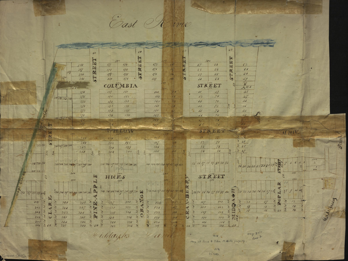
Map of Jacob & John M. Hicks property [18??]
Map No. Pierrepont-[18--?]h.Fl
Cadastral map covering area roughly bounded by Clark St., Hicks St., Old Ferry St., and the East River (modern-day Brooklyn Heights). Shows property (including lot numbers and dimensions), and names of landowners. Verso title. Oriented with north to the right.
Map area shown
Relation
Full catalog recordSize
44 × 58 cmDownload
Low Resolution Image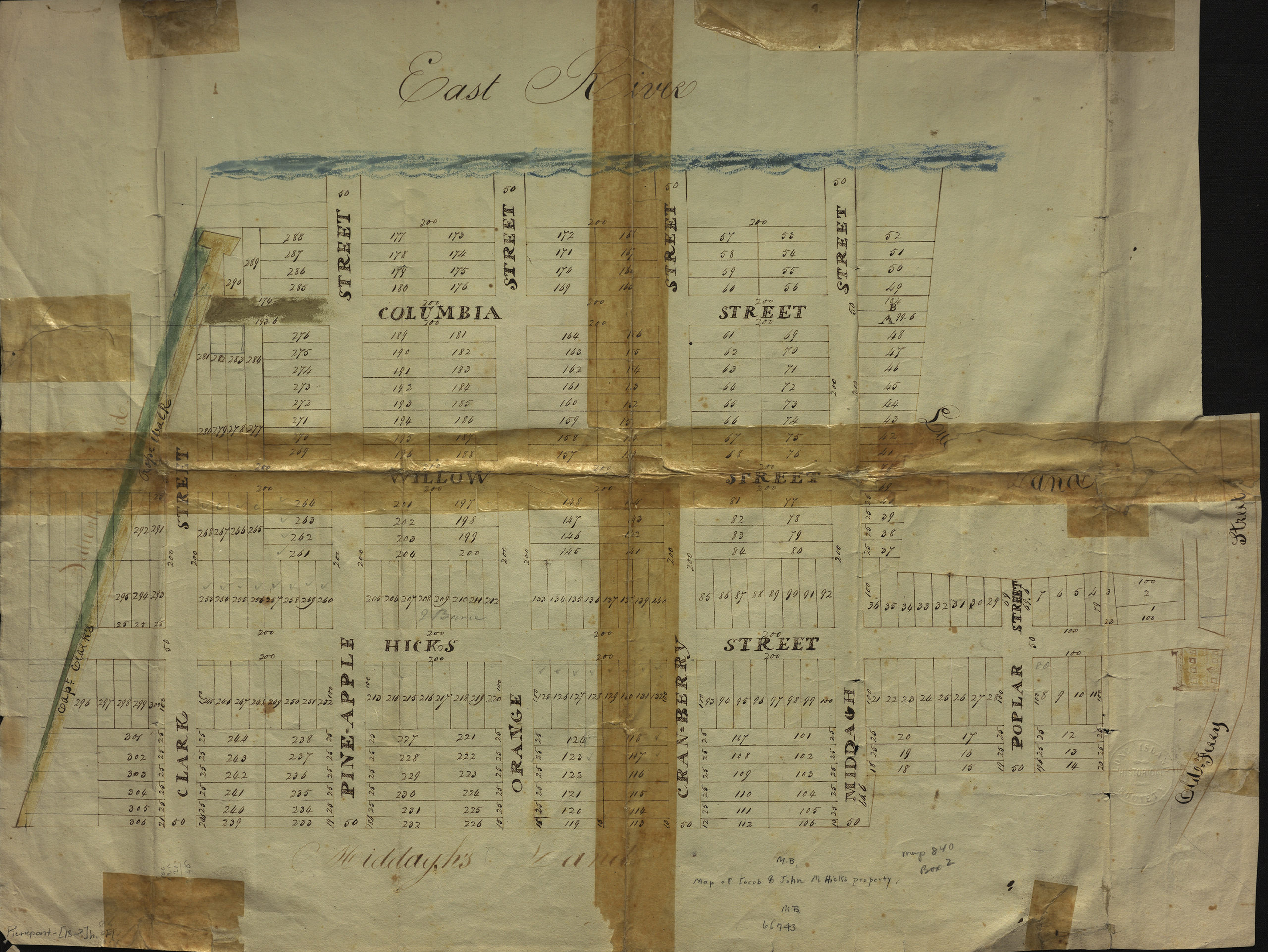
Creator
Publisher
Brooklyn Historical SocietyCitation
Map of Jacob & John M. Hicks property; [18??], Map Collection, Pierrepont-[18--?]h.Fl; Brooklyn Historical Society.Scale
Scale not givenLoading zoom image...