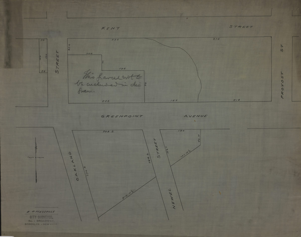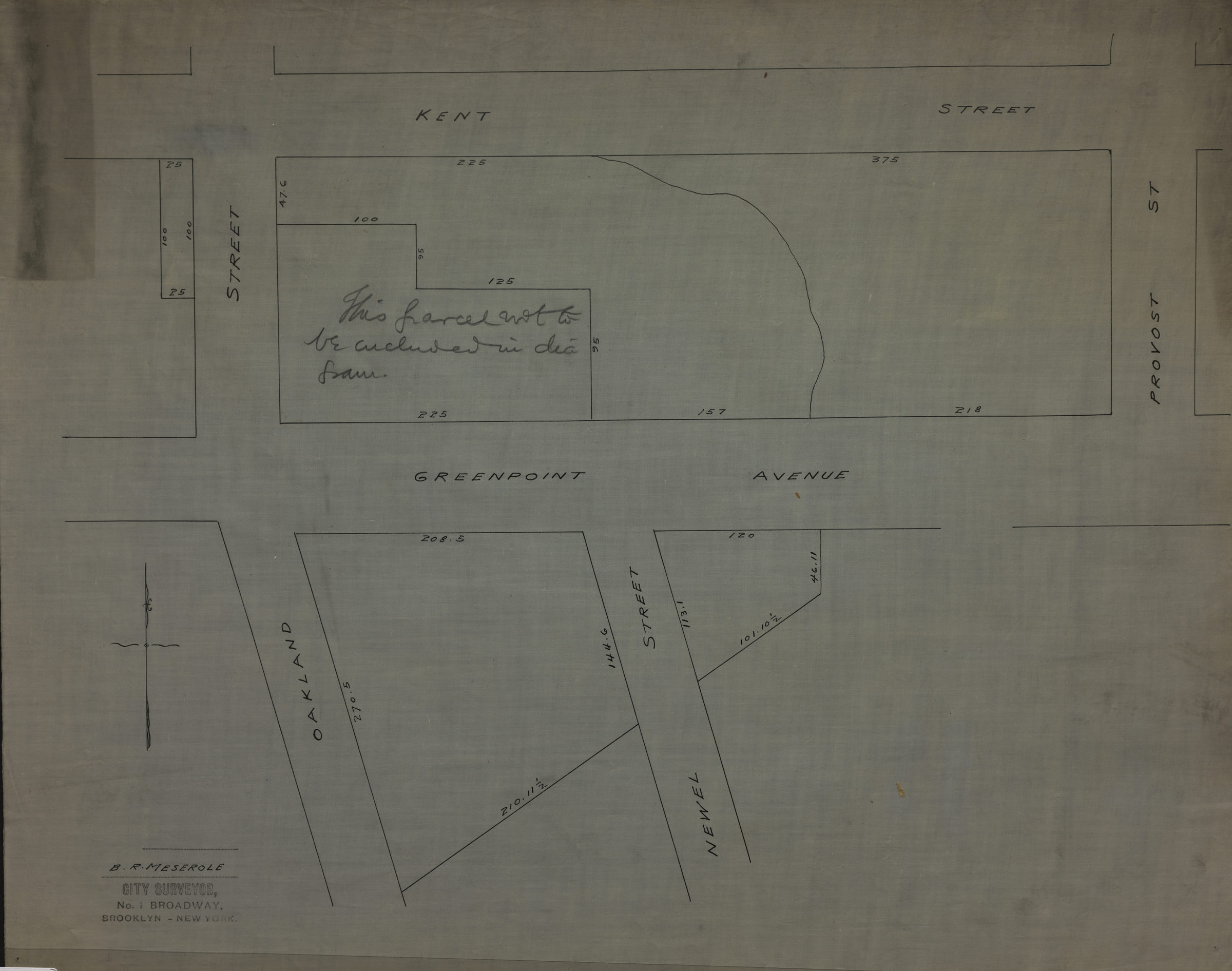
[Map of Kent St. and Greenpoint Ave east from Oakland St. to Provost St.]: B.R. Meserole city surveyor [189?]
Map No. B P-[189-?].Fl
Manuscript cadastral map covering a portion of Greenpoint. Shows properties and measurements. Title devised by cataloger. Includes note. Stamped: City Surveyor, N. 1 Broadway, Brooklyn – New York.
Map area shown
Relation
Full catalog recordSize
46 × 57 cmDownload
Low Resolution Image
Creator
Meserole, B. R.,Publisher
Brooklyn Historical SocietyCitation
[Map of Kent St. and Greenpoint Ave east from Oakland St. to Provost St.]: B.R. Meserole city surveyor; [189?], Map Collection, B P-[189-?].Fl; Brooklyn Historical Society.Scale
Scale not givenLoading zoom image...