Map of Kings County, N.Y. 1868
Map No. B A-1868.Fl
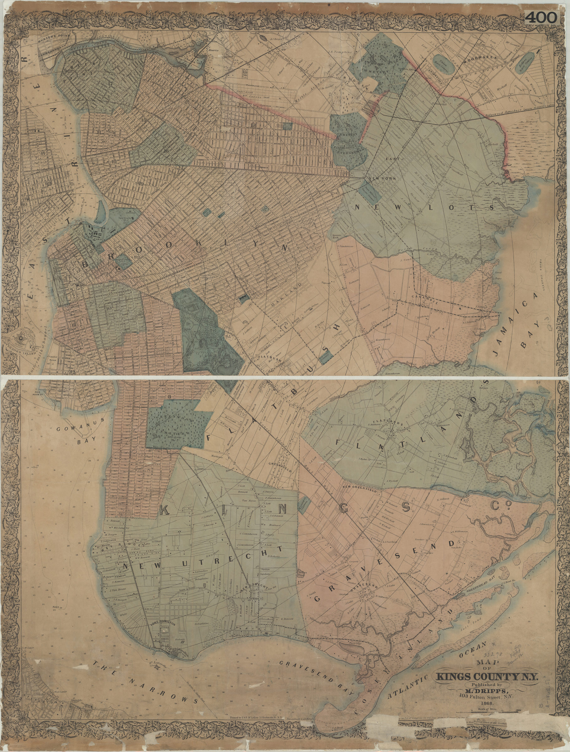
Covers all of Kings County as well as Governors Island and portions of southern Queens, Lower Manhattan, and Staten Island. Shows wards, property owners, marshes, ferry lines, piers, steam boat landings, and distances from City Hall (modernly known as Borough Hall). Depths shown by soundings and isolines. “[Entered according] to Act of Congress in the year 1868 by M. Dripps in the [Clerk’s Office] of the District Court for the Southern [District of New York].” Item is imperfect missing portion of lower right corner including portion of copyright statement. Portions of copyright note conjectured from: Dripps, M. (Matthew). Map of Brooklyn and vicinity. N.Y. : M. Dripps, 1869. Includes decorative border.
Map area shown
Relation
Full catalog recordSize
80 × 62 cmDownload
Low Resolution Image
Creator
Dripps, M.,Publisher
Brooklyn Historical SocietyCitation
Map of Kings County, N.Y.; 1868, Map Collection, B A-1868.Fl; Brooklyn Historical Society.Scale
Scale [ca. 1:22,528]Loading zoom image... 