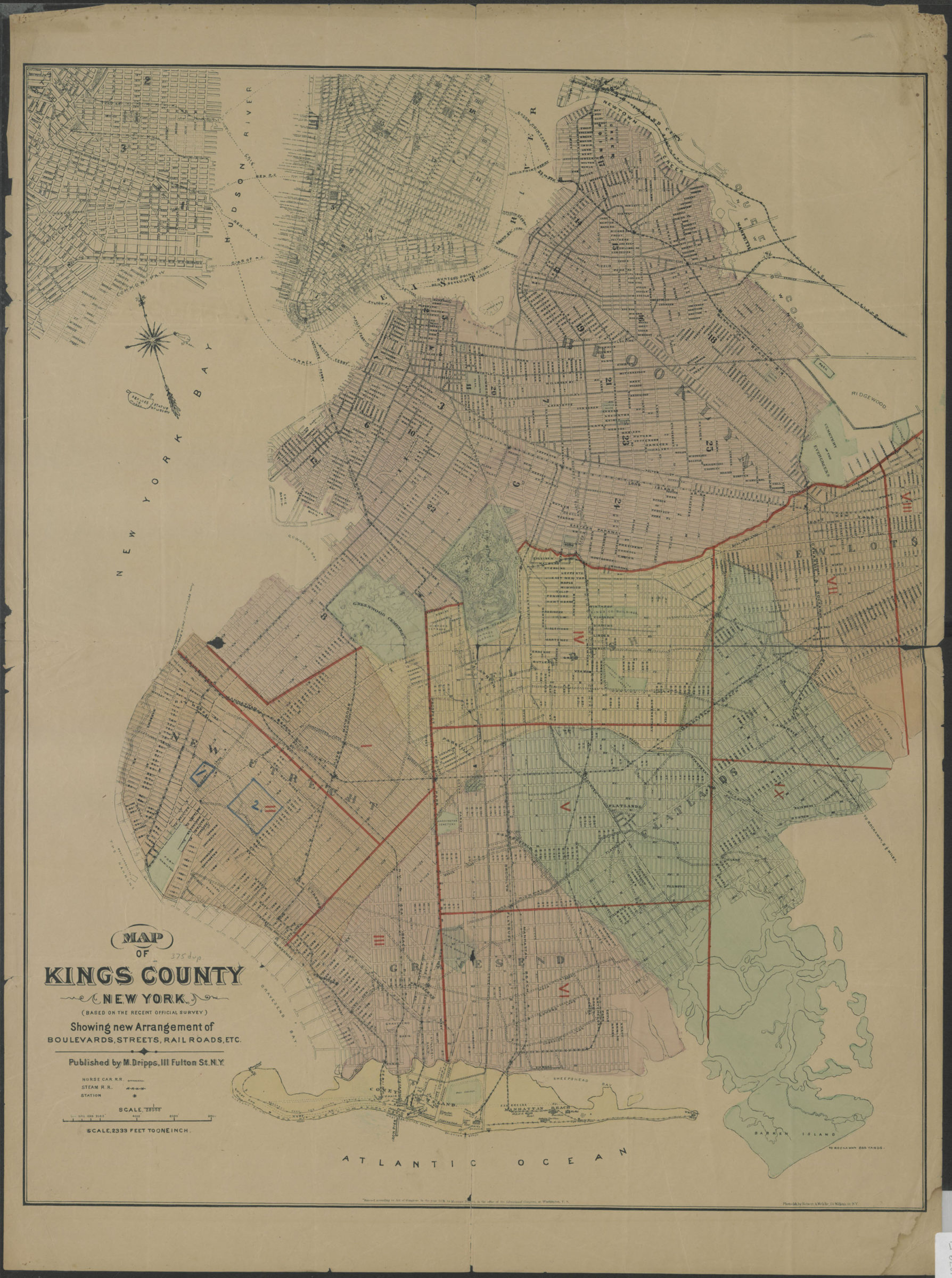
Map of Kings County New York (based on the recent official survey): showing new arrangement of boulevards, streets, railroads, etc [1879]
Map No. B A-1879.Fl c.2;B A-1879.Fl
Covers modern Brooklyn, New York (N.Y.) also Manhattan, New York (N.Y) south of 36th Street and part of Jersey City in Hudson County (N.J.) Date of situation from pencil annotation has not been verified. Date of map based on date of situation. Dripps’ office was at 111 Fulton from 1872. “Photo-lith by Robert A. Welke….” NYHS copy creased, soiled, stained. Mounted on cloth. M005526
Subjects
Places
Map area shown
Genre
MapRelation
Full catalog recordSize
67 × 53 cmDownload
Low Resolution Image
Creator
Dripps, M.,Publisher
Brooklyn Historical SocietyCitation
Map of Kings County New York (based on the recent official survey): showing new arrangement of boulevards, streets, railroads, etc; [1879], Map Collection, B A-1879.Fl c.2;B A-1879.Fl; Brooklyn Historical Society.Scale
Scale 1:28,000 1 in to 2,Loading zoom image... 