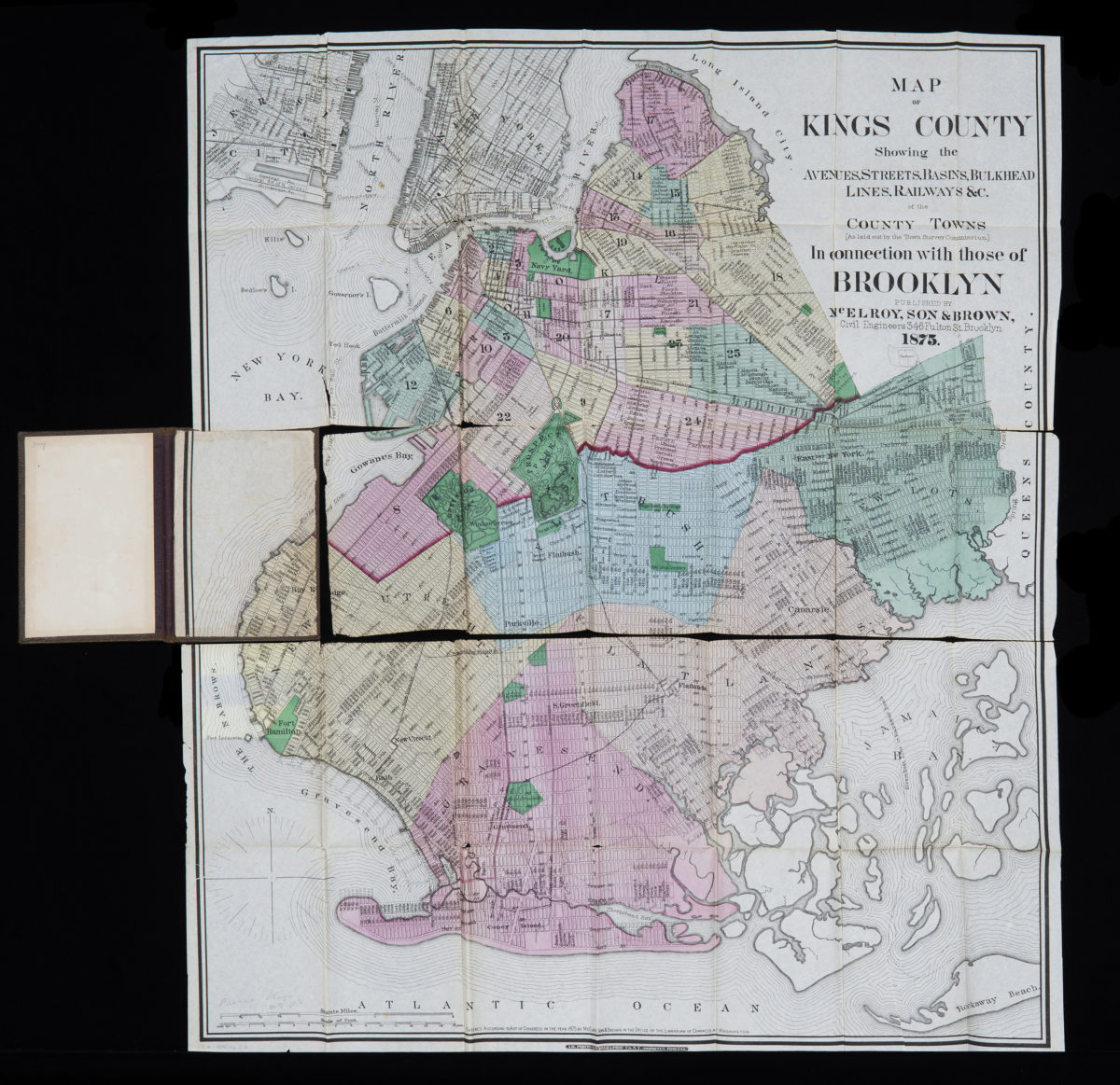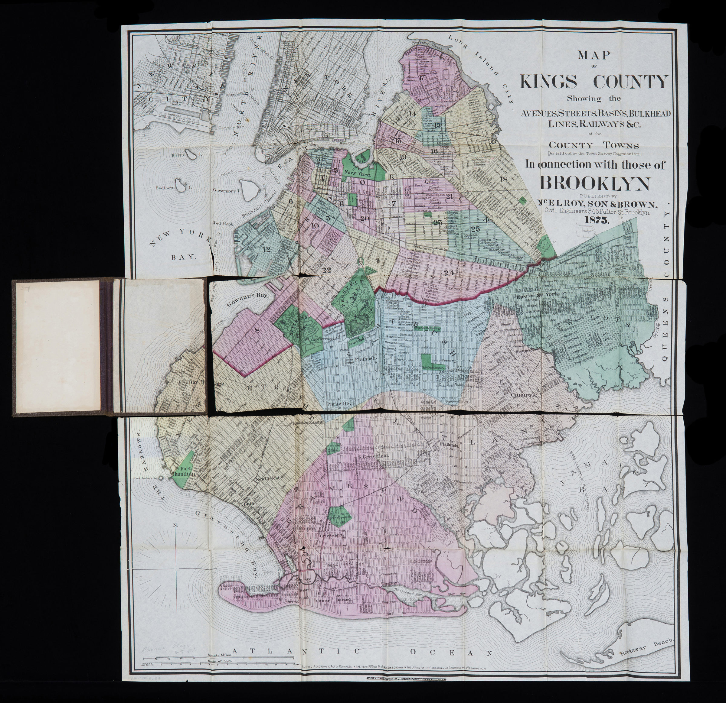
Map of Kings County: showing the avenues, streets, basins, bulkhead lines, railways &c. of the county towns (as laid out by the Town Survey Commission) in connection with those of Brooklyn 1875
Map No. B A-1875b.Fl
Also covers Manhattan south of 25th Street and Jersey City. Shows administrative boundaries, local transit, and ferry lines. “Entered according to Act of Congress in the year 1875 by McElroy, Son & Brown in the Office of the Librarian of Congress at Washington.” BHS has 2 copies.
Map area shown
Genre
MapRelation
Full catalog recordSize
77 × 62 cmDownload
Low Resolution Image
Creator
McElroy, Son & Brown (Firm),Publisher
Brooklyn Historical SocietyCitation
Map of Kings County: showing the avenues, streets, basins, bulkhead lines, railways &c. of the county towns (as laid out by the Town Survey Commission) in connection with those of Brooklyn; 1875, Map Collection, B A-1875b.Fl; Brooklyn Historical Society.Scale
Scale [ca. 1:28,000]Loading zoom image...