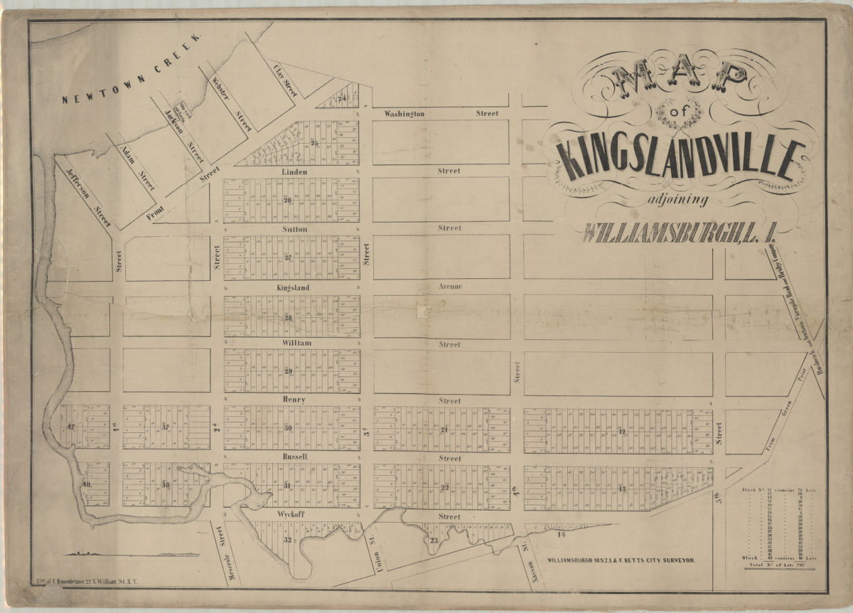
Map of Kingslandville, adjoining Williamsburgh, L.I.: J.&F. [i.e. H.F.] Betts, city surveyor 1852
Map No. B P-1852.Fl.Folio
Cadastral map covering area north from 5th St. to Newtown Creek and east from Wyckoff St. to Washington St. (modern-day Greenpoint). Shows property (including lot numbers and dimensions). Oriented with north to the left. Includes chart showing block and lot information.
Subjects
Places
Map area shown
Genre
Cadastral mapsRelation
Full catalog recordSize
66 × 91 cmDownload
Low Resolution Image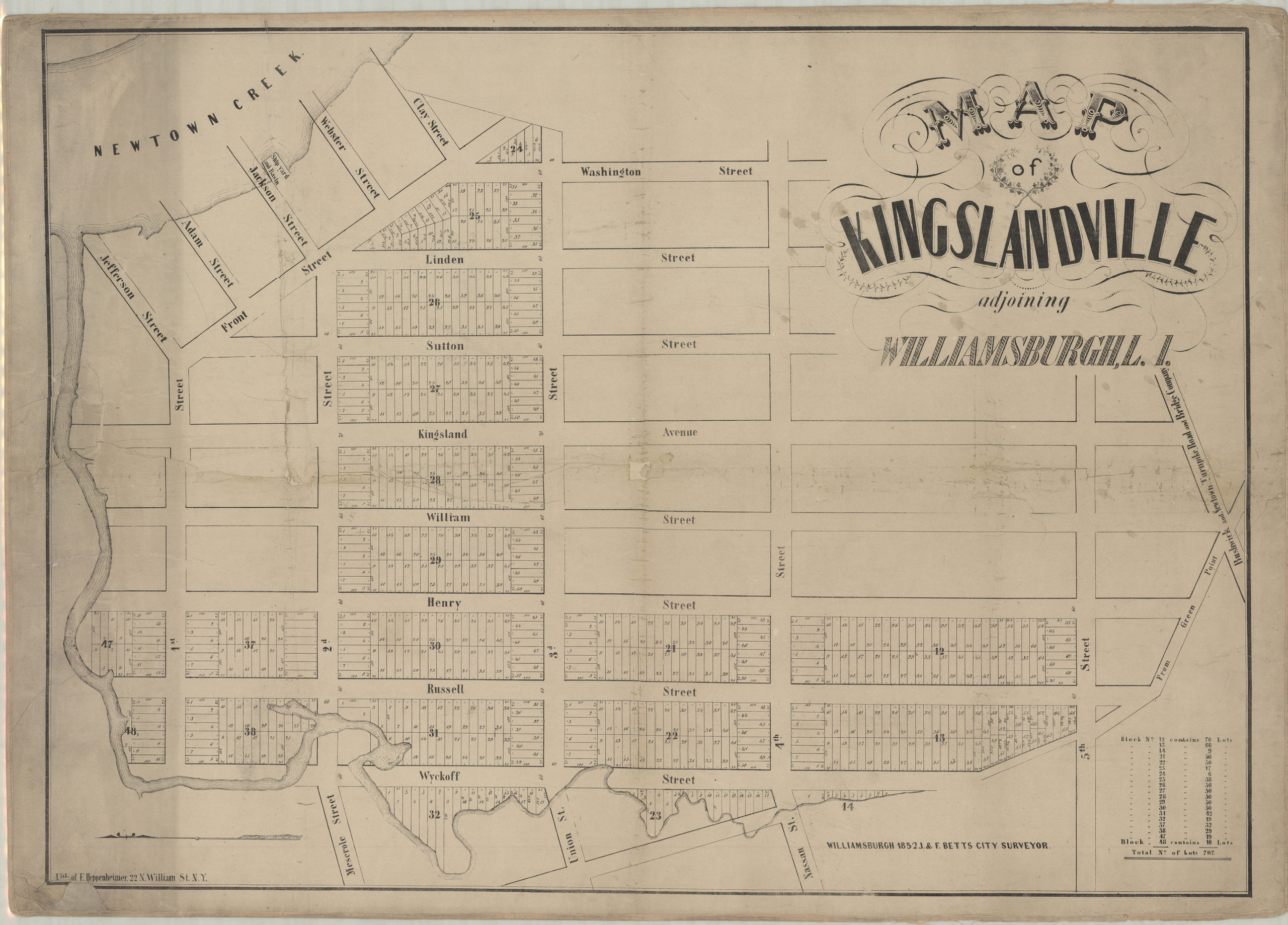
Creator
Betts, H. F.,Publisher
Brooklyn Historical SocietyCitation
Map of Kingslandville, adjoining Williamsburgh, L.I.: J.&F. [i.e. H.F.] Betts, city surveyor; 1852, Map Collection, B P-1852.Fl.Folio; Brooklyn Historical Society.Scale
Scale not givenLoading zoom image...