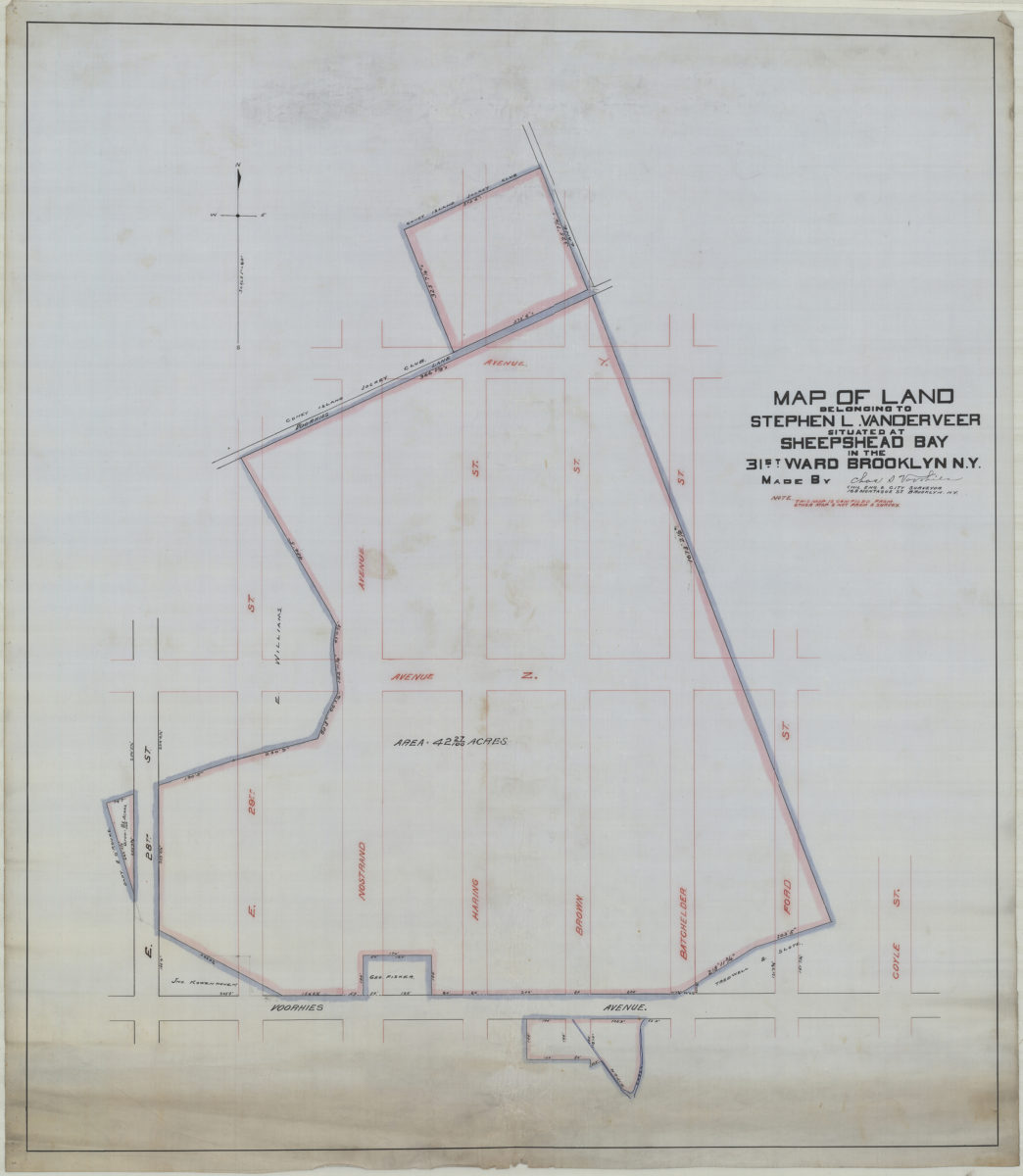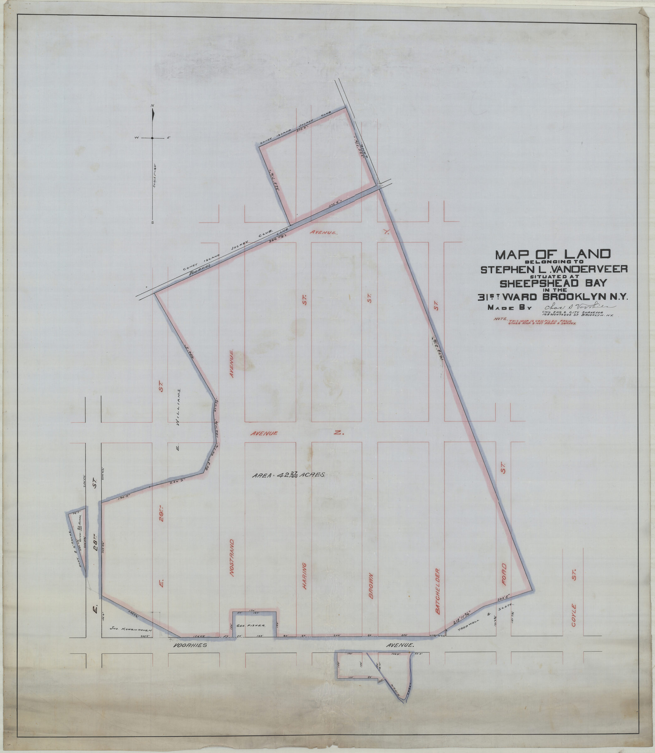
Map of land belonging to Stephen L. Vanderveer, situated at Sheepshead Bay in the 31st Ward, Brooklyn, N.Y.: made by Chas. S. Voorhies, civil eng. & city surveyor [189?]
Map No. B P-[189-?]a.Fl.Folio
Cadastral map covering area bounded by Voorhies Ave. Coyle St., Ave. Y, and E. 28th St. Shows property (including acreages), and names of landowners. “Note: This map is compiled from other map & not from a survey.”
Map area shown
Relation
Full catalog recordSize
90 × 78 cmDownload
Low Resolution Image
Creator
Voorhies, Chas S., Voorhies, Chas S.,Publisher
Brooklyn Historical Society, Brooklyn Historical SocietyCitation
Map of land belonging to Stephen L. Vanderveer, situated at Sheepshead Bay in the 31st Ward, Brooklyn, N.Y.: made by Chas. S. Voorhies, civil eng. & city surveyor; [189?], Map Collection, B P-[189-?]a.Fl.Folio; Brooklyn Historical Society.Scale
Scale [1:960] 1 in to 80Loading zoom image...