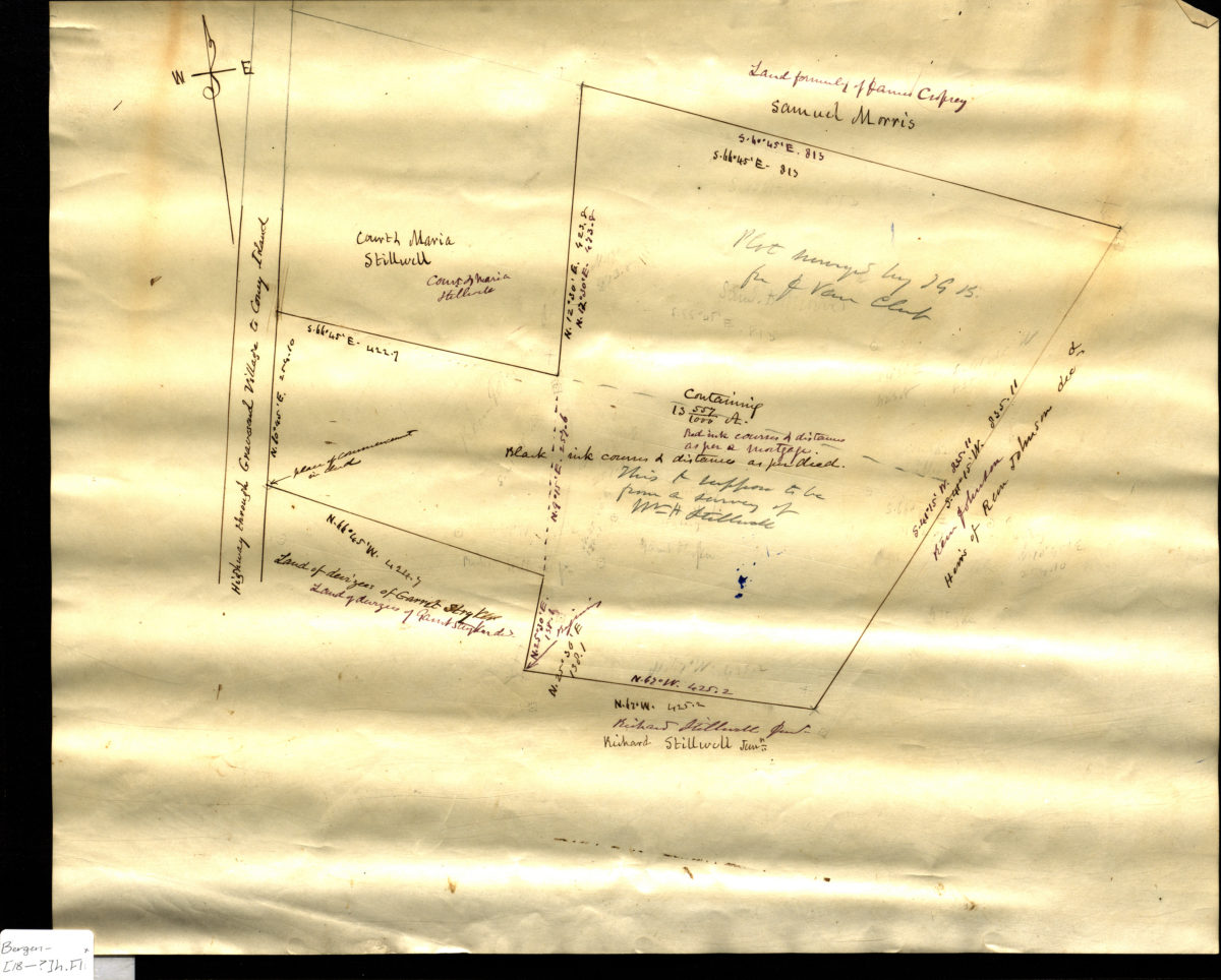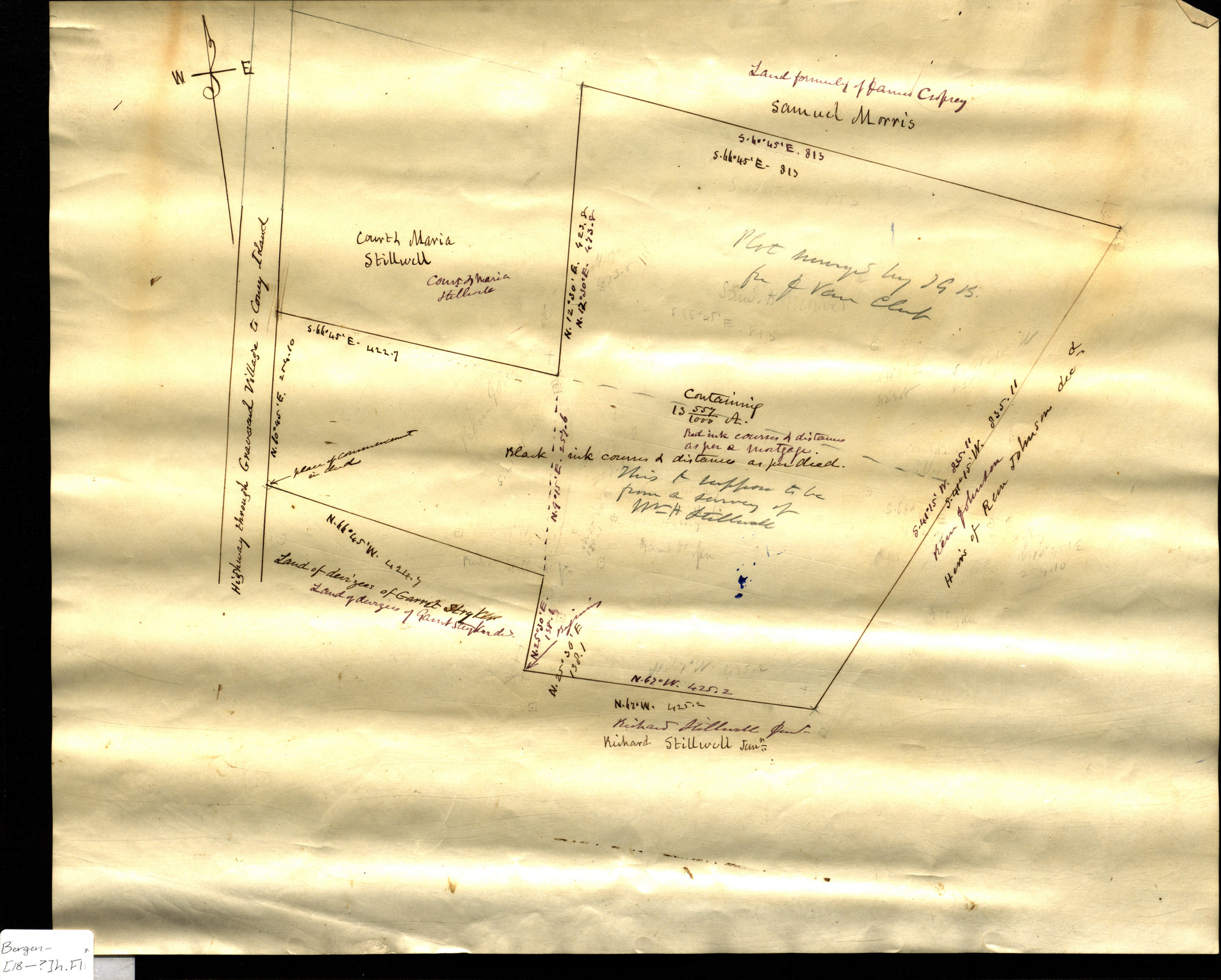
[Map of land east of the Highway through Gravesend Village to Coney Island] [18??]
Map No. Bergen-[18--?]h.Fl
Cadastral map. Shows property (including lots and dimensions), and names of landowners. Title devised by cataloger. Likely attributed to T.G. Bergen, based on handwriting on piece. Cataloger unable to determine map’s modern-day Brooklyn neighborhood.
Map area shown
Relation
Full catalog recordSize
36 × 44 cmDownload
Low Resolution Image
Creator
Bergen, Teunis G.,Publisher
Brooklyn Historical SocietyCitation
[Map of land east of the Highway through Gravesend Village to Coney Island]; [18??], Map Collection, Bergen-[18--?]h.Fl; Brooklyn Historical Society.Scale
Scale not givenLoading zoom image...