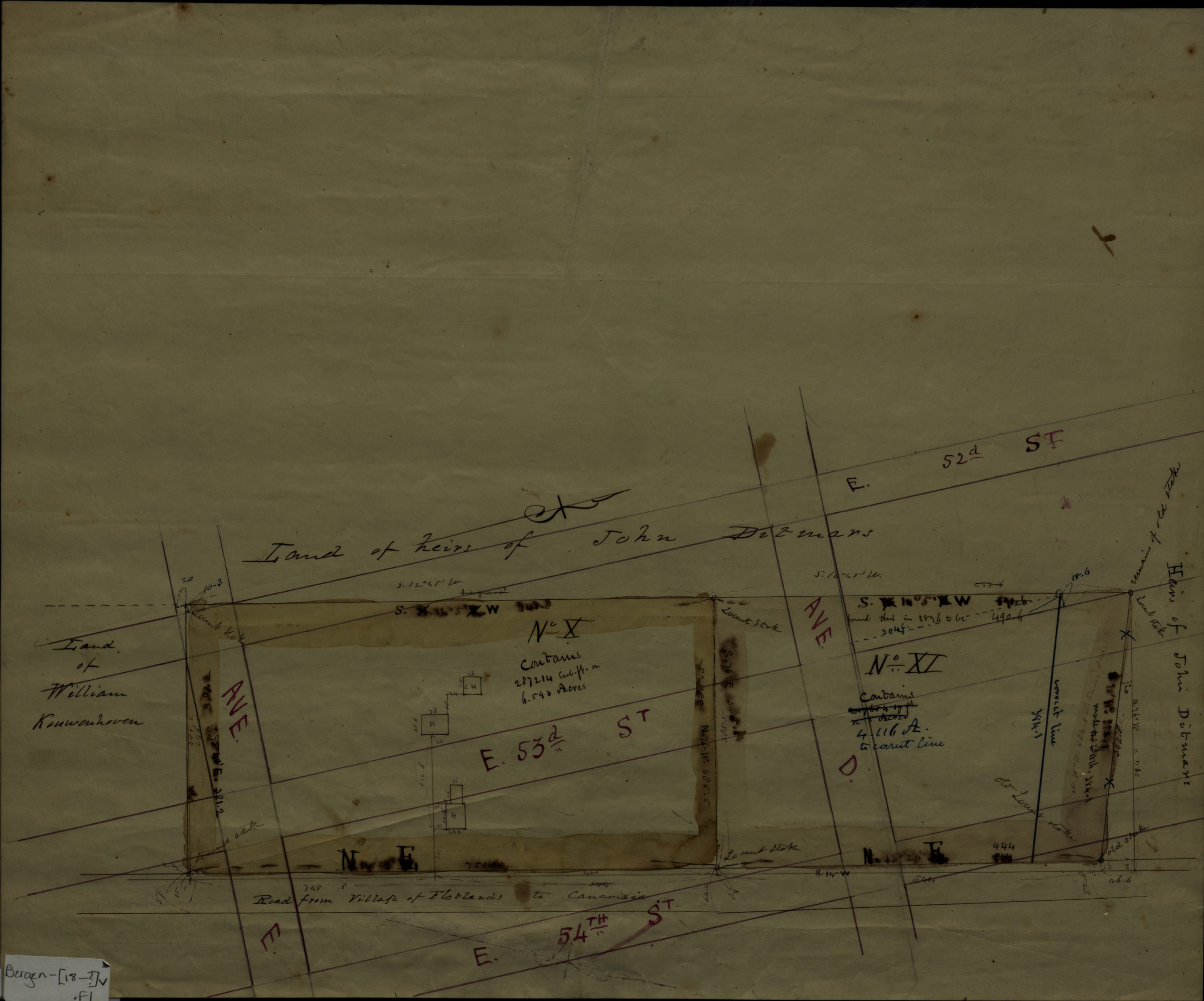
[Map of land near Avenue E, East 52nd Street, Avenue D and East 54th Street in the Town of Flatlands] [18??]
Map No. Bergen-[18--?]v.Fl
Title devised by cataloger. Cadastral map covering area near Avenue E, East 52nd Street, Avenue D and East 54th Street in modern-day East Flatbush. Shows property (including dimensions) and names of some landowners. Attributed to Teunis G. Bergen, based on handwriting. Oriented with north to the right. On verso: measurements and diagram in pencil.
Map area shown
Relation
Full catalog recordSize
36 × 43 cmDownload
Low Resolution Image
Creator
Bergen, Teunis G.,Publisher
Brooklyn Historical SocietyCitation
[Map of land near Avenue E, East 52nd Street, Avenue D and East 54th Street in the Town of Flatlands]; [18??], Map Collection, Bergen-[18--?]v.Fl; Brooklyn Historical Society.Scale
Scale not givenLoading zoom image... 