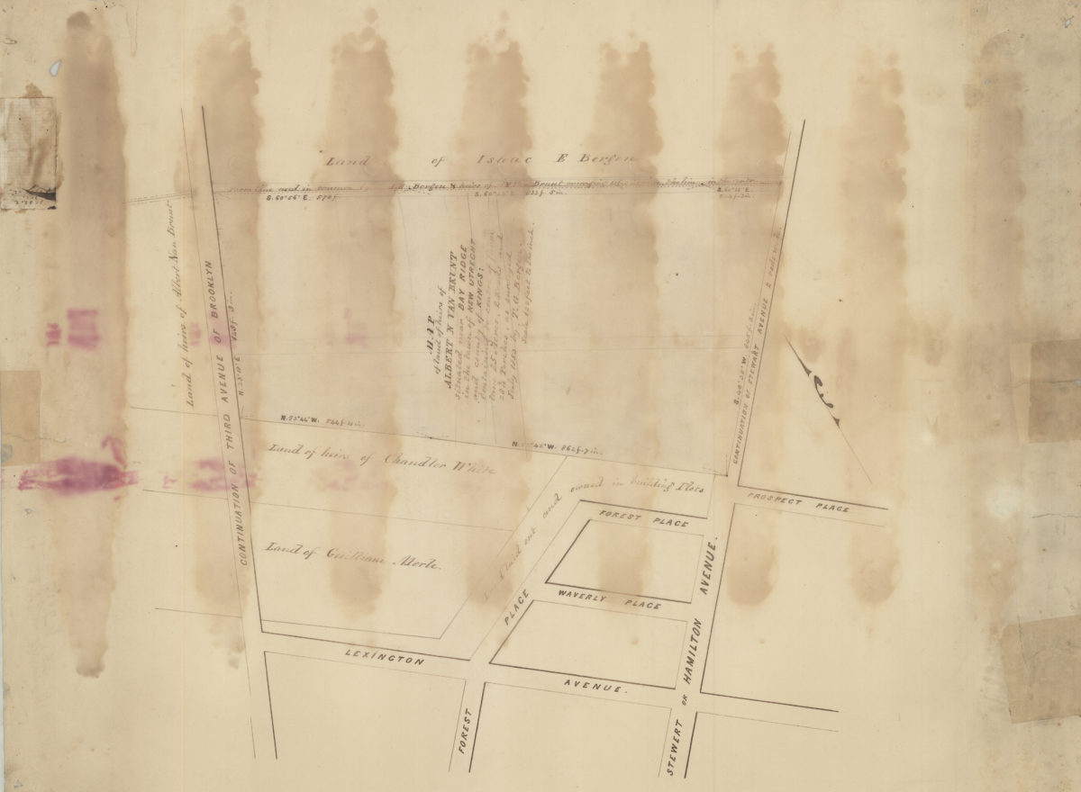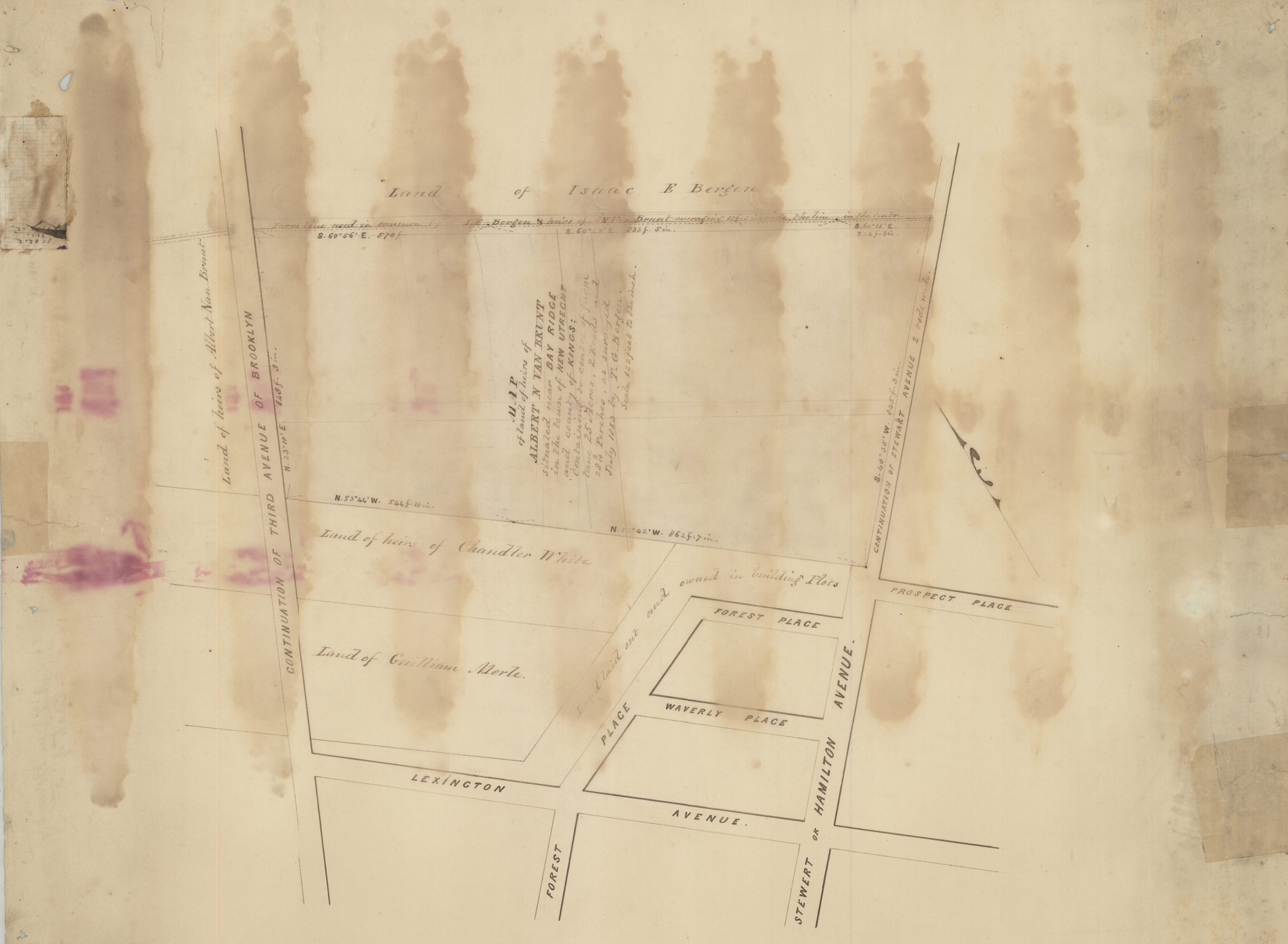
Map of land of heirs of Albert N. Van Brunt situated near Bay Ridge in the town of New Utrecht and county of Kings: containing to center of farm lane 25 acres, 2 roods and 28 9/10 perches: as surveyed July 1853 by T.G. Bergen July 1853
Map No. Bergen-1853a.Fl
Cadastral map of area bounded approximately by the continuation of Third Avenue in Brooklyn, Lexington Avenue and Stewart or Hamilton Avenue in modern-day neighborhood of Bay Ridge. Shows property and names of landowners. Oriented with north to the upper right.
Map area shown
Relation
Full catalog recordSize
60 × 48 cmDownload
Low Resolution Image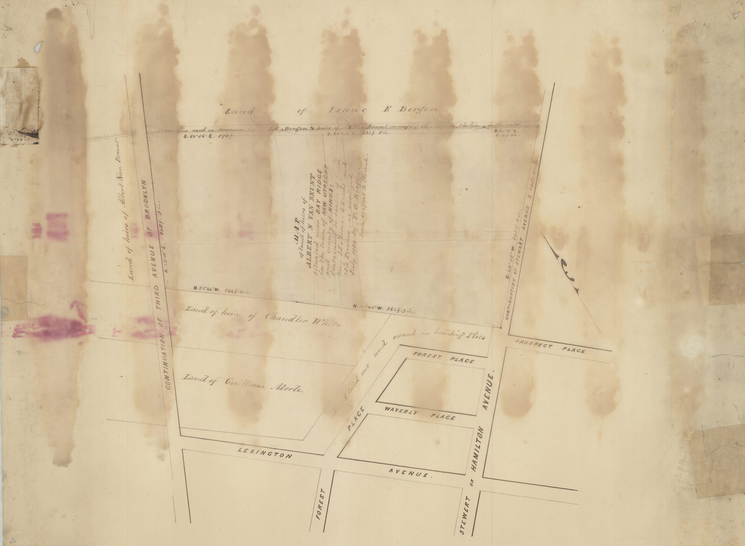
Creator
Bergen, Teunis G.,Publisher
Brooklyn Historical SocietyCitation
Map of land of heirs of Albert N. Van Brunt situated near Bay Ridge in the town of New Utrecht and county of Kings: containing to center of farm lane 25 acres, 2 roods and 28 9/10 perches: as surveyed July 1853 by T.G. Bergen; July 1853, Map Collection, Bergen-1853a.Fl; Brooklyn Historical Society.Scale
Scale [1:1464] 1 in to 12Loading zoom image...