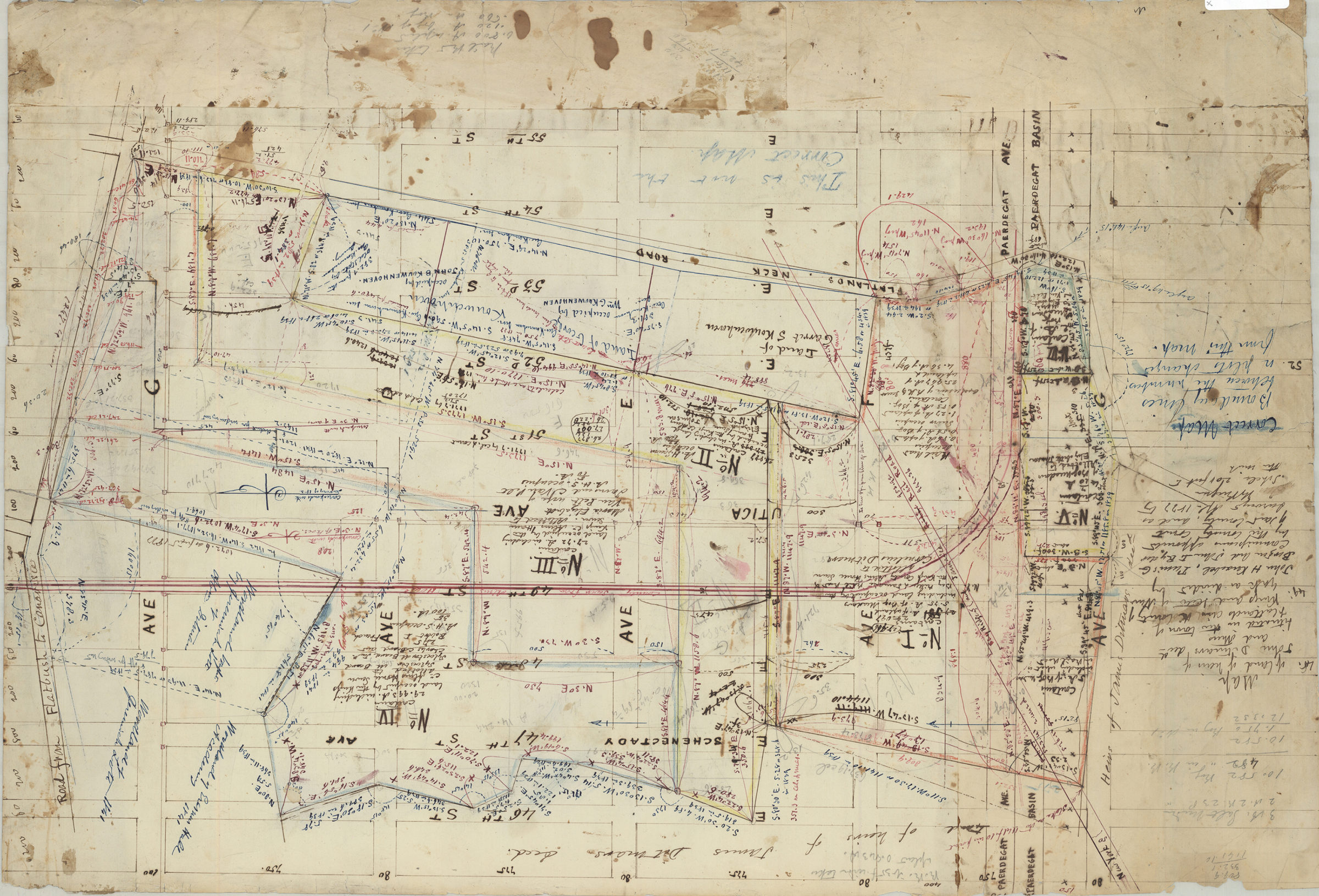
Map of land of heirs of John D. Ditmars, decd., and others, situated in the town of Flatlands in the county of Kings and … [text illegible] as divided by John H. Knaebel, Tunis G. Bergen, and John I. Ryder, April 1877
Map No. Bergen-1877a.Fl
Cadastral map covering area bounded by E. 46th St., Ave. G, E. 55th St., and Ave. C (modern-day East Flatbush and Flatlands). Shows property (including dimensions), and names of landowners. Oriented with north to the right. Includes notes and calculations.
Subjects
Places
Map area shown
Relation
Full catalog recordSize
41 × 59 cmDownload
Low Resolution Image
Creator
Bergen, Teunis G.,Publisher
Brooklyn Historical SocietyCitation
Map of land of heirs of John D. Ditmars, decd., and others, situated in the town of Flatlands in the county of Kings and … [text illegible] as divided by John H. Knaebel, Tunis G. Bergen, and John I. Ryder,; April 1877, Map Collection, Bergen-1877a.Fl; Brooklyn Historical Society.Scale
Scale [1:2,400] 1 in to 2Loading zoom image... 