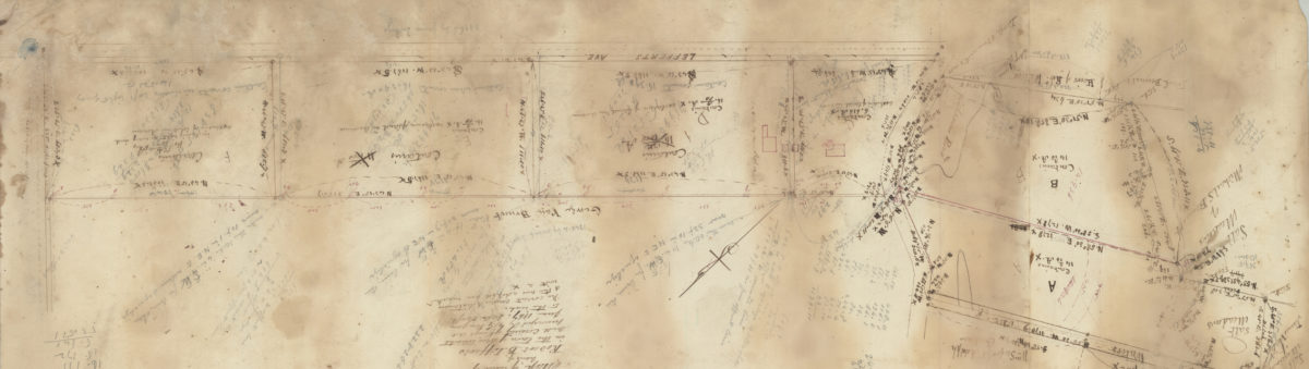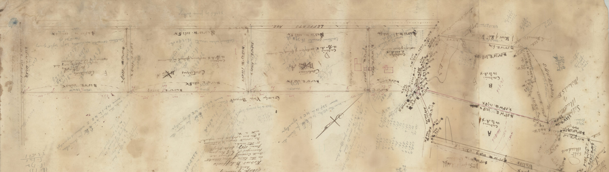
Map of land of heirs of Robert B. Lefferts in the town of New Utrecht and county of Kings, as surveyed: by T.G. Bergen June 1867
Map No. Bergen-1867.Fl
Cadastral map covering Lefferts Ave. Shows property (including acreages), and names of landowners. Cataloger unable to determine map’s modern-day Brooklyn neighborhood. No cross street names or landmarks on map. Oriented with north to the upper right. Includes notes and calculations. Area covered identical to: Map of land of heirs of Robert Lefferts, in the Town of New Utrecht and County of Kings /as suveyed June 1867 by T.G. Bergen, also in the Brooklyn Historical Society collection (Bergen-1867b.Fl). Keyed to index no index present.
Map area shown
Relation
Full catalog recordSize
23 × 75 cmDownload
Low Resolution Image
Creator
Bergen, Teunis G., Bergen, Teunis G.,Publisher
Brooklyn Historical Society, Brooklyn Historical SocietyCitation
Map of land of heirs of Robert B. Lefferts in the town of New Utrecht and county of Kings, as surveyed: by T.G. Bergen; June 1867, Map Collection, Bergen-1867.Fl; Brooklyn Historical Society.Scale
Scale [1:2,400] 1 in to 2Loading zoom image...